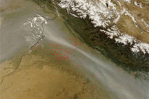

Haze continued to hover over northern India and Pakistan in mid-November 2008. The Moderate Resolution Imaging Spectroradiometer (MODIS) on NASA’s Aqua satellite took this picture on November 16, 2008. In this image, gray-beige haze hugs the southwestern face of the Himalaya, and in some areas, the haze appears to infiltrate the low-lying mountain valleys. To the south, an especially thick plume of haze forms an arc along the border between Pakistan and India.
The red dots scattered through the image are hotspots where MODIS has detected anomalously warm surface temperatures indicative of wildfires or agricultural fires. Although these fires contribute to the haze, they are not solely responsible. The haze probably results from a combination of smoke, pollution, and dust.
NASA image courtesy MODIS Rapid Response, NASA Goddard Space Flight Center. Caption by Michon Scott.
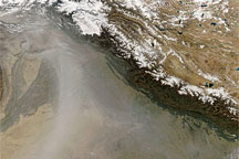
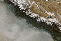
Haze hugged the Himalaya in late October 2008. The haze probably resulted from a combination of agricultural fires and urban pollution, and may have contained some airborne dust.


