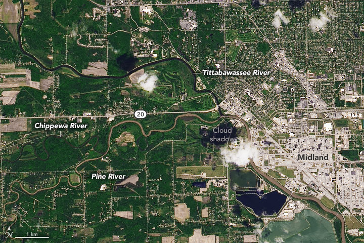
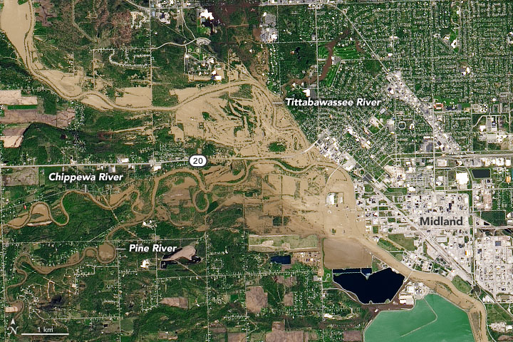
On May 17, 2020, heavy rain began pouring over the Tri-Cities region of central Michigan and, after two days, it provoked significant flooding in Midland County. The accumulating rainfall led to catastrophic dam failures that swelled rivers and streams and inundated several nearby communities. The governor ordered more than 10,000 residents of Edenville and Sanford to evacuate.
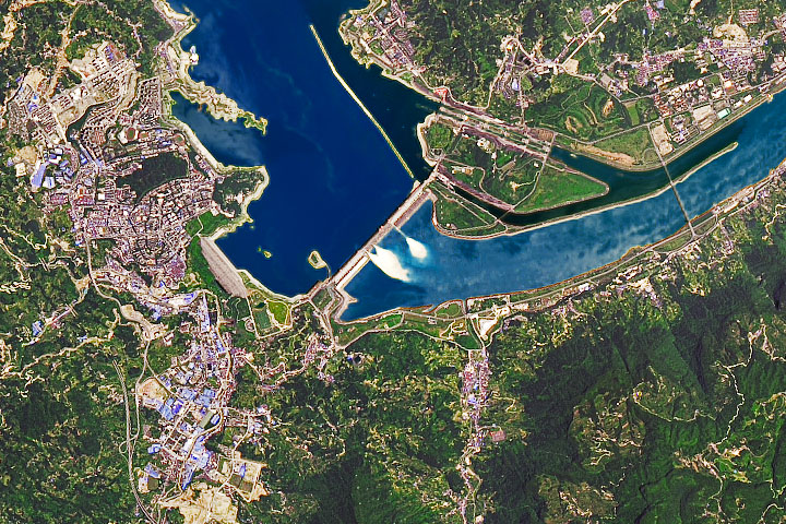
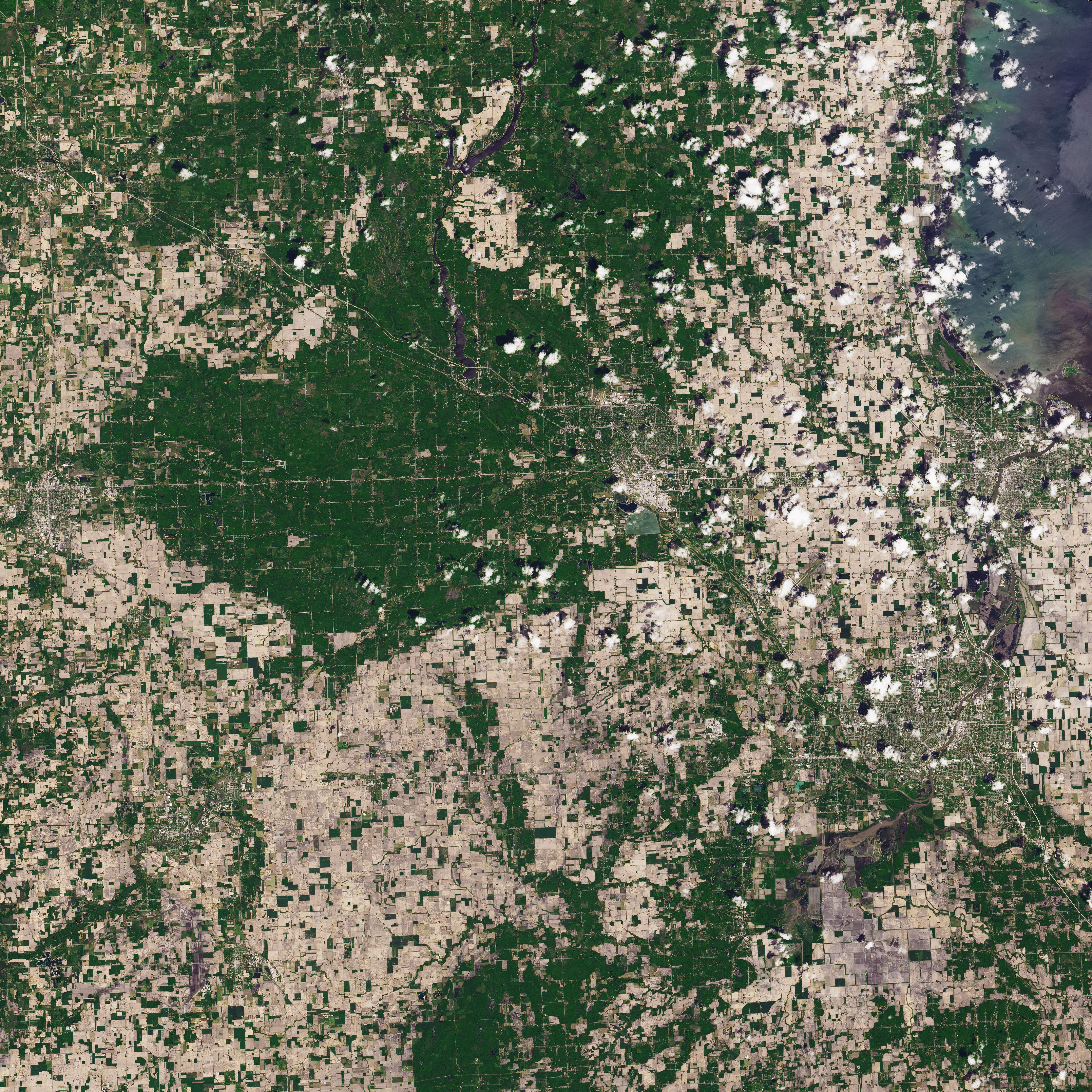
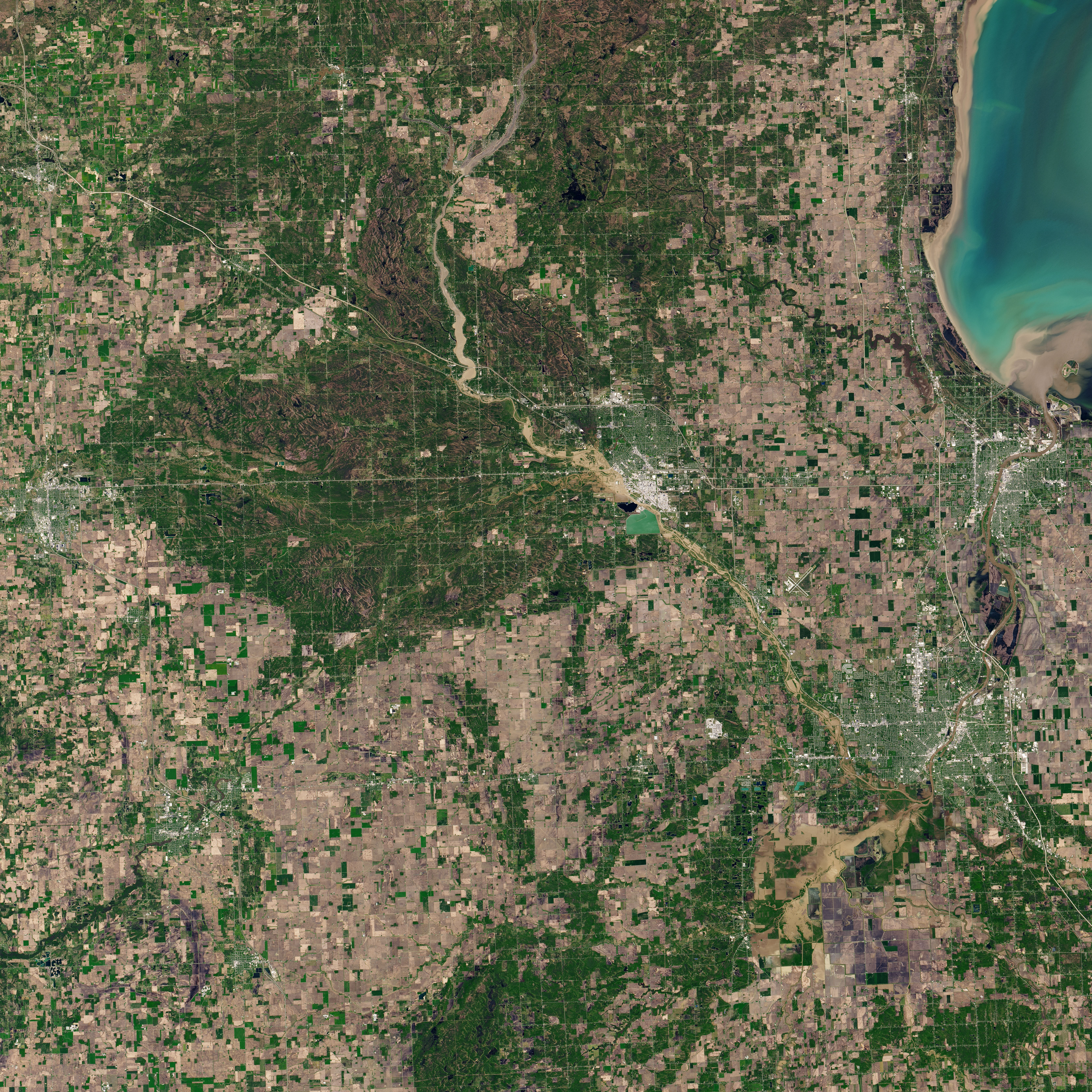
The natural-color images on this page show flooding across Midland County as observed by the Operational Land Imager (OLI) on Landsat 8. The pair above shows the Tittabawassee River on May 20, 2020 (right), compared to June 3, 2019 (left). The images below provide a wider view, including the location of the Edenville and Sanford dams.
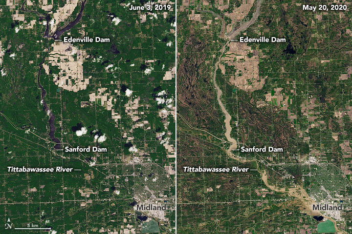
The National Weather Service reported record rainfall where more than 4 inches (10 centimeters) fell across parts of Midland in 48 hours. The Edenville Dam then collapsed on the evening of May 19, sending floodwaters south across the landscape. About an hour later, water spilled over the Sanford Dam and further flooded the Tittabawassee River and the surrounding area.
On May 20, the Tittabawassee River reached a height just over 35 feet (11 meters)—about four feet higher than levels in the devastating 1986 floods. The governor has declared a state of emergency.
NASA Earth Observatory images by Joshua Stevens, using Landsat data from the U.S. Geological Survey. Story by Kasha Patel.