Acquired April 5 and 21, 2013, these images compare conditions between Lake Michigan and Saginaw Bay.
Published Apr 23, 2013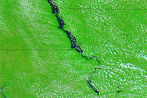
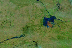
Acquired June 23, 2011, and July 4, 2011, these false-color images compare flood conditions along the Missouri River. Flooding spread noticeably between these dates.
Published Jul 5, 2011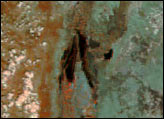
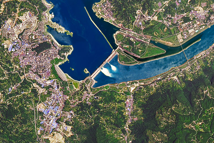
As water levels rise from excessive monsoon rainfall, dam operators discharge water through spillway gates.
Published Jul 24, 2020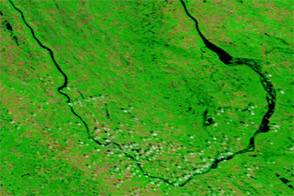
Acquired July 7, 2011, and July 4, 2010, these false-color images compare conditions along the Souris River in North Dakota, where record flooding struck in June 2011.
Published Jul 7, 2011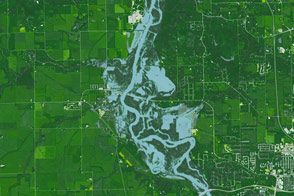
A series of heavy rainstorms raised river levels to their second highest on record.
Published Sep 29, 2016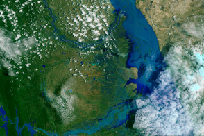
Heavy monsoon rains caused rivers to swell across Burma (Myanmar), leading to most severe flooding the country has seen in decades.
Published Aug 13, 2015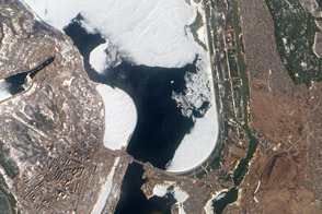
Authorities keeps a watchful eye on ice near a key dam on the Kyiv Reservoir.
Published Mar 31, 2012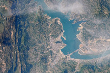
This image from April 15, 2009, is one of the first images that astronauts on the International Space Station have been able to capture of the flooding behind the Three Gorges Dam in China.
Published Jun 8, 2009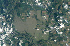
Acquired on June 14, 2011, these images show flooding along the Missouri River near Hamburg, Iowa.
Published Jun 16, 2011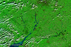
A series of rainstorms pushed rivers in southern Great Britain to flood stage in February 2014.
Published Feb 17, 2014alert message
