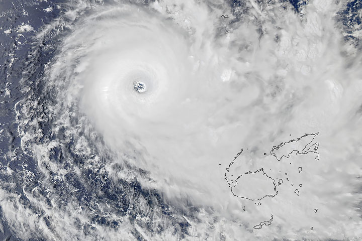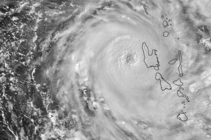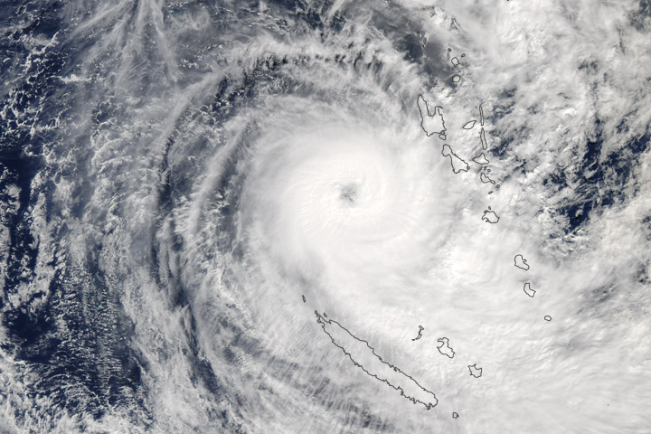
On April 6, 2020, residents of Vanuatu woke up to devastating winds and heavy rains as Tropical Cyclone Harold made landfall on the Pacific island nation. By midday, Harold was a category 5 storm with sustained winds of approximately 215 kilometers (135 miles) per hour near its center, making it one of the strongest storms ever to hit the nation. Harold ripped roofs off of buildings, caused heavy flooding, and cut communication lines on the country’s largest two islands.
In the days before reaching Vanuatu, the cyclone caused several deaths as it passed south of the Solomon Islands and overthrew a ferry with almost 30 people on it. The storm is expected to reach Fiji by Wednesday.
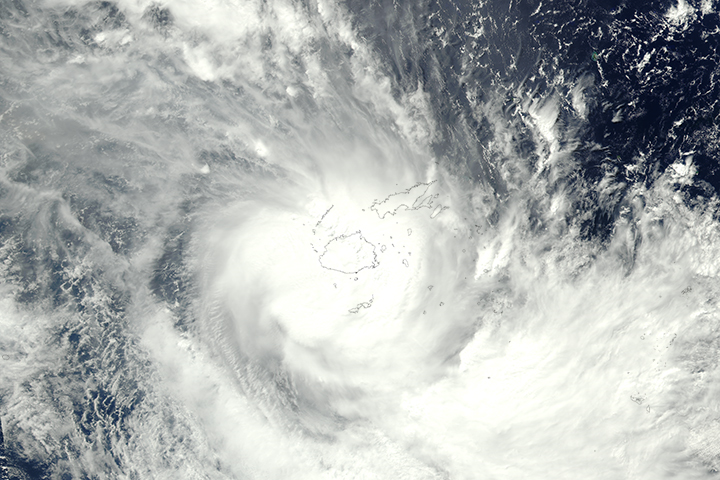
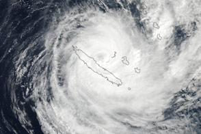
The nighttime image above shows Harold approaching Espiritu Santo, Vanuatu’s largest island. It was acquired around 1:50 a.m. local time on April 6, 2020 (14:50 UTC on April 5, 2020) by the Visible Infrared Imaging Radiometer Suite (VIIRS) on the NASA-NOAA Suomi-NPP satellite.
The storm is expected to move east of Vanuatu by April 7. Until then, forecasters at the Vanuatu Meteorology and Geohazards Department warned of destructive storm force winds with heavy rainfall and flash flooding near river banks and low-lying areas.
The country, which was already under a state of emergency due to the covid-19 pandemic, has lifted its social-distancing practices and removed restrictions on public gatherings to help people move to safe shelters and evacuation centers. However, humanitarian aid efforts have been slowed down by restrictions on international travel.
The last category 5 storm to hit Vanuatu was Cyclone Pam in 2015. The storm caused widespread damages and losses equivalent to nearly two-thirds of the country’s gross domestic product.
NASA Earth Observatory image by Joshua Stevens, using VIIRS day-night band data from the Suomi National Polar-orbiting Partnership. Story by Kasha Patel.