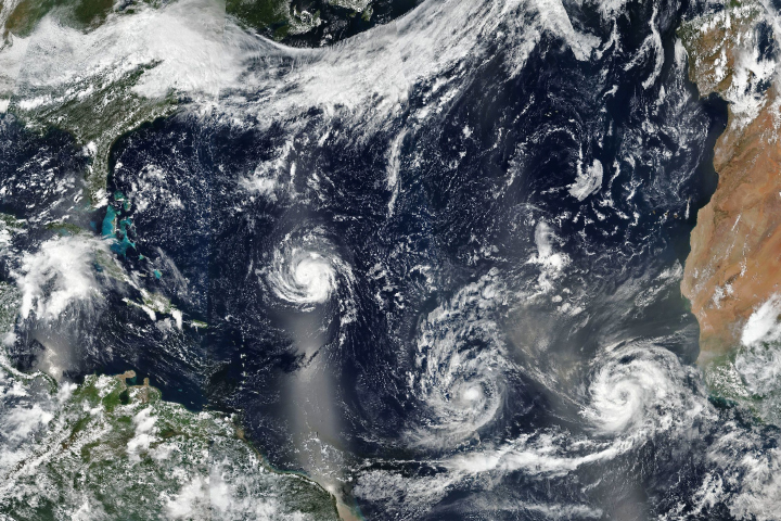
Meteorologists struggled to find the right words to describe the situation as a line of three hurricanes—two of them major and all of them threatening land—brewed in the Atlantic basin in September 2017.
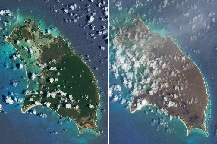
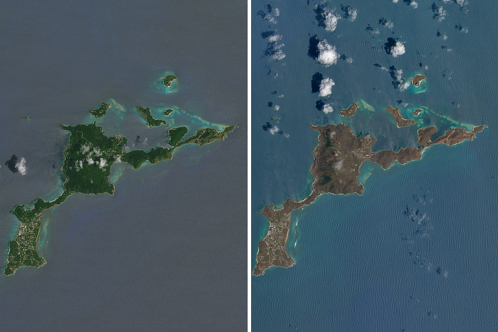
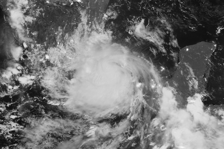
Forecasters were most concerned about Irma, which was on track to make landfall in densely populated South Florida on September 10 as a large category 4 storm. Meanwhile, category 2 Hurricane Katia was headed for Mexico, where it was expected to make landfall on September 9. And just days after Irma devastated the Leeward Islands, the chain of small Caribbean islands braced for another blow—this time from category 4 Hurricane Jose.
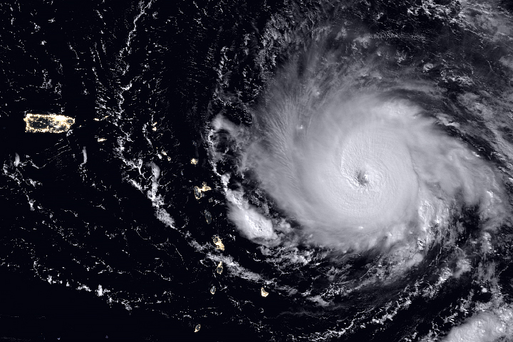
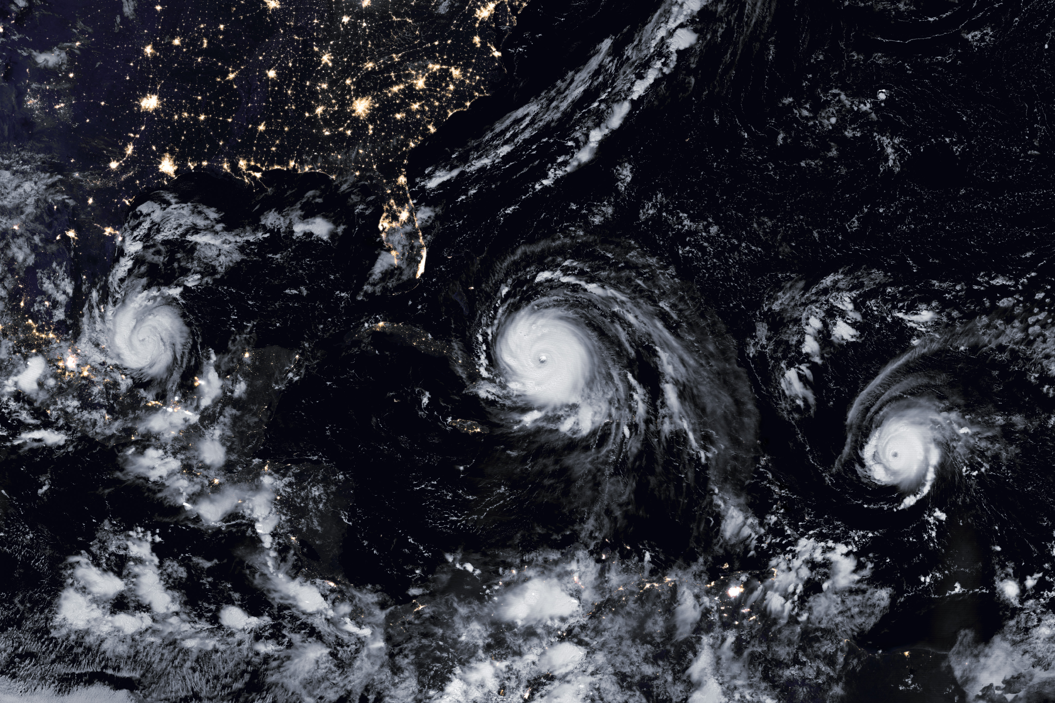
The Visible Infrared Imaging Radiometer Suite (VIIRS) on the Suomi NPP satellite captured the data for a mosaic of Katia, Irma, and Jose as they appeared in the early hours of September 8, 2017. The images were acquired by the VIIRS “day-night band,” which detects light signals in a range of wavelengths from green to near-infrared, and uses filtering techniques to observe signals such as city lights, auroras, wildfires, and reflected moonlight. In this case, the clouds were lit by the nearly full Moon. The image is a composite, showing cloud imagery combined with data on city lights.
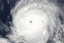
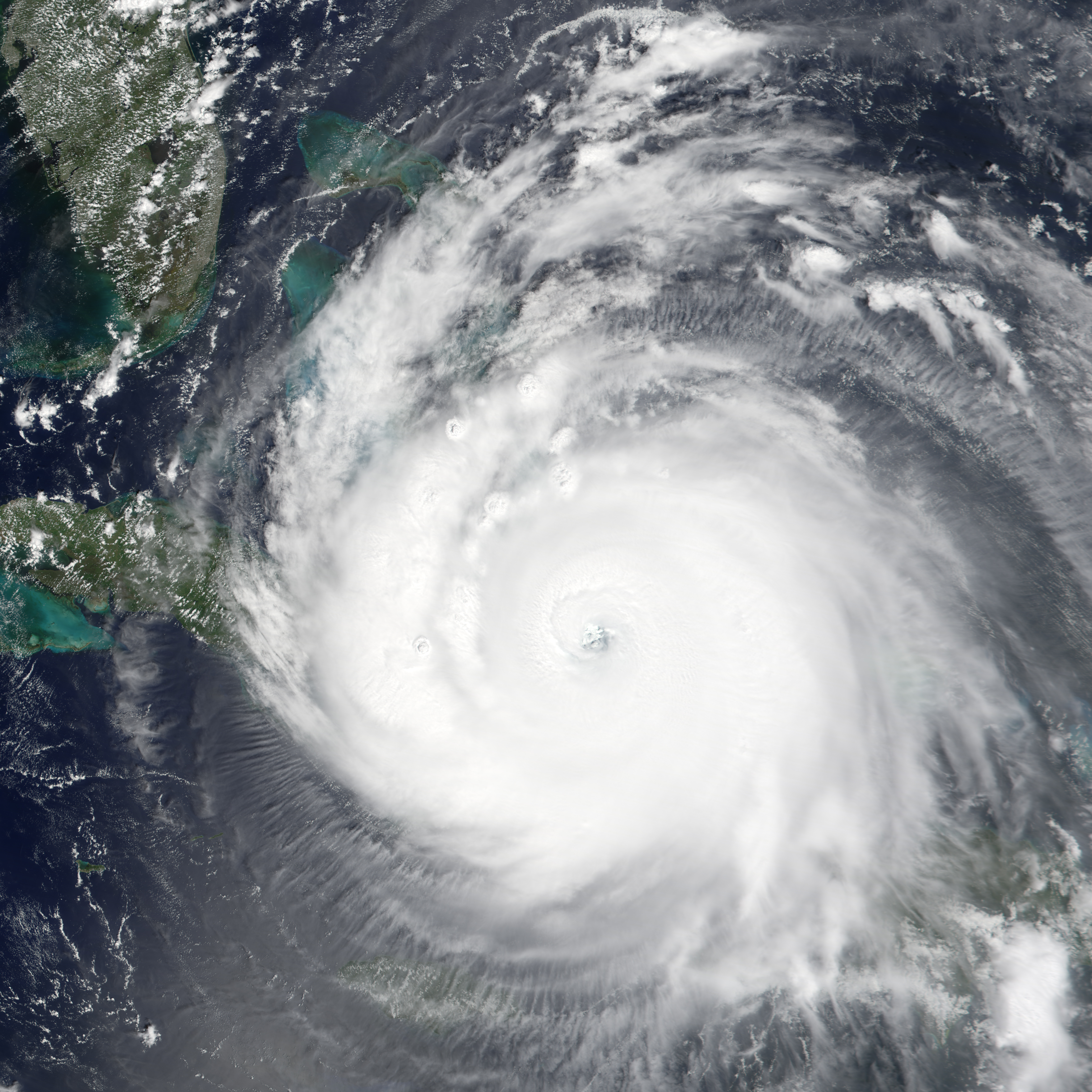
The Moderate Resolution Imaging Spectroradiometer (MODIS) on NASA’s Terra satellite acquired a natural-color image of Irma (below) at 10:00 a.m. local time (16:00 Universal Time) on September 8, 2017.
The NASA Short-term Prediction Research and Transition Center remarked on the storm’s “buzzsaw appearance.” The National Weather Service field office in Miami warned of “large airborne projectiles” and cautioned that some locations may be “uninhabitable for weeks or months” after the storm. Eric Blake, a meteorologist with the National Hurricane Center, simply tweeted that he had “never seen anything like this in the modern record” and that the forecast made him “sick to his stomach.”
In some respects, Irma is an unusual and record-breaking storm. On September 8, the storm had generated more accumulated cyclone energy—a term meteorologists use to describe the destructive potential of a hurricane—than any other Atlantic storm on record, according to meteorologist Philip Klotzbach of Colorado State University. Irma also broke a record for generating the most accumulated cyclone energy in a 24-hour period.
As all three storms approach land, meteorologists will be using assets on the ground, in air, and in space to track them. “Our human assets and aircraft penetrations are critical but limited,” said Marshall Shepherd, an atmospheric scientist at the University of Georgia. “Satellites provide a unique perspective on clouds, rainfall, sea surface state, sea surface temperature, and more. Only the satellite vantage point can provide continuous coverage of all three storms without having to refuel or sleep.”
NASA Earth Observatory images by Joshua Stevens and Jesse Allen, using VIIRS day-night band data from the Suomi National Polar-orbiting Partnership and Terra MODIS data from the Land Atmosphere Near real-time Capability for EOS (LANCE). Story by Adam Voiland.