Today’s story is the answer to the April 2018 puzzler.
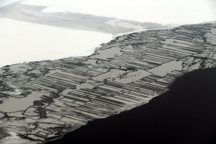
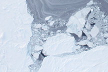
NASA’s Operation IceBridge—the airborne mission flown annually over both polar regions—is now in its tenth year making flights over the Arctic. That’s a lot of flight hours spent mapping the region’s land ice and sea ice. But on April 14, 2018, IceBridge mission scientist John Sonntag spotted something he had never seen before.
Sonntag snapped this photograph from the window of the P-3 research plane while flying over the eastern Beaufort Sea. At the time, the aircraft’s location was 69.71° North and 138.22° West, about 50 miles northwest of Canada’s Mackenzie River Delta. “We saw these sorta-circular features only for a few minutes today,” Sonntag wrote from the field. “I don’t recall seeing this sort of thing elsewhere.”
The features are more of a curiosity than anything else. The main purpose of the flight that day was to make observations of sea ice in an area that lacked coverage by the mission prior to 2013. Still, the image sparked a fair amount of intrigue, so we set out to see what we could learn. That’s not always easy based on a photograph or satellite image alone, so the following ideas are speculation.
Some aspects of the image are easy to explain. The sea ice here is clearly young ice growing within what was once a long, linear area of open water, or lead. “The ice is likely thin, soft, and mushy and somewhat pliable,” said Don Perovich, a sea ice geophysicist at Dartmouth College. “This can be seen in the wave-like features in front of the middle ‘amoeba.’”
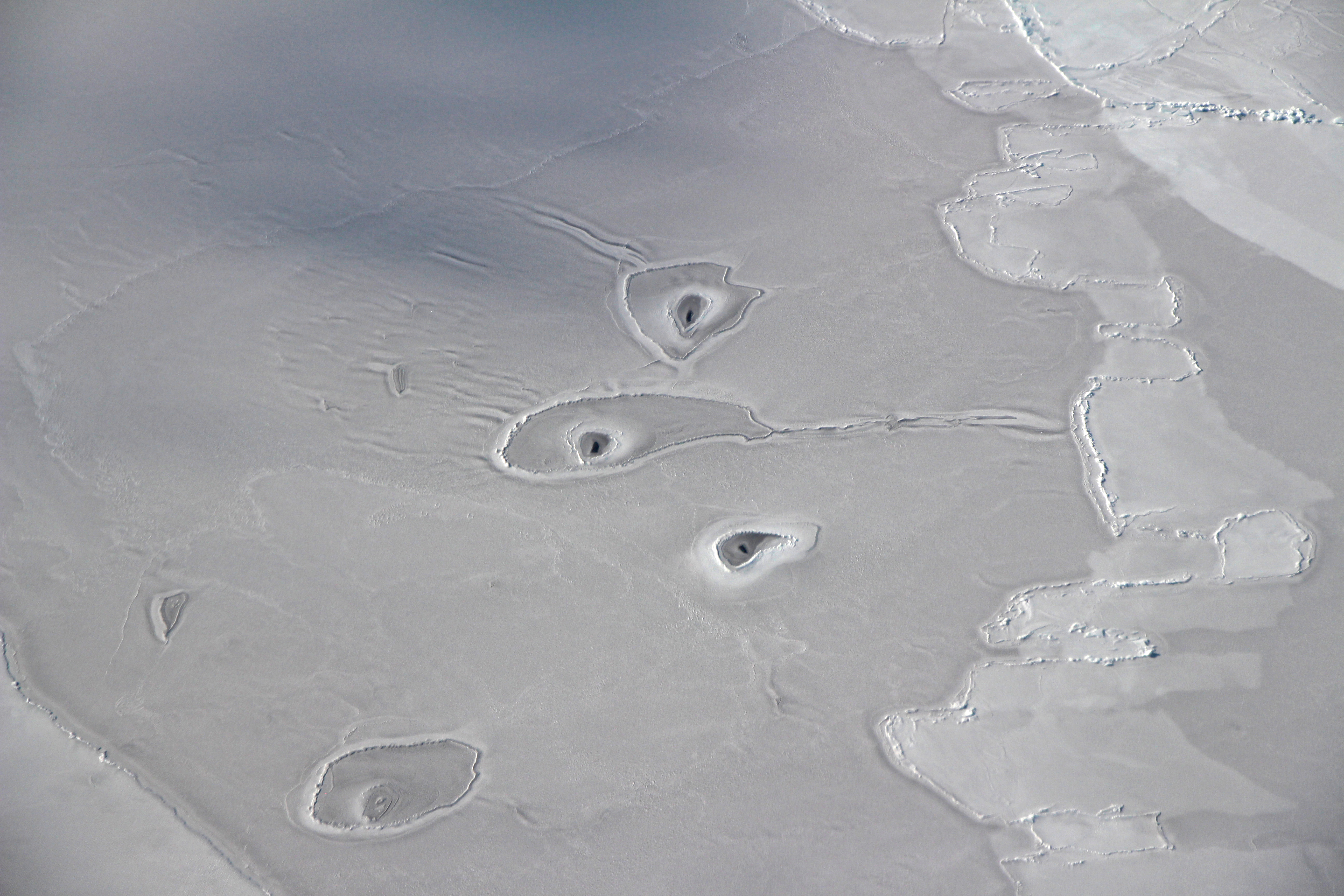
Perovich goes on to note that there might be a general left to right motion of the new ice as evidenced by the finger rafting on the right side of the image. Finger rafting occurs when two floes of thin ice collide. As a result of the collision, blocks of ice slide above and below each other in a pattern that resembles a zipper or interlocking fingers. (You can see another example in a photograph acquired in November 2017.)
“It’s definitely an area of thin ice, as you can see finger rafting near the holes and the color is gray enough to indicate little snow cover,” said IceBridge project scientist Nathan Kurtz. “I’m not sure what kind of dynamics could lead to the semi-circle shaped features surrounding the holes. I have never seen anything like that before.”
Indeed, the holes are difficult to explain. One thought is that they have a mammalian origin: the holes may have been gnawed out by seals to create an open area in the ice through which they can surface to breathe. The holes appear similar to photographs of breathing holes created by ring seals and by harp seals.
“The encircling features may be due to waves of water washing out over the snow and ice when the seals surface,” said Walt Meier, a scientist at the National Snow and Ice Data Center. “Or it could be a sort of drainage feature that results from when the hole is made in the ice.”
Chris Polashenski, a sea ice scientist at the Cold Regions Research and Engineering Laboratory, said he has seen features like this before, but does not have a solid explanation for them. He agrees that breathing holes for seals is one possibility; equally plausible is that the holes were caused by convection.
“This is in pretty shallow water generally, so there is every chance this is just ‘warm springs’ or seeps of ground water flowing from the mountains inland that make their presence known in this particular area,” said Chris Shuman, a University of Maryland at Baltimore County glaciologist based at NASA’s Goddard Space Flight Center. “The other possibility is that warmer water from Beaufort currents or out of the Mackenzie River is finding its way to the surface due to interacting with the bathymetry, just the way some polynyas form.”
NASA photograph by John Sonntag/Operation IceBridge.