The Earth Observatory has published its last Image of the Day on this website. Please join us on our new home at science.nasa.gov/earth/earth-observatory.
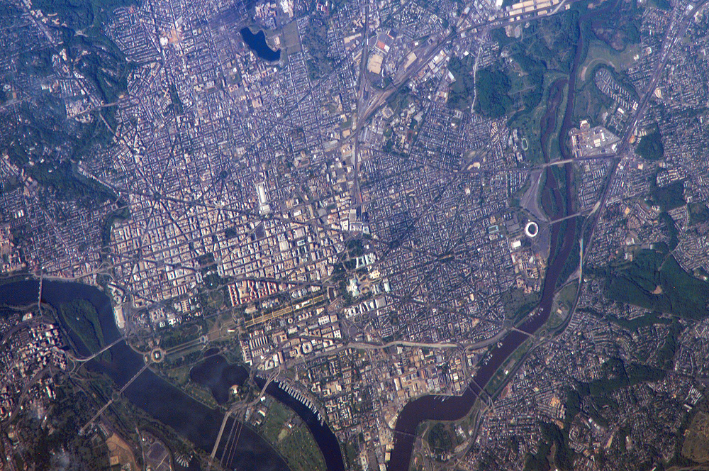
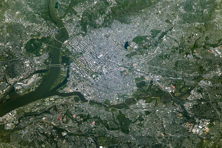
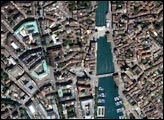
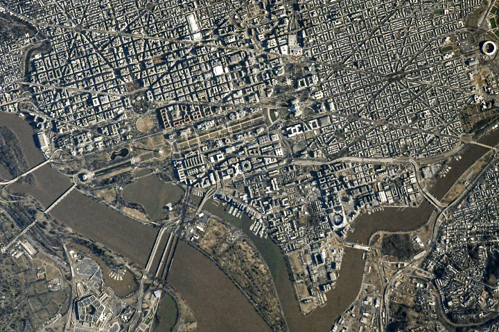
George Washington not only served as the namesake for the capital city of the United States, he also chose its location, perhaps envisioning the transportation possibilities that the Potomac River flowing past the site would provide. Early on, the city saw conflict; in the War of 1812, British forces invaded and burned several public buildings. The Civil War marked the beginning of the city’s transformation from a provincial town to a world center of culture, history, and political energy during the 20th century. According to the Census Bureau, the District of Columbia, which comprises the city of Washington, supported a population of more than half a million inhabitants in 2003.
This picture was taken as the International Space Station passed over the western border of Maryland and West Virginia. The resolution and spatial coverage of this image are similar to the 15-meter-per-pixel data obtained by sensors onboard the Landsat 7 and Terra satellites. Recognizable in this image are the Capitol Building, the Washington Monument (and its shadow), and the Lincoln Memorial, along the northeast bank of the Potomac River.
Astronaut photograph ISS013-E-13549 was acquired May 2, 2006, with a Kodak 760C digital camera using an 800 mm lens, and is provided by the ISS Crew Earth Observations experiment and the Image Science & Analysis Group, Johnson Space Center. The image in this article has been cropped and enhanced to improve contrast. The International Space Station Program supports the laboratory to help astronauts take pictures of Earth that will be of the greatest value to scientists and the public, and to make those images freely available on the Internet. Additional images taken by astronauts and cosmonauts can be viewed at the NASA/JSC Gateway to Astronaut Photography of Earth.