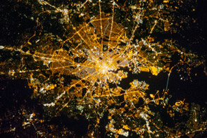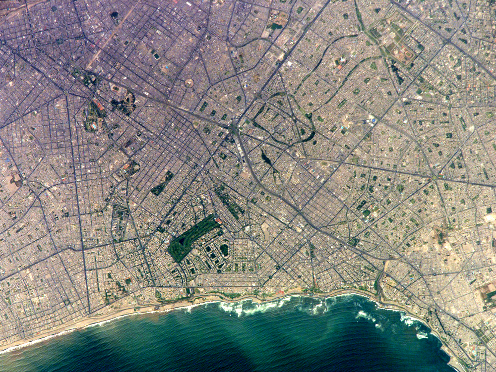
Located on the broad alluvial fan of the Rimac River, Lima is the capital of Peru and the only megacity (7.7 million inhabitants in 2002) located on the western coastline of South America. The city was established by Francisco Pizarro in 1535 and became an important colonial port, linking silver mines of the Altiplano of the high Andes Mountains with the burgeoning Spanish empire. During the mid-20th century, significant numbers of people relocated from rural mountain communities into the Lima metropolitan area. Problems now facing the metropolitan region include developing adequate water resources, controlling pollution, and preparing for natural hazards such as earthquakes and landslides.
This astronaut photograph depicts the wealthier San Isidro and Miraflores quarters of Lima. This part of the metropolitan area is characterized by numerous vegetated parks, golf courses (such as the Lima Golf Course—approximately 1 km long), and greenbelts interspersed with residential and commercial areas. The higher proportion of dark asphalt in the street grid of the residential and commercial areas lends a purple coloration to the left portion of the astronaut photograph (downtown Lima is to the north). Regions with fewer built materials and vegetation are light tan. Wave patterns are visible approaching beaches, popular tourist destinations, in the lower half of the image.
Astronaut photograph ISS010-E-20111 was acquired March 15, 2005, with a Kodak 760C digital camera with an 800 mm lens, and is provided by the ISS Crew Earth Observations experiment and the Image Science & Analysis Group, Johnson Space Center. The International Space Station Program supports the laboratory to help astronauts take pictures of Earth that will be of the greatest value to scientists and the public, and to make those images freely available on the Internet. Additional images taken by astronauts and cosmonauts can be viewed at the NASA/JSC Gateway to Astronaut Photography of Earth.