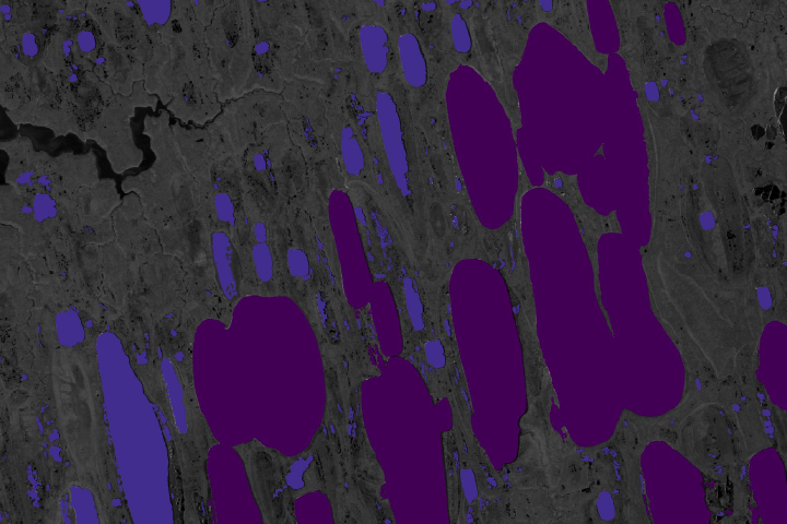
Synthetic Aperture Radar is offering scientists a new way to measure how much of the potent greenhouse gas is bubbling up from frozen Arctic lakes.
Published Jul 14, 2020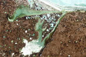
Acquired June 15, 2009, this natural-color image shows Omulyakhskaya and Khromskaya Bays along the coast of Northern Siberia.
Published Aug 14, 2011
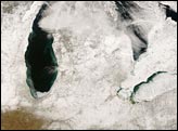
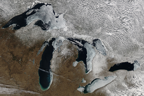
Snow cover lingered in the Great Lakes region on February 16, 2008. Against the backdrop of snowy ground appear the deep blue waters of the Great Lakes and nearby water bodies. In this wintertime shot, the lakes are relatively ice-free, except for Lake Erie.
Published Feb 20, 2008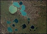
The extent of ice on North America's Great Lakes is past its annual peak, but remains above the average maximum extent.
Published Mar 18, 2015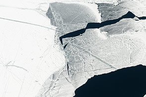
Ice cover surpassed 80 percent for the first time in 20 years.
Published Feb 21, 2014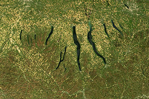
Huge sheets of ice carved out the U-shaped valleys that hold New York’s Finger Lakes. When they retreated north about 10,000 years ago, glaciers left deposits of gravel that dammed streams and caused the depressions to become lakes.
Published Nov 30, 2013
Across the rippling, crevassed whitescape of the East Antarctic Ice Sheet, two unusual shapes appear in this grayscale satellite image of the frozen continent.
Published Feb 4, 2006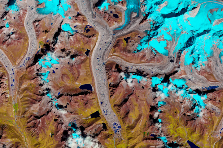
Throughout the Himalayas, many glaciers are retreating and meltwater lakes are growing, putting people at risk downhill and downstream.
Published May 9, 2017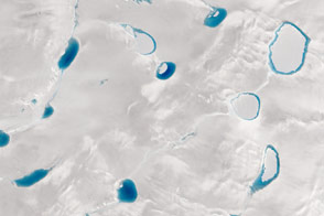
When it comes to the blue hue of meltwater lakes, darker means deeper; satellites can help scientists discover just how deep.
Published Sep 9, 2015alert message
