
Satellites and astronauts observed the potent storm as it headed for landfall in the southeastern United States.
Published Sep 12, 2018
The U.S. National Hurricane Center warned of heavy rain and strong winds across the region, as well as large, destructive waves.
Published Sep 22, 2020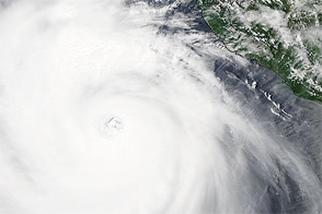
Acquired July 21, 2011, this image shows Hurricane Dora off the coast of Mexico, not far from Cabo Corrientes.
Published Jul 22, 2011
The powerful hurricane is believed to be the strongest on record to hit the northwestern Bahamas.
Published Sep 1, 2019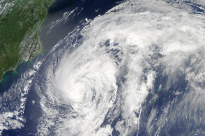
The third hurricane of the season stirred up the North Atlantic in late August 2014 but stayed offshore.
Published Aug 28, 2014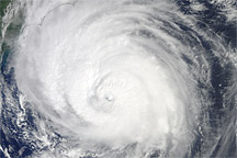
Acquired September 2, 2010, this natural-color image shows Hurricane Earl grazing the North Carolina coast.
Published Sep 3, 2010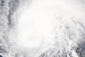
Acquired September 2, 2011, this natural-color image shows Hurricane Katia west of the Leeward Islands.
Published Sep 2, 2011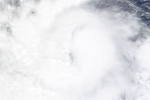
Acquired June 22, 2010, this natural-color image shows Hurricane Celia over the eastern Pacific Ocean.
Published Jun 23, 2010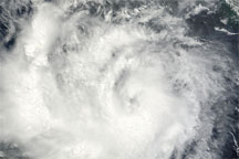
Acquired June 23, 2010, this natural-color image shows Darby just off the coasts of Mexico and Guatemala.
Published Jun 24, 2010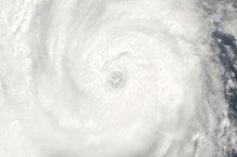
Acquired August 27, 2010, this natural-color image shows Hurricane Danielle over the Atlantic Ocean.
Published Aug 27, 2010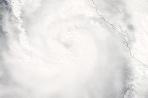
Acquired October 11, 2011, this natural-color image shows Hurricane Jova approaching the coast of Mexico.
Published Oct 13, 2011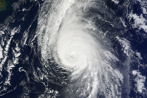
The fierce storm was just hours from passing over Bermuda when a NASA satellite captured this view.
Published Oct 17, 2014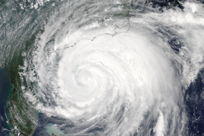
Hurricane Irene extends from central Florida to North Carolina in this image taken at 2:05 Eastern Daylight Time on August 26, 2011.
Published Aug 29, 2011alert message
