Ice cover surpassed 80 percent for the first time in 20 years.
Published Feb 21, 2014
Across the rippling, crevassed whitescape of the East Antarctic Ice Sheet, two unusual shapes appear in this grayscale satellite image of the frozen continent.
Published Feb 4, 2006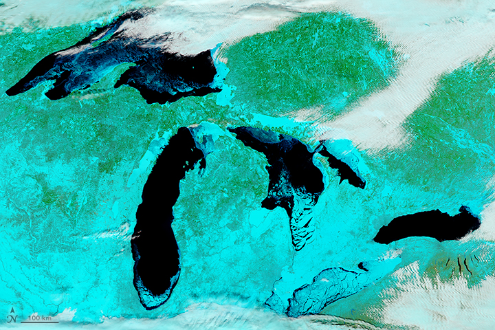
Lake Erie is usually the first to freeze over because it is shallower than the other Great Lakes.
Published Feb 18, 2018Image of the Day Atmosphere Temperature Extremes Sea and Lake Ice
The extent of ice on North America's Great Lakes is past its annual peak, but remains above the average maximum extent.
Published Mar 18, 2015
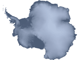
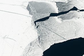
To the untrained eye, Antarctica may look like a giant piece of solid ice that rarely changes, but scientists studying the continent have long known better. The icy surface is dynamic, with glaciers and "streams" of ice flowing toward the ocean.
Published Apr 27, 2007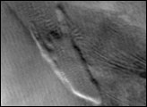
Throughout Antarctica, broad ribbons of ice known as ice streams shed large quantities of ice into the ocean.
Published Apr 24, 2007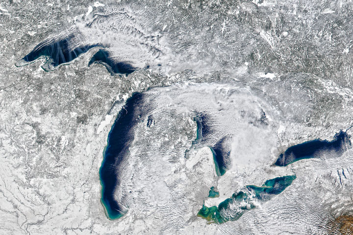
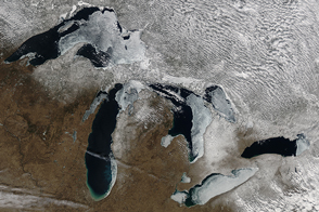
Warm air prevailed in the 2019-2020 winter season, preventing much ice from forming on the lakes.
Published Feb 20, 2020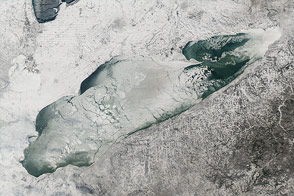
Nearly 90 percent of the lake was ice-covered on January 9, 2014.
Published Jan 15, 2014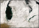
Snow cover lingered in the Great Lakes region on February 16, 2008. Against the backdrop of snowy ground appear the deep blue waters of the Great Lakes and nearby water bodies. In this wintertime shot, the lakes are relatively ice-free, except for Lake Erie.
Published Feb 20, 2008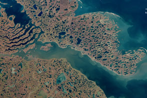
Acquired September 2, 2000, this natural-color image shows the area around Liverpool Bay in Canada’s Northwest Territories.
Published Aug 21, 2011
Melt ponds on the surface of Greenland’s ice sheet are an important indicator of the strength of the 2013 melt season.
Published Jul 9, 2013alert message
