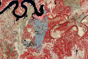
Acquired September 3, 2011, this false-color image shows the burn scar from the 101 Ranch Fire in Palo Pinto County, Texas.
Published Sep 7, 2011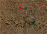
Taken on May 2, 2100, this image shows land burned in the large Rockhouse Fire in southwestern Texas.
Published May 3, 2011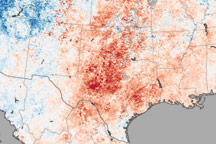
This temperature map shows the extremely warm temperatures that helped create hazardous fire conditions in Texas in April.
Published Apr 22, 2011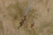
The Rock House Fire stretches in a long line around the town of Fort Davis, Texas, in this true-color image taken on April 10, 2011.
Published Apr 11, 2011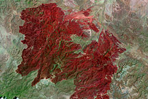
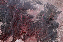
This Landsat image, taken on May 2, 2011, shows all 314,444 acres burned in the Rockhouse Fire in southwestern Texas.
Published May 5, 2011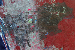
A blaze in Western Australia devastated the town of Yarloop.
Published Jan 19, 2016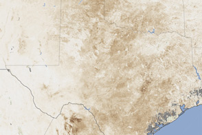
Severe drought has taken a serious toll on vegetation and farmers in Texas, New Mexico, and Oklahoma.
Published Jul 27, 2011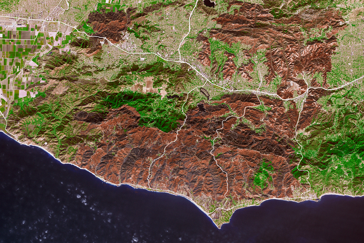
As the destructive California fire nears full containment, it has left behind an expanse of charred land.
Published Nov 19, 2018

The Landsat-5 satellite acquired this image of the Swenson Fire burn scar on April 18, 2011.
Published Apr 27, 2011alert message
