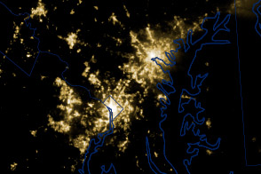
A powerful line of thunderstorms knocked out power to millions of households in the U.S. Midwest and Mid Atlantic on June 29, 2012.
Published Jul 4, 2012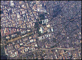
George Washington not only served as the namesake for the capital city of the United States, he also chose its location, perhaps envisioning the transportation possibilities that the Potomac River flowing past the site would provide. Recognizable in this image are the Capitol Building, the Washington Monument (and its shadow), and the Lincoln Memorial, along the northeast bank of the Potomac River.
Published May 22, 2006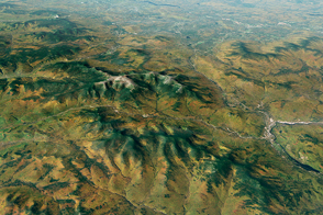
The tallest peaks in New England face some pretty nasty weather.
Published Apr 25, 2017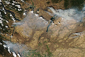
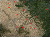
In September 2012, lightning sparked numerous wildfires in central Washington.
Published Sep 11, 2012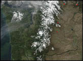
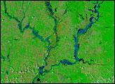
Heavy rains in early June 2008 soaked the U.S. Midwest, leaving swollen rivers in their wake. By June 8, 2008, the National Weather Service had issued flood warnings for numerous counties throughout Indiana and Illinois. The lower Wabash, White, and East Fork White watersheds had all been affected by the deluge, according to National Weather Service bulletins, and streamflow gauges on parts of the White and East Fork White River recorded 100-year-flood levels, according to preliminary reports from the U.S. Geological Survey.
Published Jun 12, 2008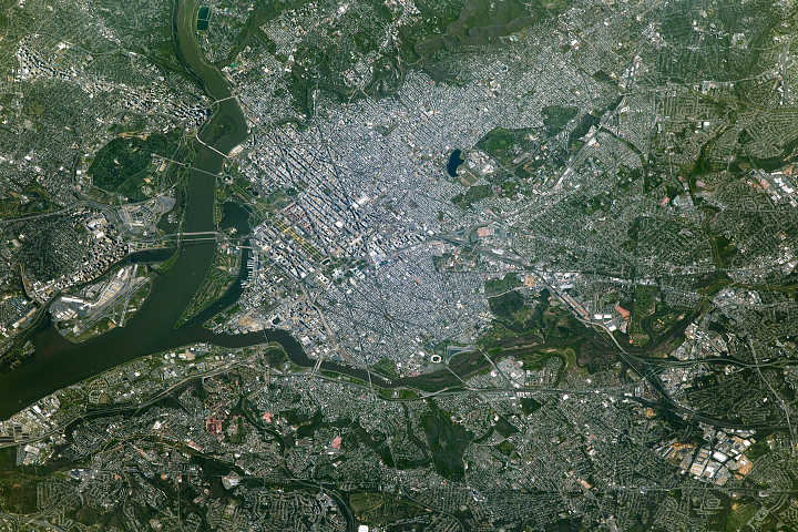
Wedged between Maryland and Virginia, the District of Columbia was established in 1790 to serve as the permanent seat of the U.S. federal government.
Published Jul 10, 2017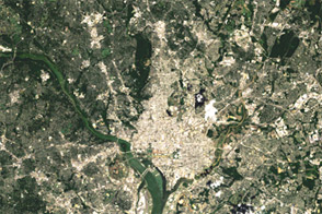
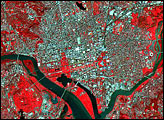
Acquired on August 27, 1984, and August 22, 2011, these images document growth around Washington, DC.
Published Jul 5, 2012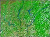
alert message
