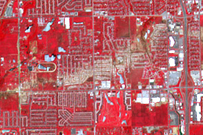
The ASTER instrument on NASA’s Terra satellite captured this wide view of the destruction wrought by the May 20, 2013, tornado in Moore, Oklahoma.
Published Jun 5, 2013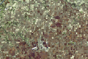
An EF-4 tornado left its mark on northern Illinois before devastating a small farming community.
Published Apr 14, 2015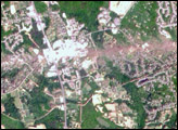
This pair of images from the Multi-angle Imaging Spectroradiometer (MISR) shows the strip of flattened and possibly denuded vegetation left by the F4 tornado (winds from 207 to 260 miles per hour, causing “devastating damage”) that struck La Plata, Maryland on April 28, 2002.
Published May 8, 2002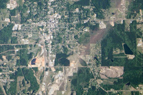
An EF4 tornado tore through this small town, leaving a trail of damaged buildings and trees.
Published May 9, 2014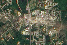
A number of severe thunderstorms swept through the mid-Atlantic states on April 28, bringing high winds, hailstones, and heavy rains to many areas. The intense storms spawned at least two tornadoes, one of which was classified as an F4 twister. The powerful tornado touched down in southern Maryland and ripped through the town of La Plata, destroying most of the historic downtown. The twister—the strongest ever recorded to hit the state and perhaps the strongest ever recorded in the eastern U.S.—flattened everything in its path along a 39 kilometer (24 mile) swath running west to east through the state.
Published May 2, 2002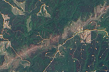
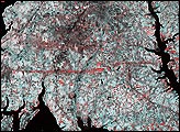
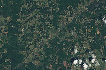
Acquired May 7, 2011, this natural-color image shows part of a tornado track near the town of Berry, Alabama.
Published May 13, 2011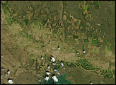
A pale green swath in this Landsat image from April 28, 2011, reveals the path of a tornado outside of Griffin, Georgia.
Published Apr 29, 2011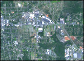
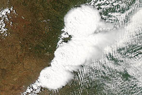
A supercell thunderstorm system spawned a destructive tornado near Oklahoma City on May 20, 2013.
Published May 22, 2013alert message
