Mount Ararat (16,940 feet; 5165 meters) is the largest volcano in Turkey. Although not currently active, its most recent eruption has probably been within the last 10,000 years. It is located in extreme northeastern Turkey, near the borders with Iran and Armenia. Southwest of the main peak lies Little Ararat (12,877 feet; 3896 meters). Ahora Gorge is a northeast-trending chasm dropping 6000 feet from the top of the mountain and was the focus of a major earthquake in 1840. A number of claims by different explorers to have found remnants of Noah’s Ark on Mt. Ararat have led to continuing expeditions to the mountain, many of which have focused their searches on the gorge area.
Published Jun 17, 2001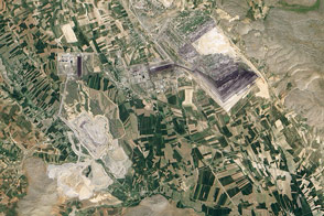
In February 2011, landslides decimated an open pit coal mine near Elbistan.
Published Jun 21, 2012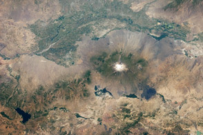
Taken July 8, 2011, this astronaut photograph shows the border region of Turkey, Armenia, and Iran, including the Aras River.
Published Jul 25, 2011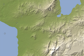
A strong earthquake struck Turkey in late October 2011. This image maps the quake and aftershocks onto the mountainous landscape of eastern Turkey.
Published Oct 24, 2011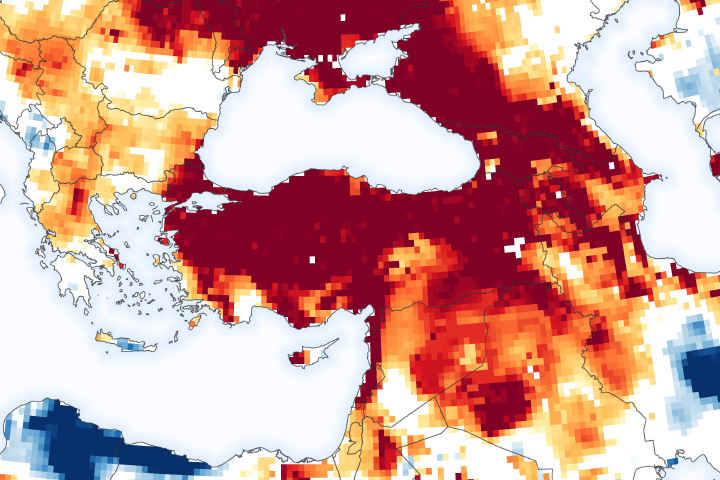
Multiple seasons of below-average rainfall have affected the country’s drinking water supplies and groundwater reservoirs.
Published Jan 16, 2021
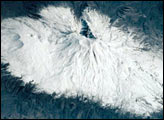
Strong winter storms brought snow and cold to much of the Eastern Mediterranean.
Published Jan 30, 2004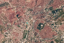
The distinctive red brick roof tiles of buildings in Ankara, Turkey, are the most striking feature in this astronaut photo from April 11, 2009.
Published May 11, 2009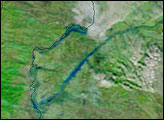
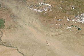
Acquired July 29, 2011, this natural-color image shows a dust plume blowing across Iraq, Syria, and Turkey.
Published Jul 29, 2011alert message
