Drought has struck a huge reservoir on the border Zambia and Zimbabwe, reducing the hydro power supply from Kariba dam .
Published Feb 12, 2016
Surging with fresh water from heavy winter snow melt, Lake Powell rose significantly in the summer of 2011 after many years of low levels.
Published Aug 12, 2011
In May 2016, the reservoir behind Hoover Dam reached its lowest level since the 1930s.
Published May 27, 2016
Ongoing drought and diminished snowpack in the Rockies have combined with increasing demands downstream to cause the great reservoir to drop to historically low levels.
Published Aug 1, 2014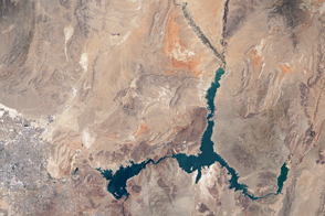
The water within a large, key reservoir in the southwestern United States has fallen to levels not seen since the 1930s.
Published Aug 18, 2015
In August 2010, Lake Mead reached its lowest level since 1956, the result of a persistent drought and increasing human demand.
Published Sep 23, 2010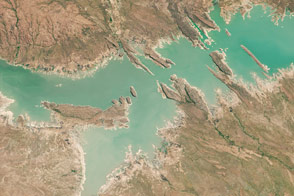
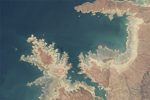
Low water levels on this Mozambique reservoir betrayed signs of drought stress in August 2016.
Published Aug 16, 2016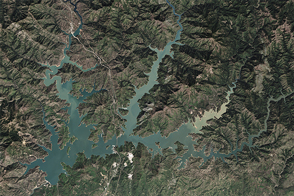
After four years of shrinking due to drought, the largest reservoir in California got a much-needed boost from El Niño-fueled winter precipitation.
Published Apr 7, 2016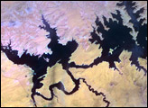
In the 1950s, construction began on the Glen Canyon Dam on the Colorado River in northern Arizona. The dam created Lake Powell: a long, skinny, meandering reservoir straddling the Arizona-Utah border. Ingenuity of human design, however, did not protect this massive reservoir from the drought that struck much of the southwestern United States between 2000 and 2007.
Published Oct 17, 2007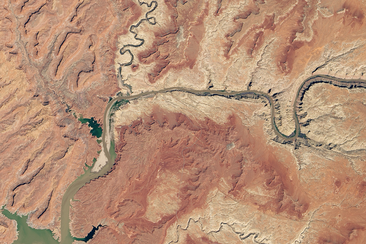
Heavy winter and spring snowfall provided much-needed meltwater, but the effects of long-term drought mean the lake is nowhere near its highs from the 1980s and 90s.
Published Oct 1, 2019alert message
