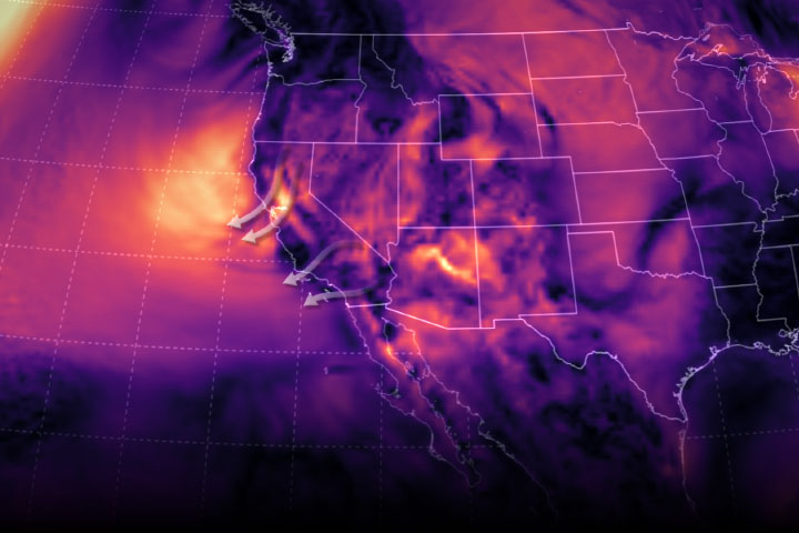
Fierce Diablo winds helped fan flames, which have consumed more than 75,000 acres.
Published Oct 29, 2019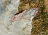
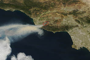
On May 2, 2013, the MODIS instrument on the Terra satellite captured this image of wildfire burning near Los Angeles, California.
Published May 4, 2013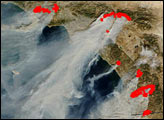
Record-setting fire activity in 2018 fits with a longer trend of larger and more frequent California fires since 2000.
Published Nov 27, 2018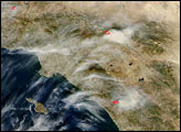
While the 2014 wildfire season has been active in California, the fires have not been particularly large or damaging.
Published Aug 26, 2014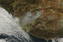
Acquired shortly before noon local time on September 22, 2009, this true-color image shows smoke from the Guiberson Fire blowing southwestward toward the Pacific coastline. A red outline gives the rough perimeter of the fire.
Published Sep 23, 2009
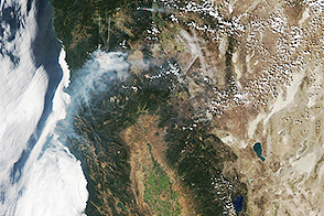
Temperature, humidity, and winds contributed to the rapid spread of fire in Lake County, about 100 miles northwest of Sacramento.
Published Jun 27, 2018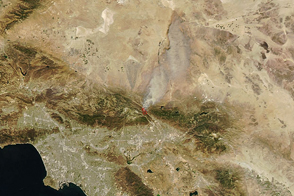
Dry, windy weather intensified the blaze near San Bernardino.
Published Aug 17, 2016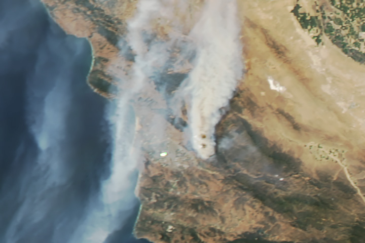
As the smoke from this fire makes clear, surface winds do not always blow in the same direction as those at higher altitudes.
Published Jul 21, 2017alert message
