Acquired October 19, 2012, and October 26, 2011, these images compare conditions in northeastern Nigeria and neighboring countries, all affected by flooding in 2012.
Published Oct 19, 2012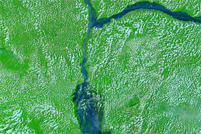
Satellite images show stark changes around the confluence of the Niger and Benue Rivers, in a region where more than a million people have been displaced in 2012.
Published Oct 16, 2012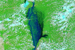
Acquired October 11, 2012, and October 8, 2010, these images compare conditions near the confluence of the Benue and Niger Rivers in southern Nigeria. Floods struck the region in 2012.
Published Oct 12, 2012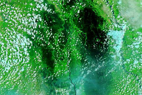
These images from September 18, 2011, and September 17, 2012, compare conditions in northern Cameroon, which experienced severe flooding in September 2012.
Published Sep 18, 2012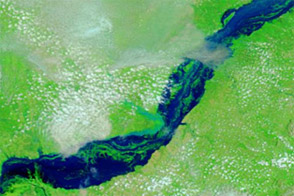
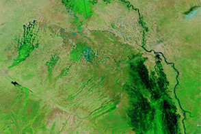
Acquired September 8, 2012, and September 23, 2009, these false-color images compare conditions along the Benue River, which flooded in 2012.
Published Sep 12, 2012