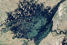
Water flowed from the flooded Zambezi River into the wetland in northern Namibia shown in this image.
Published Apr 20, 2009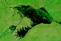
Water stretches across kilometers of land in Namibia's Caprivi strip in this Terra MODIS image from April 14, 2009.
Published Apr 16, 2009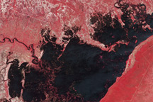
This pair of images from the Advanced Spaceborne Thermal Emission and Reflection Radiometer (ASTER) on NASA’s Terra satellite shows flooding in along the Chobe River in Namibia.
Published Apr 8, 2009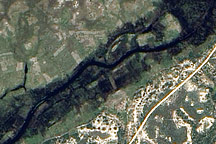
This detailed, photo-like image from April 1, 2009, shows floods covering fields of crops around the Bukalo Channel in northern Namibia.
Published Apr 7, 2009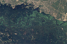
This pair of images illustrates the dramatic flooding of the Zambezi River in Namibia in late March 2009.
Published Apr 2, 2009