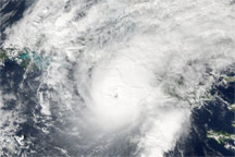
On November 8, 2008, Hurricane Paloma ballooned into an extremely dangerous Category 4 hurricane with sustained winds of 230 kilometers per hour (145 miles per hour) and stronger gusts.
Published Nov 10, 2008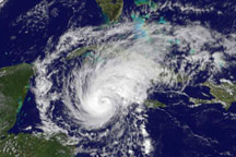
Hurricane Paloma was well-formed, with distinctive spirals and a clear eye on November 7, 2008, when the GOES satellite captured this image.
Published Nov 8, 2008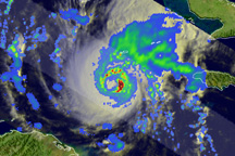
Although it was November, Cuba potentially faced its a third major hurricane of the season as Hurricane Paloma approached. Hurricane Paloma became an intensifying Category 2 storm on November 7, a few hours after TRMM captured this image.
Published Nov 7, 2008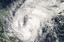
Hurricane Paloma developed as a late-season storm in the Caribbean Sea in early November. This image shows the developing storm on November 6, 2008.
Published Nov 7, 2008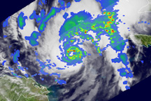
A late-season storm, Paloma developed as a tropical depression in the Caribbean off the coast of Honduras and Nicaragua on November 5, 2008. This image shows the storm as a Category 1 hurricane on November 6.
Published Nov 7, 2008