The storm was headed for Okinawa and the main island of Japan in late September 2012.
Published Sep 29, 2012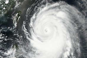
Typhoon Malakas approached Japan and made landfall as a category-3 storm.
Published Sep 19, 2016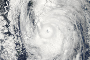
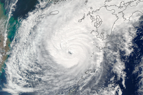
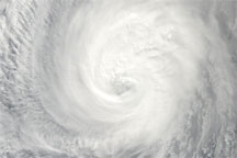
Poised to go ashore over Japan, Typhoon Roke is a large, well-developed storm in this image from September 20, 2011.
Published Sep 21, 2011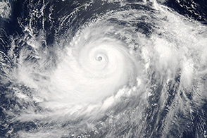
Typhoon Halong churned south of Japan when the Aqua satellite acquired this image on August 6, 2014.
Published Aug 6, 2014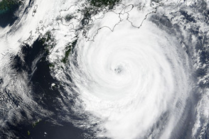
The storm was set for landfall late on July 16.
Published Jul 17, 2015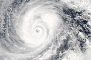
The second massive storm of October 2014 barrels down on Japan.
Published Oct 10, 2014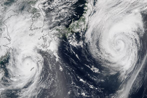
Two typhoons spun over the western North Pacific near Japan.
Published Aug 25, 2015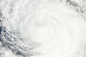
Acquired July 18, 2011, this natural-color image shows Typhoon Ma-on approaching southern Japan.
Published Jul 18, 2011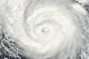
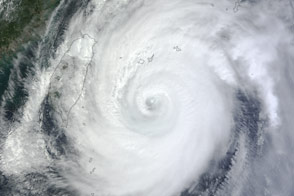
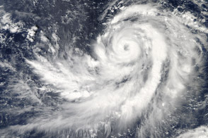
Acquired September 16, 2012, this natural-color image shows Typhoon Sanba over Okinawa, Japan.
Published Sep 17, 2012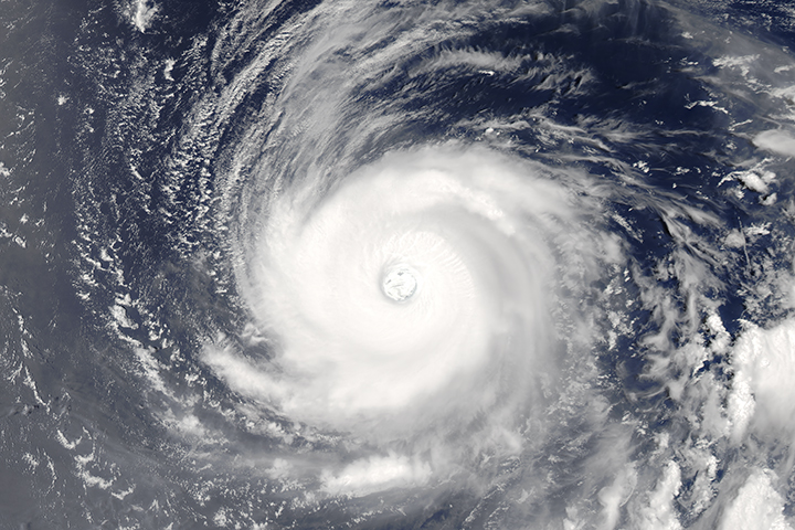
The powerful, well developed storm spins over the western tropical Pacific Ocean.
Published Aug 1, 2017
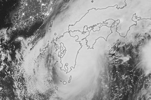
Clouds from Super Typhoon Malakas blanketed Japan as the storm made landfall on the island of Kyushu.
Published Sep 20, 2016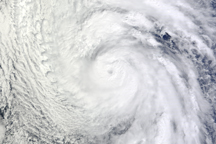
The loose spiraling clouds of Typhoon Chaba are spread across most of the Philippine Sea in this true-color image from October 27, 2010.
Published Oct 27, 2010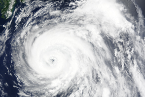
Acquired November 30, 2009, this true-color image shows Typhoon Nida spanning hundreds of kilometers in the Western Pacific Ocean.
Published Nov 30, 2009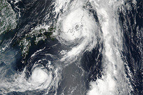
The 27th named storm of the year in Pacific could be headed for Japan.
Published Oct 17, 2013