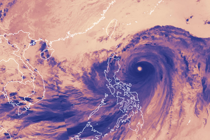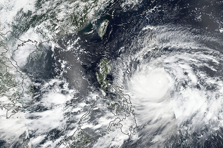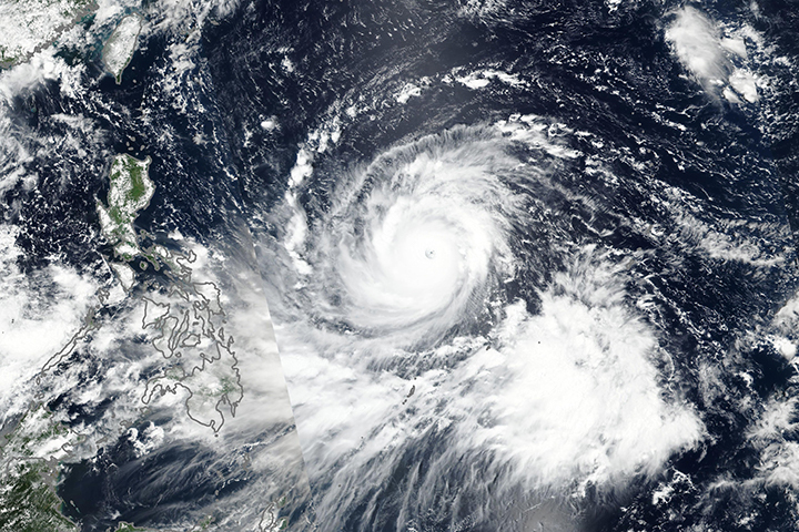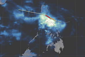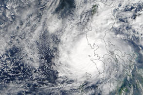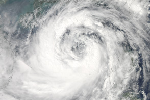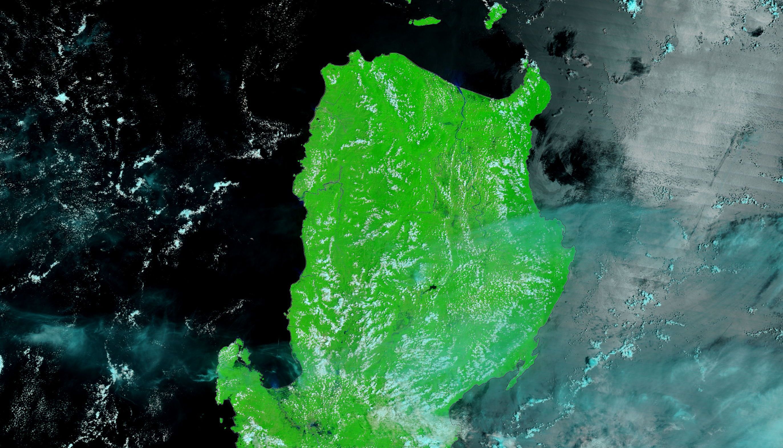
Super Typhoon Mangkhut (Ompong) slammed into the Philippines near the northern tip of Luzon on September 15, 2018, with winds that exceeded 265 kilometers per hour (165 miles per hour). The storm also brought intense rainfall, with some parts of Luzon picking up more than 66 centimeters (26 inches) of rain.
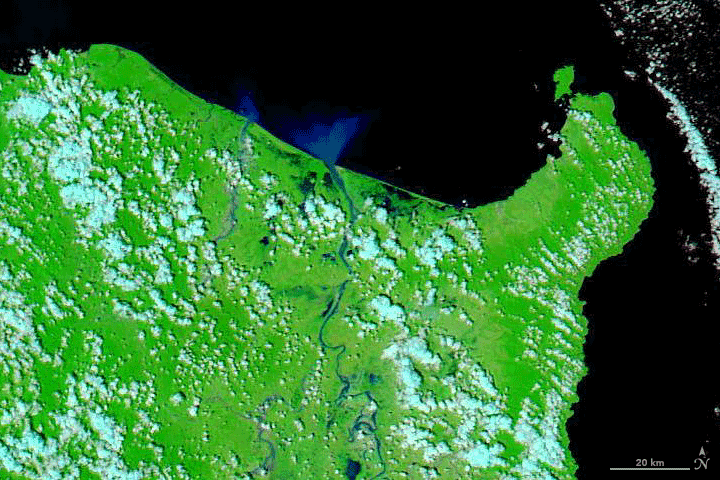
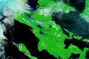
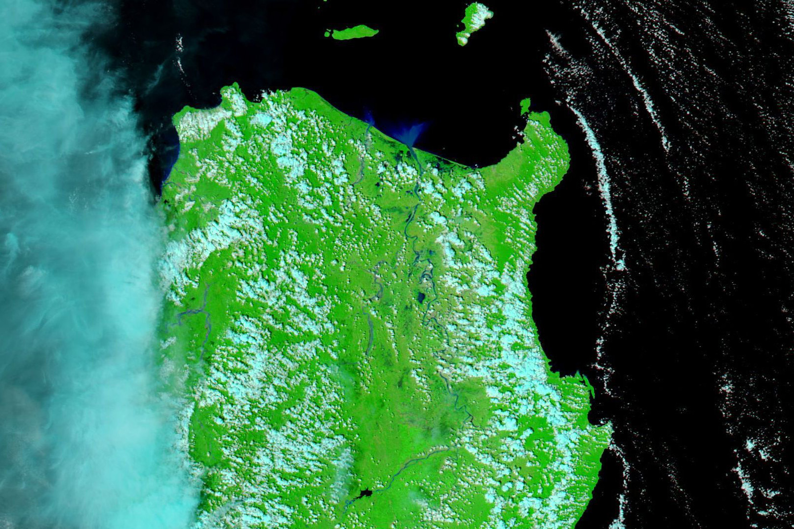
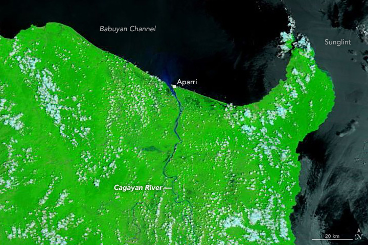
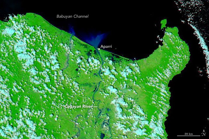
The Moderate Resolution Imaging Spectroradiometer (MODIS) on NASA’s Terra satellite observed floodwaters in northern Luzon on September 17, 2018. For comparison, the second image shows the same area on September 6, 2018.
These false-color images use a combination of visible and infrared light to make it easier to distinguish between water and land. River water appears navy blue; vegetation is bright green. Clouds appear pale blue-green. Sunglint has discolored some of the water in the first image.
According to the United Nations, the storm damaged or destroyed roughly 1,475 homes and caused hundreds of millions of dollars of crop losses.
NASA Earth Observatory image by Adam Voiland, using MODIS data from LANCE/EOSDIS Rapid Response. Caption by Adam Voiland.