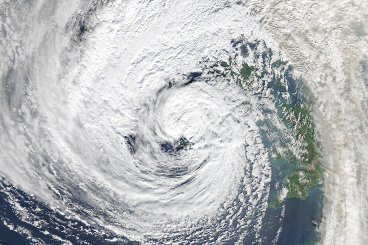
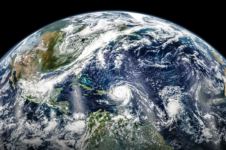
In the latest twist from an unusually potent Atlantic hurricane season, a tropical storm is now headed for the shores of Ireland. Hurricane Ophelia probably won’t make it to the island as a true hurricane; it is more likely to evolve into an extratropical cyclone as it passes over cooler North Atlantic water. But either way, strong winds and heavy rain are expected to blow into the southwest coast of Ireland and over parts of the United Kingdom on October 16, 2017.
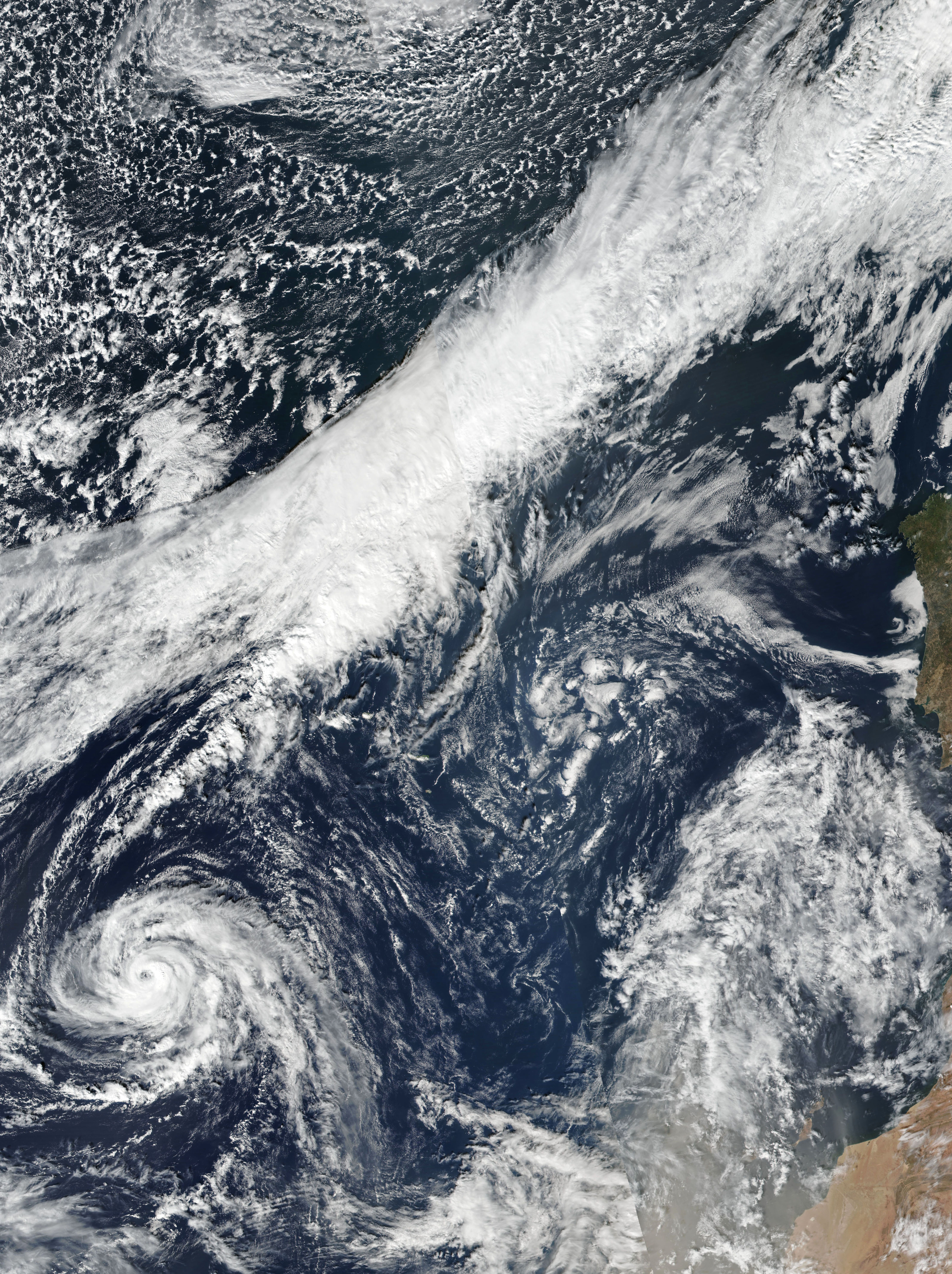
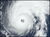
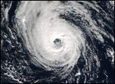
The Visible Infrared Imaging Radiometer Suite (VIIRS) on Suomi NPP captured these images of Ophelia approaching the Azores on October 13, 2017. At 11 a.m. Atlantic Standard Time (15:00 Universal Time) that day, shortly before VIIRS collected its data, the U.S. National Hurricane Center (NHC) reported sustained winds of 100 miles (160 kilometers) per hour and a central pressure of 971 millibars (28.68 inches). Hurricane-force winds extended outward up to 25 miles (35 kilometers) from the center and tropical-storm-force winds extended up to 90 miles (150 kilometers).
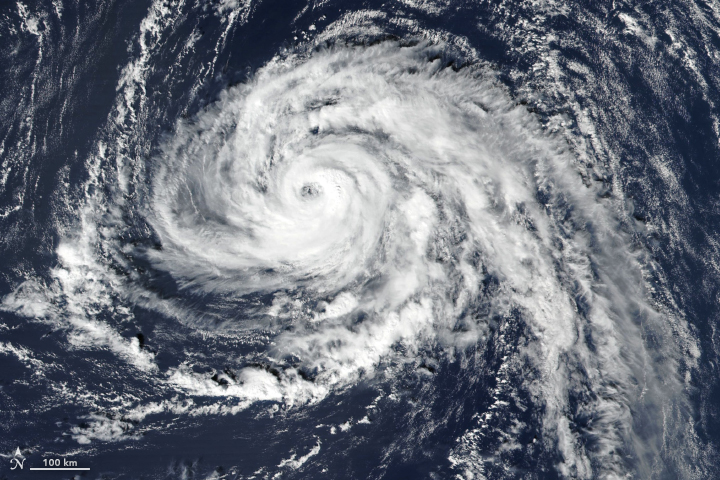
In a forecast discussion posted at 11 a.m. AST on October 13, the NHC noted that Ophelia was likely to remain at hurricane force through its extratropical transition. The UK Met Office predicted heavy rain and winds of 55 to 65 miles per hour (gusts to 80) when the storm arrives on Irish shores on October 16.
Ophelia is likely to be the most potent storm to reach Ireland since Hurricane Gordon in 2006. It is not that unusual for extra-tropical remnants of hurricanes to reach the area, but they usually come west from Newfoundland and the Canadian Maritimes. This week’s storm is unusual in that it formed and stayed in the eastern Atlantic.
According to meteorologists writing for The Washington Post, Ophelia marks the 10th consecutive tropical weather system in the Atlantic Basin to turn into a hurricane (as opposed to remaining tropical depressions or storms), tying a record for the most hurricanes in a row. “In an average season, we would typically have seen only five hurricanes by October 13, along with five additional named storms of lesser intensity,” the Capital Weather Gang wrote. “This year there have been 15 named storms from Arlene in April to Ophelia in early October.”
NASA Earth Observatory image by Joshua Stevens, using VIIRS data from LANCE/EOSDIS Rapid Response. Story by Mike Carlowicz.


