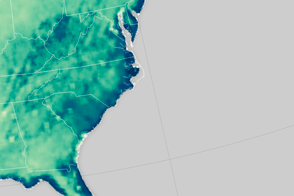
Located about 200 kilometers southeast of Los Angeles, in a heavily farmed area of the Sonoran Desert, the Salton Sea is California’s largest lake. It was formed by accident in the early 1900s, when water diverted from the Colorado River broke through canal gates and filled the low-lying basin—continuing a long history of drying and filling. Today, the lake is fed primarily by the runoff from farm irrigation, and to a lesser extent from urban runoff, groundwater and rainfall. But an unusual combination of conservation, drought, and water laws may someday take the lake away.
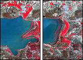
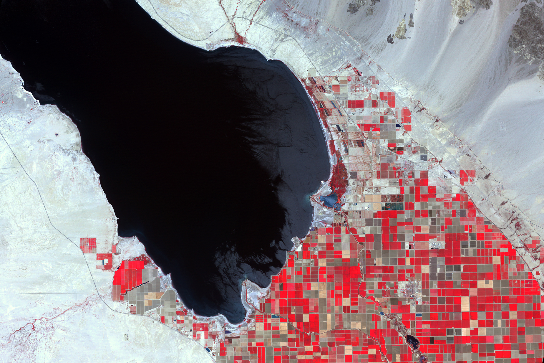
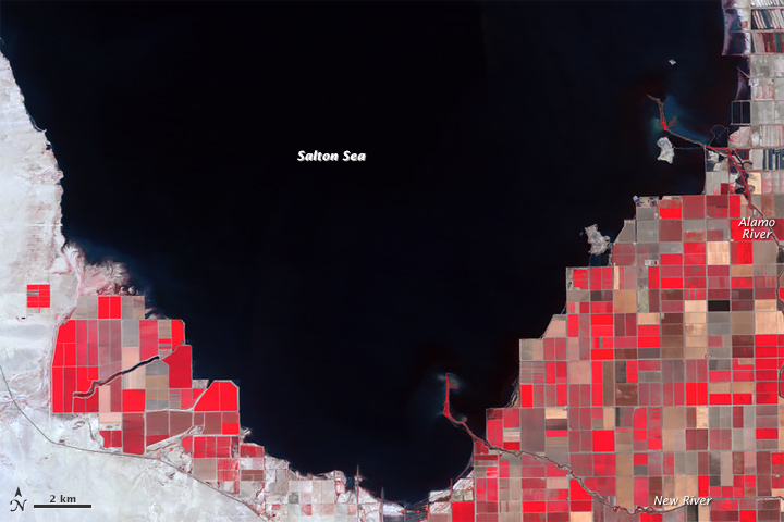
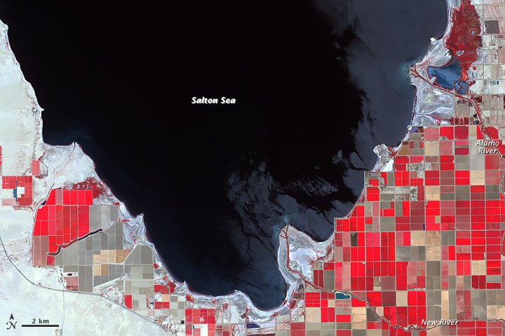
The false-color infrared images above illustrate changes that have already occurred over a span of about three decades. The top image was acquired by the Thematic Mapper on Landsat 5 on May 31, 1984; the bottom image was acquired by the Advanced Spaceborne Thermal Emission and Reflection Radiometer (ASTER) on NASA’s Terra satellite on June 14, 2015. Turn on the image comparison tool to see where the shoreline has receded and agricultural fields have gone fallow.
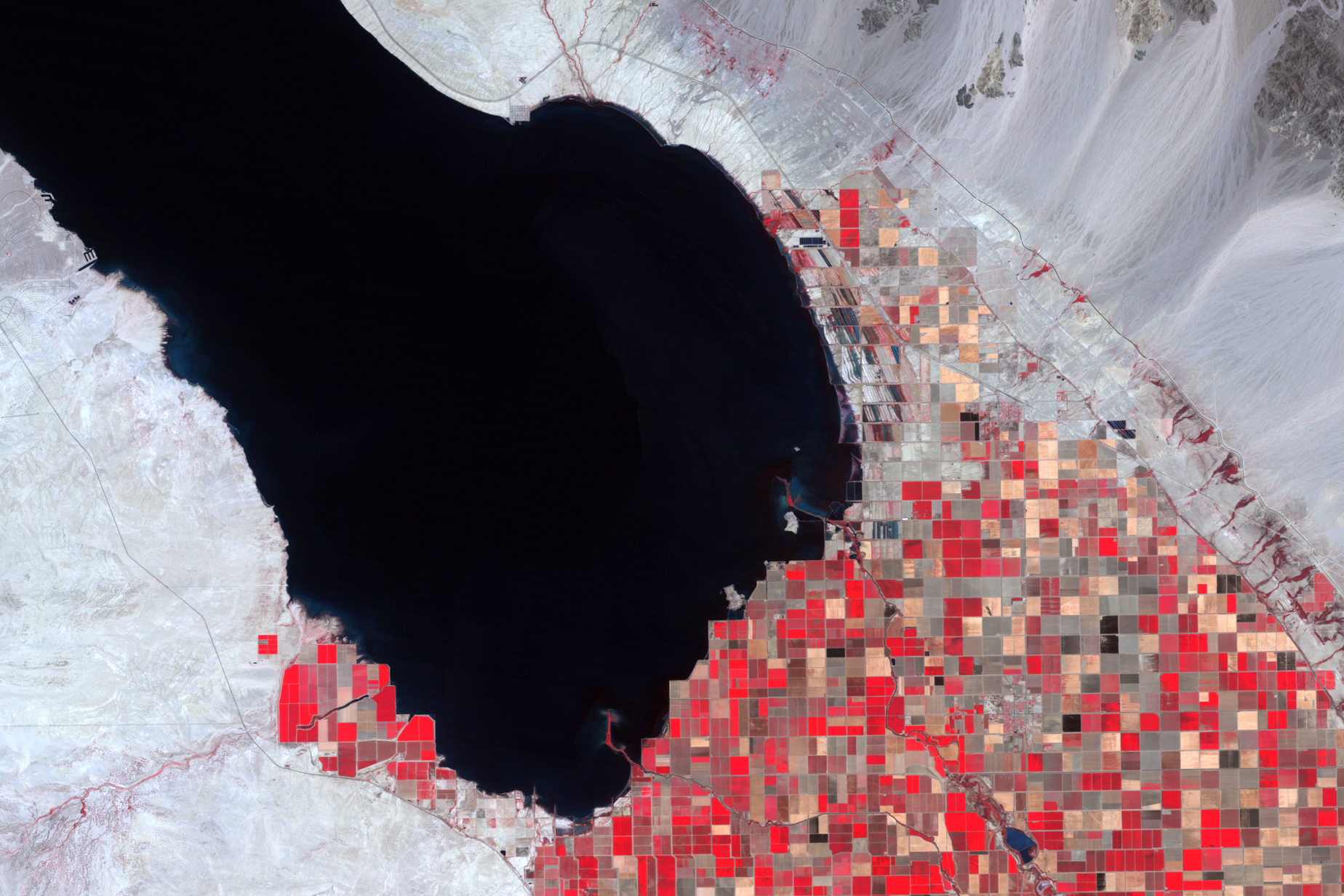
Tim Krantz, an environmental studies professor and Salton Sea expert at the University of Redlands, notes that the most obvious changes have been to the lake’s southern shoreline. Deltas of the New and Alamo rivers are fully exposed in 2015, whereas in 1984 they represented proper “bird-foot” deltas. The deltas were exposed due to a 2.4-meter (8-foot) drop in the lake’s surface elevation since 1984. The lake spans 960 square kilometers (370 square miles), but it is shallow—just 16 meters (52 feet) at its deepest point. This makes it extremely sensitive to even slight reductions of inflow. As a result, vast expanses of the lakebed are easily exposed.
“The changes from 1984 to 2015 are the result of other water conservation activities in the watershed, such as wastewater treatment going online in Mexicali, and lining of the Coachella and All-American diversion canals from the Colorado River,” Krantz said. “These are all good things, but they mean less water in the Salton Sea.”
Areas of agriculture around the lake have changed as well. Healthy plants with active chlorophyll are highly reflective in the near infrared; they appear red in these images. Over 30 years, a greater amount of agricultural land has become brown and fallow, particularly along the southwestern shoreline.
“This is how the reductions of inflow will manifest themselves, as farmers convert to more drought-tolerant crops (a good thing), while fallowing other fields,” Krantz said. “The result is less water to the lake, which receives almost all of its inflows from agricultural runoff.”
Krantz notes that even more drastic reductions could be in store for the lake. The Imperial Irrigation District controls most of the water diverted from the Colorado River, and is required by the Quantification Settlement Agreement to maintain the lake at its present elevation of 99 meters (235 feet) below sea level through 2017.
After that point, water transfers from the Imperial Irrigation District to San Diego and coastal cities are expected to begin. According to Krantz, the magnitude of these transfers, combined with the reduced inflow from the wastewater treatment, the canal lining, and drought, could reduce the lake to the size of two small pools by the 2030s. In addition to habitat loss and ecological issues, another concern is that newly exposed lakebed sediments would become airborne and affect air quality.
“The addition of such large areas of dust emissive lake bottom sediments to the desert winds could result in a human health disaster,” Krantz noted, “the Western Hemisphere’s “Aral Sea,” but with 1.5 million people living in close proximity.”
NASA Earth Observatory images by Jesse Allen, using ASTER data from NASA/GSFC/METI/ERSDAC/JAROS, and U.S./Japan ASTER Science Team, and Landsat data from the U.S. Geological Survey. Caption by Kathryn Hansen.