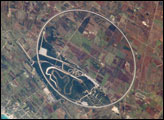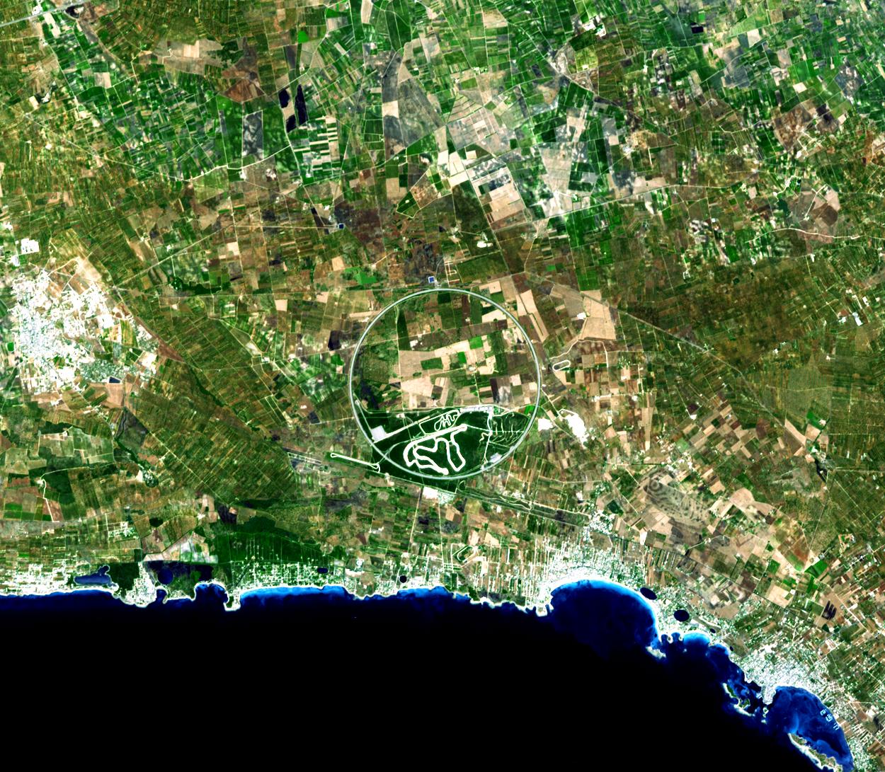
You might associate southern Italy with sunny cloudless skies, Mediterranean waters, and sandy beaches, and certainly those things are on display in this image. But for anyone interesting in knowing just how fast a car can go, southern Italy might call to mind the Nardò Ring. The Nardò Ring is a circular track that is 12.5 kilometers (7.8 miles) in circumference, and steeply banked to minimize the amount of steering a driver has to do. For a car moving at 200 miles per hour (about 320 kilometers per hour), the track is like an infinitely long straight road, says Motor Trend. Car manufacturers and racers use the track to test a car’s top speed.
The Nardò Ring is also easy to spot from space, making it a frequent subject of astronaut photography. It also shows up well in satellite images such as this one. The Advanced Spaceborne Thermal Emission and Reflection Radiometer (ASTER) flying on NASA’s Terra satellite captured this cloud-free image of the Nardò Ring on August 17, 2007. The man-made track imposes a white circle on the geometric rectangles of green and tan made by agricultural fields. Several smaller tracks wind through the southernmost section of the ring.
The surrounding countryside hints at a much slower way of life than that portrayed by the Nardò Ring. The land is largely agricultural with populated areas along the coast. The largest center of population shown in the image is the small town of Villaggio Boncore. Its reflective man-made surfaces shine bright white in the lower right corner of the image. A sandy beach lines the Gulf of Taranto, which is turquoise near the shore where waters are shallow.
Image courtesy NASA/GSFC/METI/ERSDAC/JAROS and the U.S./Japan ASTER Science Team. Caption by Holli Riebeek.
alert message