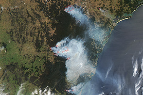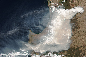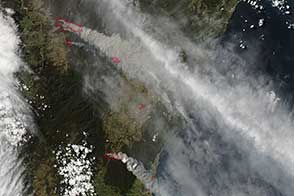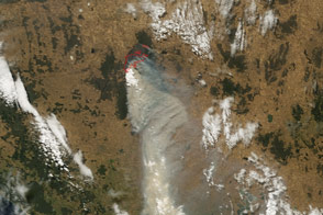
On January 3, 2015, the Moderate Resolution Imaging Spectroradiometer (MODIS) on NASA’s Terra satellite captured this image of smoke from the Adelaide Hills fire. As of January 5, fire had destroyed or badly damaged 26 homes. With temperatures forecast to soar as high as 38 degrees Celsius (100 degrees Fahrenheit) in the next few days, firefighters are concerned conditions could worsen.
NASA image from LANCE/EOSDIS Rapid Response. Caption by Adam Voiland.
In January 2015, intense bushfires in the Adelaide Hills charred thousands of hectares and destroyed several homes.

alert message