The Earth Observatory has published its last Image of the Day on this website. Please join us on our new home at science.nasa.gov/earth/earth-observatory.
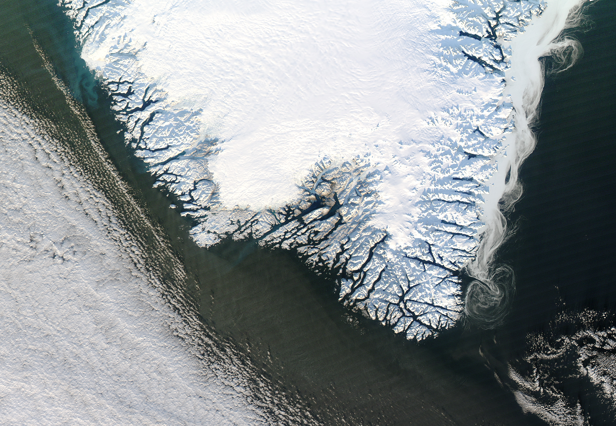
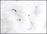
As the year 2012 drew to a close, the Moderate Resolution Imaging Spectroradiometer (MODIS) on NASA’s Aqua satellite captured this scene of sea ice, land ice, and fresh snow in southern Greenland. It is a fairly typical wintertime scene, but one that illustrates both seasonal and thousand-year changes.
As its name implies, the East Greenland Current flows along Greenland’s east coast, and it carries ice southward out of the Arctic Ocean via the Fram Strait. Sea ice carried by this cool current typically reaches the southern tip of Greenland at the beginning of winter. In this image, the southward-moving ice forms a series of tendrils and swirls in ghostly gray.
On Greenland itself, a fresh coat of snow blankets most of the land. The brilliant white snow is lighter than the bare ice beneath it, and serves as an excellent reflector of sunlight.
Albedo is the portion of energy an object reflects back into space, indicated by a value between 0 and 1. Fresh snow has an albedo of about 0.9, reflecting nearly all sunlight back into space. Dark ocean water has an albedo of about 0.06, absorbing almost all the light energy it receives. Bare ice falls roughly between these two extremes, with an albedo of about 0.5. So fresh snow sitting on the surface of Greenland’s ice sends most of the energy it receives back into space, serving as an insulator for the ice below. But for the coastal ice of southern Greenland, this situation is temporary.
“Melting of this snow, and then melting of the older ice sheet below, will likely resume in March or April,” says Ted Scambos, lead scientist at the National Snow and Ice Data Center. “In recent decades, the retreat of the ice edge has increased due to ice flow and summer melt. Last year’s melt volume was the highest by far in the past 35 years. This melt exposes bare ice near the edge of the ice sheet.”
“The Greenland ice sheet is far smaller than it was during past ice ages, tens to hundreds of thousands of years ago,” Scambos continues. “As the ice sheet retreated millennia ago, it revealed the craggy landscape of fjords and rugged hills seen along the coast.” Those rugged hills cast long shadows in in the low-angled sunlight.
NASA image courtesy Jeff Schmaltz, LANCE MODIS Rapid Response. Caption by Michon Scott, with information from Florence Fetterer, Walt Meier, and Ted Scambos, National Snow and Ice Data Center.