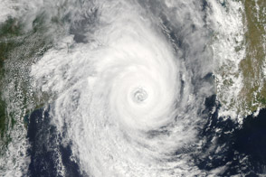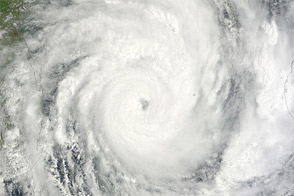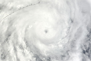

On January 23, 2012, Tropical Cyclone Funso raged over the Mozambique Channel, packing sustained winds of 100 knots (185 kilometers per hour) and gusts up to 125 knots (230 kilometers per hour). The U.S. Navy’s Joint Typhoon Warning Center (JTWC) reported that Funso was located roughly 590 nautical miles (1,095 kilometers) northeast of Mozambique’s capital city of Maputo.
The Moderate Resolution Imaging Spectroradiometer (MODIS) on NASA’s Terra satellite captured this natural-color image on January 23, 2012. The storm spans the channel between Mozambique and Madagascar, and bears a distinct eye. Coastlines and national borders are outlined in black.
The JTWC reported that conditions were favorable for storm intensification. Wind shear (changing wind speed and direction with altitude) tends to hamper storm development, but Funso experienced minimal vertical wind shear on January 23. In addition, sea surface temperatures in the Mozambique Channel were between 28 and 29 degrees Celsius (82 and 84 degrees Fahrenheit)—warm enough to continue fueling the storm. Different models forecast different storm tracks for Funso, including a slowdown, recurvature, and movement toward the south.
NASA image courtesy Jeff Schmaltz, LANCE/EOSDIS MODIS Rapid Response Team at NASA GSFC. Caption by Michon Scott.
Atmosphere Water Severe Storms
Tropical Cyclone Funso swirls over the Mozambique Channel in this natural-color image from January 23, 2012.
On January 23, 2012, Tropical Cyclone Funso raged over the Mozambique Channel.


