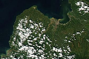

Even though it was a weak cyclone, Tropical Storm Washi has proven to be the deadliest storm of 2011. Known locally as Sendong, the storm moved across the southern Philippines island of Mindanao on December 16 and 17, inundating the island with heavy rain. The rain poured off mountains and filled rivers, triggering deadly flooding and landslides. As of December 22, the Philippine government has reported 1,010 people dead, with 1,603 injured and 51 missing. Most of the casualties occurred in the coastal cities of Cagayan de Oro and Iligan.
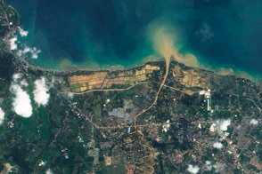
The Advanced Land Imager (ALI) on NASA’s Earth Observing-1 (EO-1) satellite acquired this image of Cagayan de Oro on December 20, 2011. The image shows evidence that the Iponan River overflowed during the storm. Brown smudges along the bank of the river are either standing water or mud. Exposed ground throughout the scene—such as the fields near the coast—is similarly muddy.
Flash flooding along the rivers occurred at night, sweeping away homes near the rivers. The floods damaged 28,030 homes and affected 614,098 people, according to the Philippine government.
NASA Earth Observatory image created by Jesse Allen, using EO-1 ALI data provided courtesy of the NASA EO-1 team. Caption by Holli Riebeek.
The mud-lined river banks shown in this image hint at devastating flooding in the city of Cagayan de Oro in the Philippines.
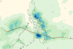
Tropical Storm Washi inundated the Philippines with heavy rain in mid-December 2011.


