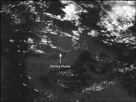
A large brush fire in southern Washington state burned over 150,000 acres on June 28th and 29th, 2000. Ignited by a car crash, the fire was burning near the Hanford nuclear reservation, although it had not released any radioactivity by afternoon on the 29th.
The image above was aquired by a NOAA Geostationary Operational Environmental Satellite (GOES) at 4:30 PDT June 28, 2000. The smoke plume was relatively small and thin compared to a forest fire of the same size.
For current GOES images of the Pacific, see the Public Use of Remote Sensing Data GOES Archive.
(Image by the GOES Projedct Science Office based on data from NOAA.)