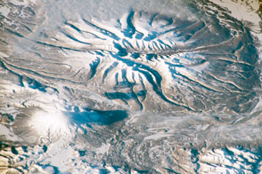
In 1802, Mount Chimborazo was thought to be the world’s tallest mountain, and the ambitious young German naturalist Alexander von Humboldt set out to climb it. He didn’t reach the summit, but he did reach an altitude of nearly 6,100 meters (20,000 feet), which was a new record for European mountaineers at that time. Humboldt’s trip to South America, including his trek up the side of Chimborazo, changed the way naturalists thought about altitude, vegetation, and volcanoes.
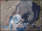
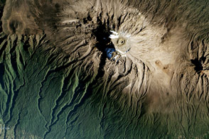
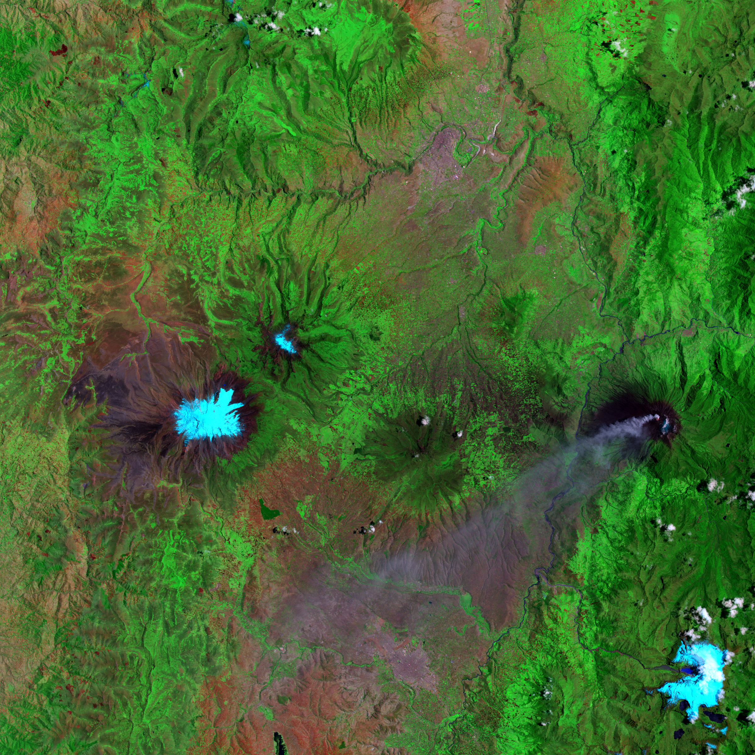
Landsat 7’s Enhanced Thematic Mapper Plus (ETM+) sensor captured this image on September 16, 2001. In this image, snowcapped Chimborazo is on the left, and the smoking Tungurahua Volcano is on the right. In this false-color image, pale blue indicates snow cover, bright green indicates lush vegetation, and red indicates sparser vegetation. Tungurahua’s volcanic ash plume appears in lavender. This steep-sloped volcano is one of Ecuador’s most active volcanoes; an eruption beginning in 1995 forced a temporary evacuation of the nearby city of Baños, situated at Tungurahua’s base.
Now a dormant volcano, Chimborazo has long appealed to ambitious mountaineers. Although it is not the world’s tallest peak, its summit is the point farthest from the Earth’s center. Chimborazo lies just one degree south of the equator, and the Earth bulges slightly at the equator. (In other words, the Earth is not a perfect sphere). Because of the bulge, the summit of a peak lying along the equator would be farther from the center of the Earth than the summit of an equally high peak at a higher latitude. Besides tantalizing mountain climbers, Chimborazo has also provided lessons about ecosystems to astute naturalists.
At the dawn of the 19th century, fighting nausea and nosebleeds, Humboldt’s party made its way up the mountainside, through a multitude of landscapes. The vegetation at the base of Chimborazo is lush, but its summit is covered with ice, and Humboldt realized that climate and vegetation vary as much with altitude as they do with latitude. This wasn’t his only insight during his long trip to South America; he also concluded that volcanoes appear along fissures in the planet’s crust. He published his observations in 1811, and his research inspired a generation of 19th-century naturalists. But the glory of reaching the summit would not be his. Defeated by altitude sickness, Humboldt’s party turned back. No one reached the peak of Chimborazo until 1880, when Edward Whymper, and Louis and Jean-Antoine Carrel climbed it.
NASA image created by Jesse Allen, Earth Observatory, based on data provided by the Landsat 7 science team and the University of Maryland’s Global Land Cover Facility.