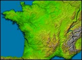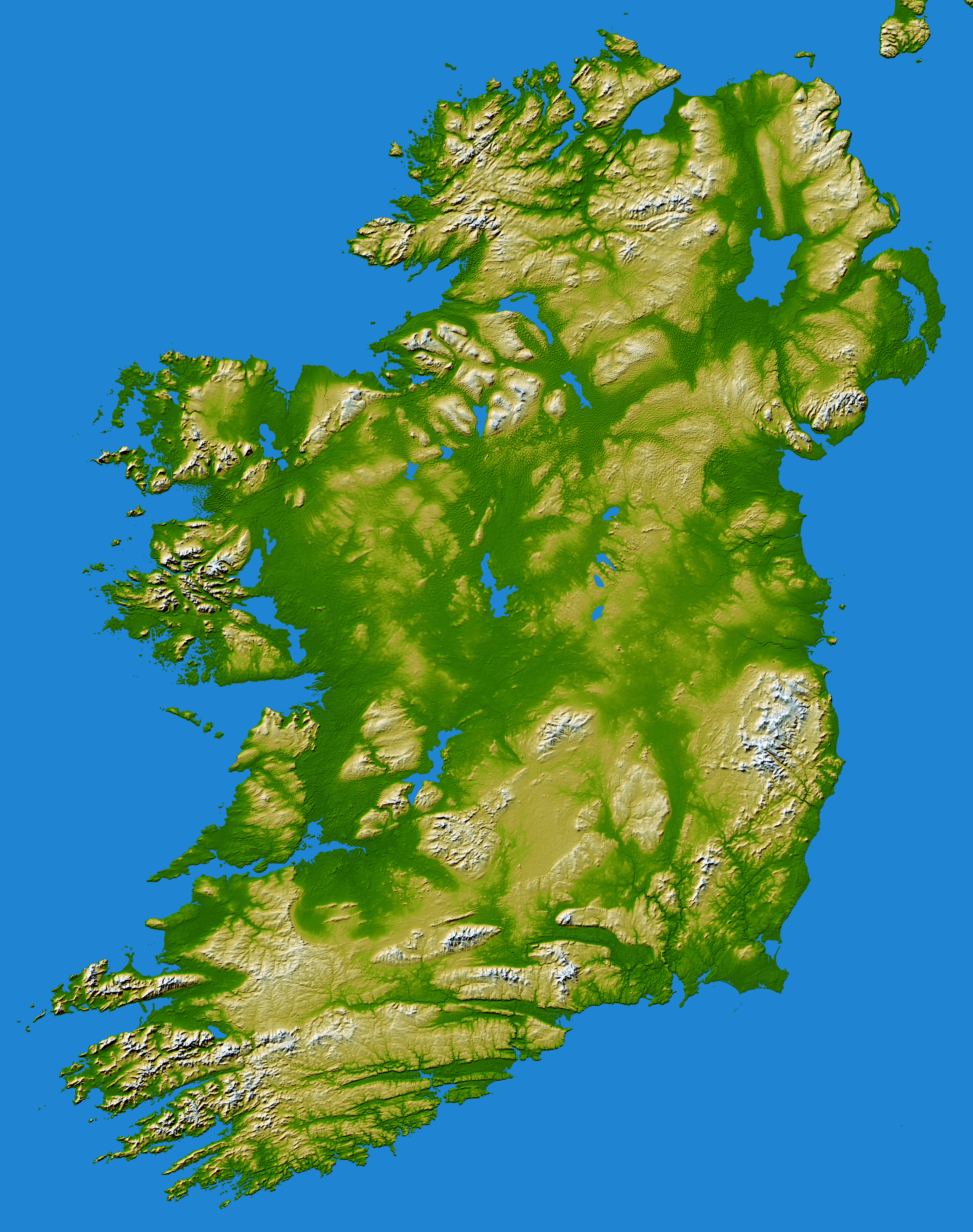
The topography of the island of Ireland features a hilly, central lowland composed of limestone surrounded by a broken border of coastal mountains. The mountain ranges vary greatly in geological structure. The mountain ridges of the south are composed of old, red sandstone separated by limestone river valleys. The limestone valleys appear as deep green grooves that tend to run in an east-west direction. Granite predominates in the mountains of Galway, Mayo, and Donegal in the west and north-west, as well as in Counties Down and Wicklow on the east coast. A basalt plateau covers much of the north-east of the country.
The central plain, broken in places by low hills, is extensively covered with glacial deposits of clay and sand. It has considerable areas of bog and numerous lakes. The island has seen at least two general glaciations. Everywhere ice-smoothed rock, mountain lakes, glacial valleys, and deposits of sand, gravel and clay mark the passage of the ice.
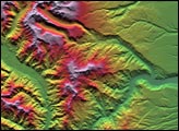
Two visualization methods were combined to produce this image: shading and color-coding of topographic height. The shade image was derived by computing topographic slope in the northwest-southeast direction, so that northwest slopes appear bright and southeast slopes appear dark. Color-coding is directly related to topographic height, with green at the lower elevations, rising through yellow and tan, to white at the highest elevations.
Elevation data used in this image were acquired by the Shuttle Radar Topography Mission aboard the Space Shuttle Endeavour, launched on Feb. 11, 2000. SRTM used the same radar instrument that comprised the Spaceborne Imaging Radar-C/X-Band Synthetic Aperture Radar (SIR-C/X-SAR) that flew twice on the Space Shuttle Endeavour in 1994. SRTM was designed to collect 3-D measurements of the Earth's surface. To collect the 3-D data, engineers added a 60-meter (approximately 200-foot) mast, installed additional C-band and X-band antennas, and improved tracking and navigation devices. The mission is a cooperative project between NASA, the National Geospatial-Intelligence Agency (NGA) of the U.S. Department of Defense and the German and Italian space agencies. It is managed by NASA's Jet Propulsion Laboratory, Pasadena, Calif., for NASA's Earth Science Enterprise, Washington, D.C.