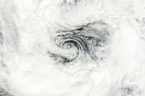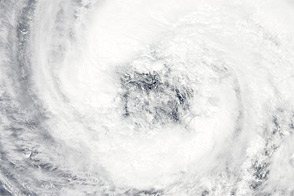

Tropical Storm Talas formed over the western Pacific Ocean on August 25, 2011, and took a north-northwesterly route across Japan. The storm dropped heavy rain on the island, leaving floods and landslides in its wake. On September 5, 2011, The Japan Times reported that the death toll from the storm had reached 32, with 57 more missing. It was the deadliest storm to strike Japan since 2004.
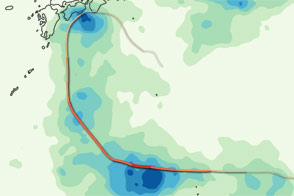
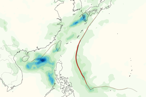
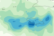
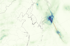
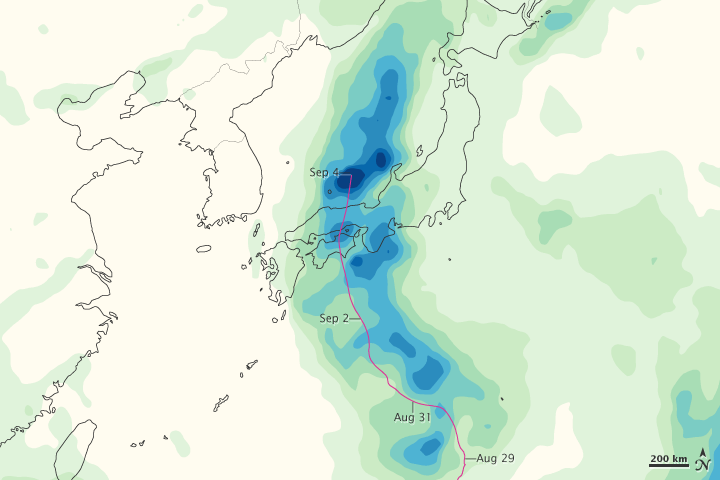
This color-coded image shows rainfall totals from August 30 to September 5, 2011. The heaviest rainfall—more than 350 millimeters or 14 inches—appears in dark blue. The lightest rainfall—less than 50 millimeters or 2 inches—appears in light green. Areas with only a trace of rain appear pale yellow. Superimposed on the rainfall totals is a storm track, shown in pink.
The flooded rivers, ruined roads, and avalanches of earth not only claimed lives, but also hampered search-and-rescue efforts, The Japan Times said. The death toll from the storm was expected to rise. Meanwhile, thousands of residents remained cut off from the outside world, and authorities were attempting to rescues via helicopter.
This image is based on data from the Multisatellite Precipitation Analysis produced at NASA’s Goddard Space Flight Center, which estimates rainfall by combining measurements from many satellites and calibrating them using rainfall measurements from the Tropical Rainfall Measuring Mission (TRMM) satellite.
NASA Earth Observatory image by Jesse Allen, using near-real-time data provided courtesy of TRMM Science Data and Information System at Goddard Space Flight Center. Caption by Michon Scott.