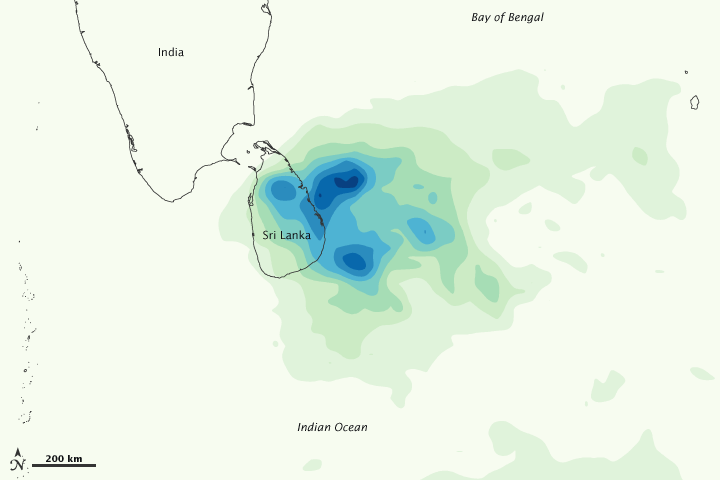


A month after flooding killed 43 people and displaced over a million residents, torrential rains once again pummeled Sri Lanka. By February 6, 2011, rain had fallen for six consecutive days, forcing a quarter-million people into government relief camps. Authorities confirmed eight deaths and listed two more people as missing, according to Deutsche Presse-Agentur.
This map shows rainfall amounts over Sri Lanka from February 1 through 7, 2011. The heaviest rainfall—more than 600 millimeters (24 inches)—appears in dark blue. The lightest rainfall—less than 75 millimeters (3 inches)—appears in light green. Although the heaviest precipitation occurs offshore, significant rainfall extends over the entire island.
This image is based on data from the Multisatellite Precipitation Analysis produced at NASA’s Goddard Space Flight Center, which estimates rainfall by combining measurements from many satellites and calibrating them using rainfall measurements from the Tropical Rainfall Measuring Mission (TRMM) satellite.
NASA Earth Observatory image by Jesse Allen, using near-real-time data provided courtesy of TRMM Science Data and Information System at Goddard Space Flight Center. Caption by Michon Scott.
This map shows rainfall amounts over Sri Lanka February 1 through 7, 2011. Heaviest rain appears in blue and lightest rain appears in green.
Heavy rains struck Sri Lanka for the second time in a month in February 2011.

