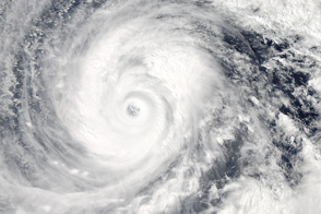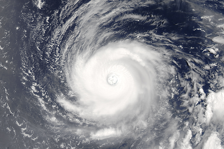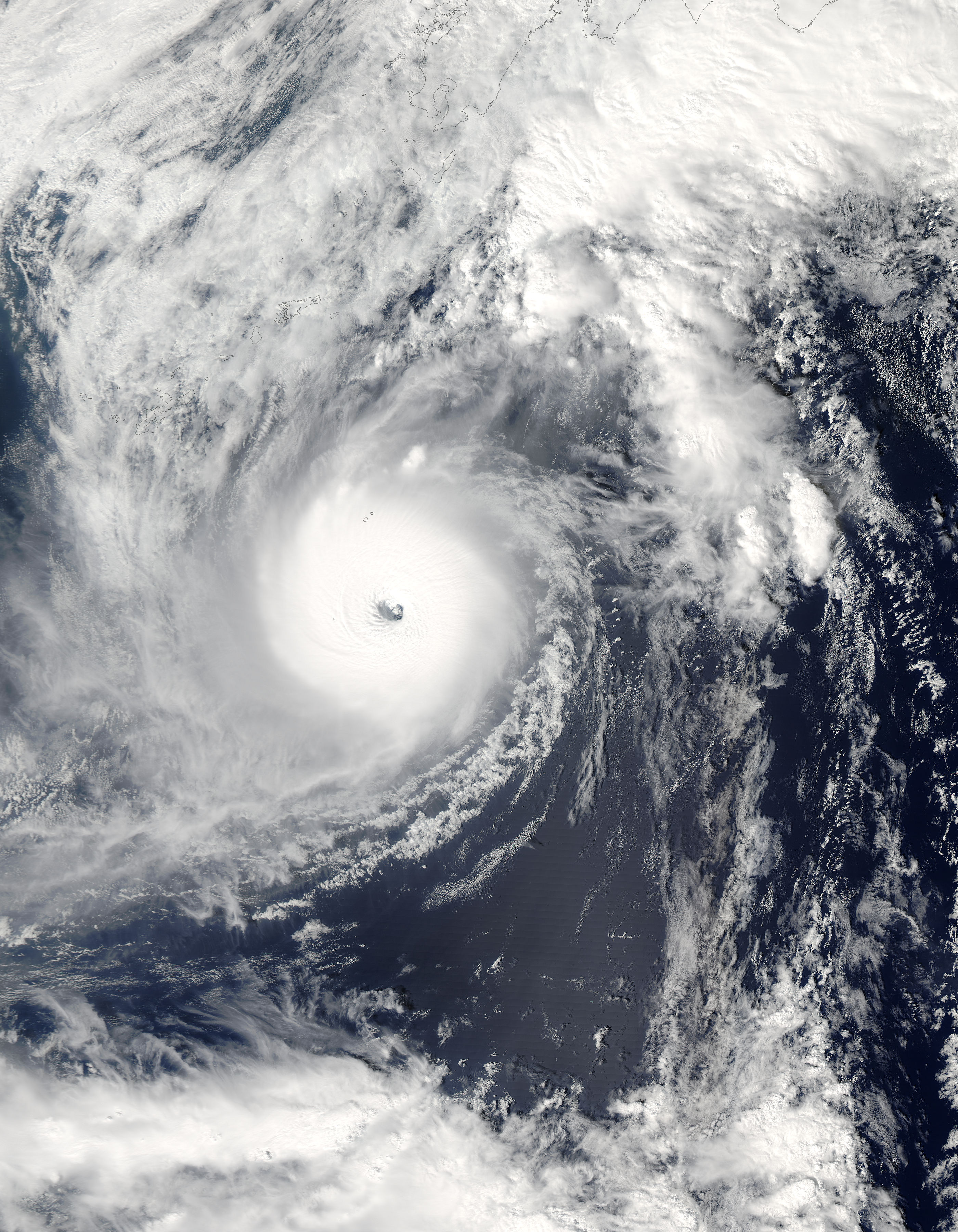
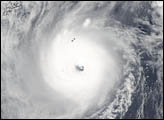
With sustained winds of 160 mph (257 kph) and gusts of up to 185 mph (298 kph), Super Typhoon Ma-On was situated due south of Japan on October 8, 2004. The eye of the storm was located about 621 miles (1,000 km) southwest of Tokyo and was moving north-northeastward at about 25 mph (40 kph). As the waters south of Japan are currently warmer than average, Ma-On may not weaken much as it approaches Japan, making it an extremely dangerous storm. Given its current trajectory, forecasts suggest that Super Typhoon Ma-On will make landfall somewhere between Kyoto and Tokyo within the next 48 hours. As Ma-On passes over mountains in the central part of the island, there will likely be extremely heavy precipitation in various places with the potential for flash flooding and mudslides. Local residents are encouraged to take safety precautions.
The U.S. Navy's Joint Typhoon Warning Center is an excellent source of timely information about Typhoon Ma-On as it approaches land.
The true-color image above was acquired on October 8, 2004, by the Moderate Resolution Imaging Spectroradiometer (MODIS) aboard NASA's Aqua satellite. The high-resolution copy available above is 500 meters per pixel, but additional copies are also available.
NASA image courtesy Jeff Schmaltz, MODIS Rapid Response team, Goddard Space Flight Center
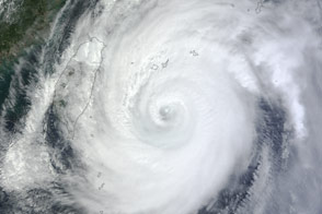
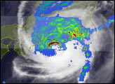
Typhoon Ma-on was the ninth typhoon to strike Japan in 2004, and the most powerful to come ashore over eastern Japan in the past 10 years. This series of TRMM images shows the storm's development from tropical depression to powerful super typhoon back to typhoon before it made landfall on October 10, 2004.
alert message