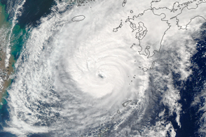
The second massive storm of October 2014 barrels down on Japan.
Published Oct 10, 2014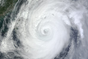
The storm was headed for Okinawa and the main island of Japan in late September 2012.
Published Sep 29, 2012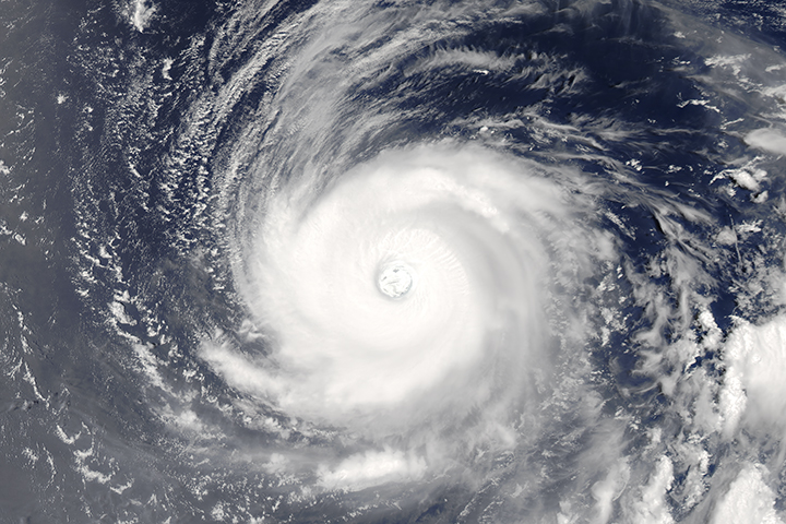
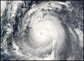
The powerful, well developed storm spins over the western tropical Pacific Ocean.
Published Aug 1, 2017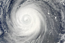
Though Typhoon Choi-wan maintains its tightly wound symmetric shape in this photo-like image from September 18, 2009, the striking clear eye of previous days is gone.
Published Sep 18, 2009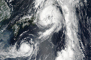
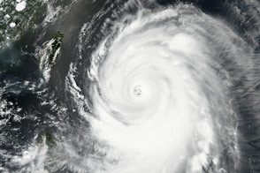
Typhoon Malakas approached Japan and made landfall as a category-3 storm.
Published Sep 19, 2016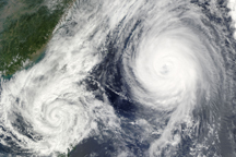
A little over 1,000 kilometers separated the center of Tropical Storm Parma from the center of Typhoon Melor on October 6, when the this composite image was taken.
Published Oct 7, 2009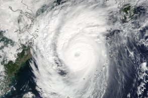
On October 4, 2016, Typhoon Chaba was headed north between the Japanese mainland and South Korea. Authorities in the area expected flash flooding, structural damage, and power outages.
Published Oct 4, 2016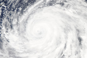
Acquired July 17, 2011, this natural-color image shows Typhoon Ma-on south of Japan.
Published Jul 17, 2011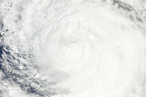
Acquired July 18, 2011, this natural-color image shows Typhoon Ma-on approaching southern Japan.
Published Jul 18, 2011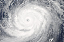
Super Typhoon Choi-wan maintained its tight circular shape and well-defined eye on September 17, 2009, when this image was taken.
Published Sep 17, 2009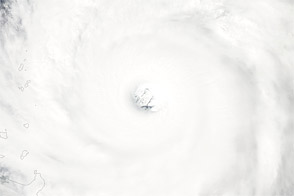
Acquire September 27, 2012, this image shows Super Typhoon Jelawat northeast of the Philippines.
Published Sep 27, 2012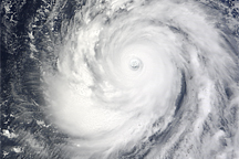
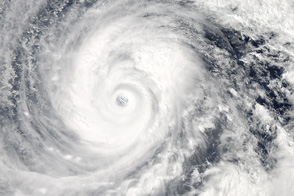
Super-Typhoon Choi-wan had a symmetrical shape, a trait of a strong, well-organized cyclone, when this photo-like image was taken on September 16, 2009.
Published Sep 16, 2009alert message
