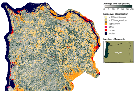


To implement the conservation plan for the Northern spotted owl, wildlife and land managers need to locate the birds. Mapping their habitat would be prohibitively expensive over the 25-million acres of affected land if carried out by the traditional means of ground-based surveys. Instead, scientists at the U.S. Forest Service and the Bureau of Land Management are using satellites – Landsat 5 and Landsat 7 – to determine where spotted owls are likely to nest. Dark green areas in this 1996 Landsat image correspond to heavily forested areas with large conifers – potential owl habitat.
For more information see Spotting the Spotted Owl
Image by Janine Savage, Global Change Master Directory, based on data from the Interagency Vegetation Mapping Project