Several central European nations have banded together in an ambitious project to protect and restore one of Europe’s most important wetland ecosystems: the Lower Danube River. Since the end of the 19th century, the Lower Danube has lost nearly 80 percent of its wetlands in the human drive to control floods, create farm and grazing land, generate electricity and make water transport easier. Now Romania, Bulgaria, Moldova, and Ukraine have committed to the Lower Danube Green Corridor project, currently Europe’s largest international wetland preservation effort.
The Danube Delta is already protected as part of a biosphere reserve, an oasis of natural vegetation in a sea of farmland for resident and migratory waterfowl and other wildlife. The restoration project will add dozens more protected areas to the existing ones—forming a green corridor that will stretch from Yugoslavia in the west to the Black Sea in the east. The countries have promised that the Lower Danube Green Corridor will cover a minimum of 773,166 hectares of existing protected areas (1 hectare is about 2.5 acres, or 0.01 square kilometers); 160,626 hectares of new protected areas; and 223,608 hectares that will be restored to the river’s natural floodplain. If successful, the corridor will eventually cover about 2.2 million acres.
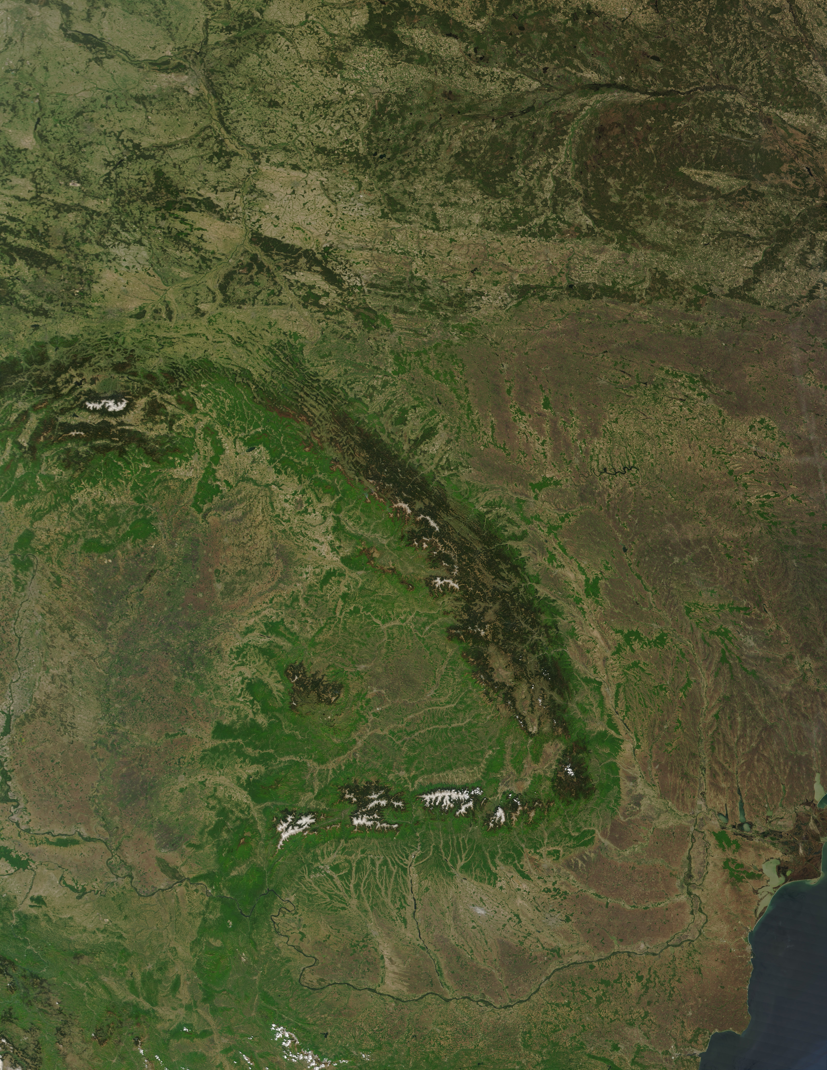
The background image above shows the Danube flowing in from bottom left, and along its eastward path, it marks the border of Romania (to the north) and Bulgaria (to the south). The Danube cuts sharply northward into Romania and then once again veers eastward toward the Black Sea. Along this section, the river flows along the southern borders of Ukraine (top right) and Moldova (to the west). The wetlands and vast reed beds of the Danube Delta are dark brown in the scene, which was captured by the Moderate Resolution Imaging Spectroradiometer (MODIS) on the Terra satellite on May 6, 2003.
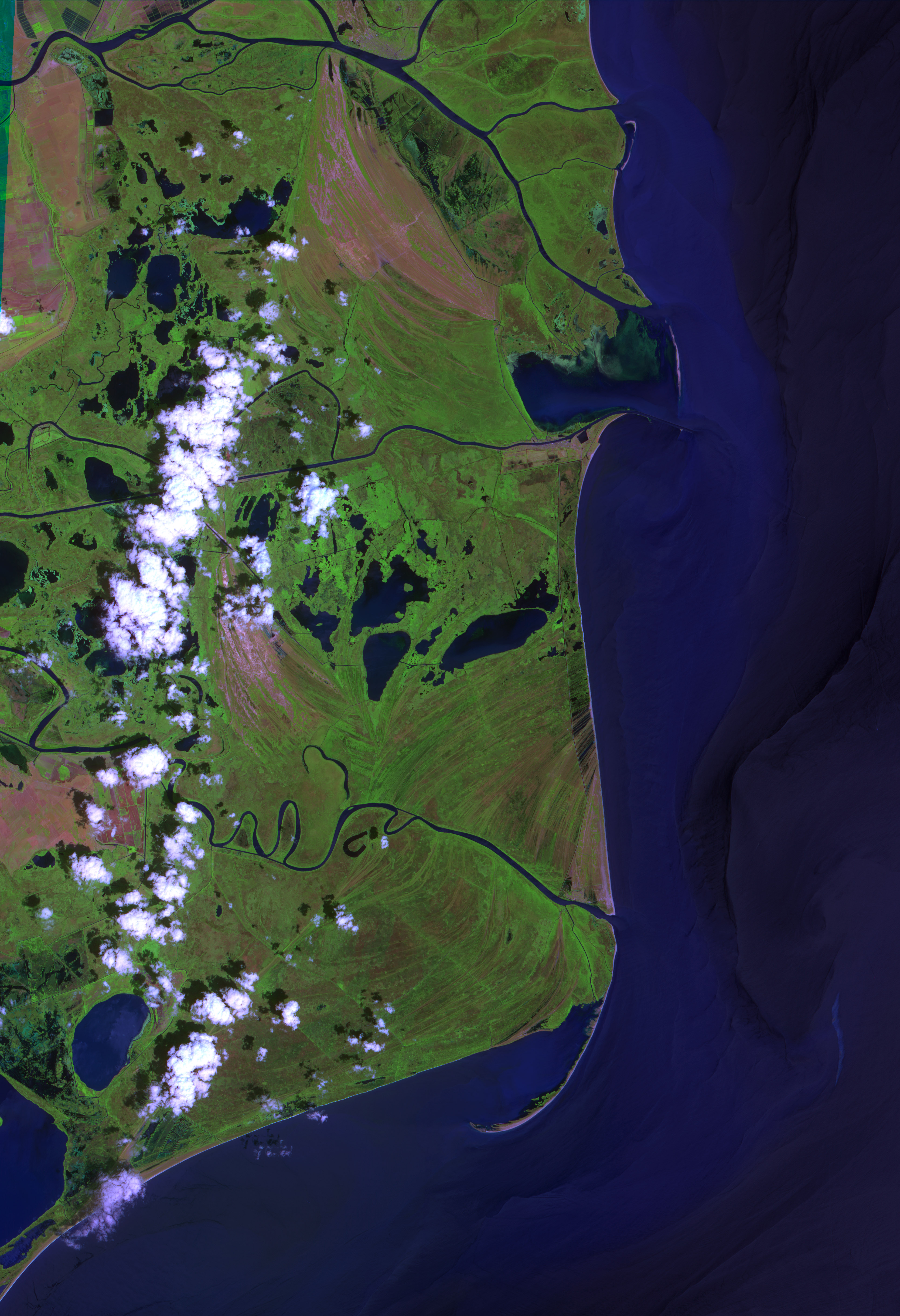
The white box shows the area covered by the inset from the Advanced Spaceborne Thermal Emission and Reflection Radiometer (ASTER), captured on August 10, 2000. This north-flowing section of the Danube harbors numerous sites that are slated to be preserved as part of the new Green Corridor. Greater detail of the area can be seen in the full-resolution versions of the background MODIS image, the ASTER inset, and the additional ASTER image of the Delta.
ASTER data made available by NASA/GSFC/MITI/ERSDAC/JAROS, and U.S./Japan
ASTER Science Team
MODIS image courtesy of Jacques Decloitres,
MODIS Rapid Response Team, NASA Goddard Space Flight Center
alert message


