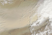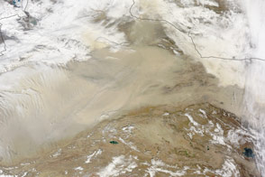
A day before dust settled over eastern China, dust storms blew through northern China and southern Mongolia on April 23, 2009. This true-color image is a composite of observations taken by the Moderate Resolution Imaging Spectroradiometer (MODIS) on NASA’s Terra satellite. The right third of this image was acquired at 11:10 a.m. local time (3:10 UTC), and the remainder was acquired on a separate orbit, around 12:45 p.m. local time (4:45 UTC). Although composed from two different orbits, this image shows a discernible track of dust through northern China. In the east, dust and clouds swirl together over southern Mongolia.
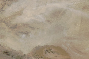
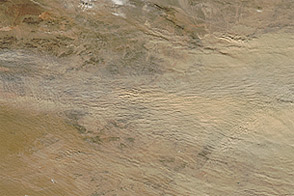
Just off the left edge of the image is the Taklimakan Desert, a reliable source of dust storms especially in springtime. Much of the dust in this image likely arises there, although dust storms also frequently arise in Mongolia’s Gobi Desert. Resting in the Tarim Basin, between the mountain ranges of the Tien Shan (or Tian Shan) in the north and the Kunlun Shan in the south, the Taklimakan Desert is one of the world’s largest shifting sand deserts, with dunes towering to as much as 200 meters (656 feet).
NASA image by Jeff Schmaltz, MODIS Rapid Response Team, Goddard Space Flight Center. Caption by Michon Scott.