The Earth Observatory has published its last Image of the Day on this website. Please join us on our new home at science.nasa.gov/earth/earth-observatory.
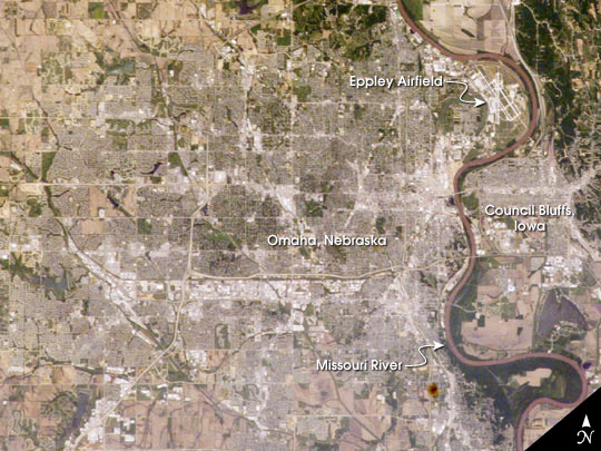
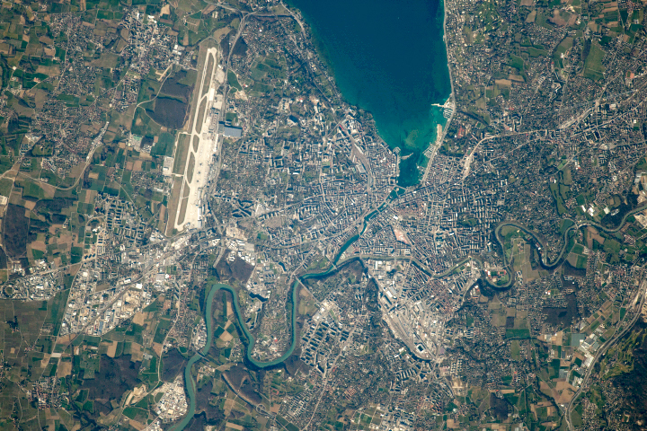
The Missouri River served as a vital waterway for transport of the epic Lewis and Clark Expedition. In the vicinity of Omaha, Nebraska, and Council Bluffs, Iowa, this mighty river meanders southward through a broad floodplain some two to eight miles wide, bordered by dissected bluffs. In late July 1804, the expedition paused to rest and repair their boats and planned the “first” Native American council (Council Bluff) with representatives of the Otoe Tribe.
This photograph was taken by the Expedition 7 crew of the International Space Station on June 13, 2003, and is among the first acquisitions of an ongoing effort to document from space dozens of historical sites along the Lewis and Clark Expedition’s entire route. In this near-vertical view of Omaha—with a population estimated at more than three quarters of a million residents—the city is situated on high ground to the west of the river while Eppley Airfield and the town of Council Bluffs are located on the floodplain.
Astronaut photograph ISS007-E-7247 was taken with an Electronic Still Camera and a 180-mm lens and is provided by the Earth Sciences and Image Analysis Laboratory at Johnson Space Center. Additional images taken by astronauts and cosmonauts can be viewed at the NASA-JSC Gateway to Astronaut Photography of Earth.