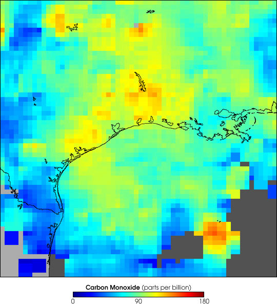


Satellite remote sensing provides a useful way to investigate the impact of intense local pollution sources, such as urban and industrial emissions, on regional air quality. This false-color image shows carbon monoxide plumes at an altitude of roughly 2 km (700 millibars) in the atmosphere over the Houston area and extending out over the Bay of Galveston. This image represents a composite of data collected over a 10-day period, September 6-15, 2002, by the Measurements Of Pollution In The Troposphere (MOPITT) instrument aboard NASA’s Terra satellite. The white areas show where no data were collected, either due to persistent cloud cover or gaps between viewing swaths. Carbon monoxide is a good tracer of pollution since it is produced by incomplete combustion processes, such as those associated with electricity generation and petrochemical processing in the region. The high concentrations of carbon monoxide correspond well with the particulate pollution measured during this same time period by the Terra Multi-angle Imaging SpectroRadiometer (MISR).
Image courtesy NCAR MOPITT Team