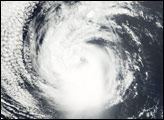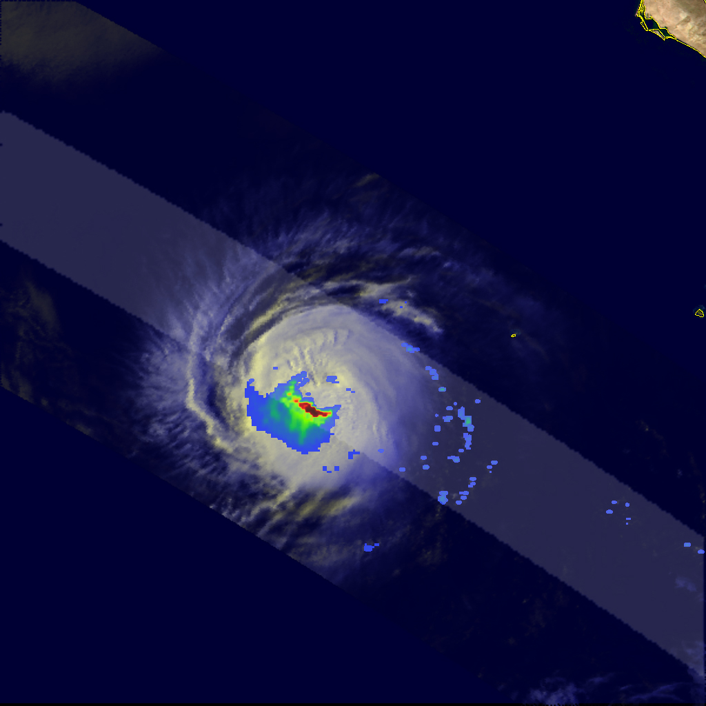
Hurricane Elida formed in the Eastern Pacific Ocean off the Central American coast on July 12, 2008. As is the case with most storm systems that form in this region, it traveled westward, pulling away from the coast. Elida reached hurricane status on July 14, and reached a peak strength of Category 2, with sustained winds of 165 kilometers per hour (105 miles per hour), according to Unisys Weather.
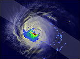
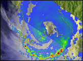
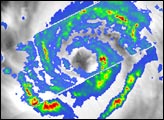
This image shows patterns of rainfall within the storm as observed by the Tropical Rainfall Measuring Mission (TRMM) satellite on July 16, 2008, at 4:46 p.m. local time (00:46 UTC, July 17). Reds in this visualization show areas that received intense rainfall, with yellow and green showing strong rain, and lighter rainfall in blue. At the time TRMM acquired these data, Elida was still a Category 2 hurricane.
No eye was evident in the clouds that made up the storm, though the storm did have a compact spiral structure. Powerful thunderstorms and heavy rain form a tightly focused arc, suggesting the existence of a distinct eyewall even though no eye is visible in the cloud structure. Because TRMM can see both the rainfall and the cloud structure, it provides more information about a storm than sensors that record the cloud structure alone.
The TRMM satellite was placed into service in November 1997. From its low-earth orbit, TRMM provides valuable images and information on storm systems around the tropics using a combination of passive microwave and active radar sensors, including the first precipitation radar in space. In this image, rain rates in the center of the swath are from the TRMM Precipitation Radar, and those in the outer swath come from the TRMM Microwave Imager. The rain rates are overlaid on infrared data from the TRMM Visible Infrared Scanner. TRMM is a joint mission between NASA and the Japanese space agency, JAXA.
NASA image produced by Hal Pierce. Caption by Jesse Allen.