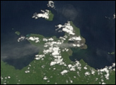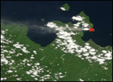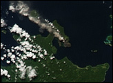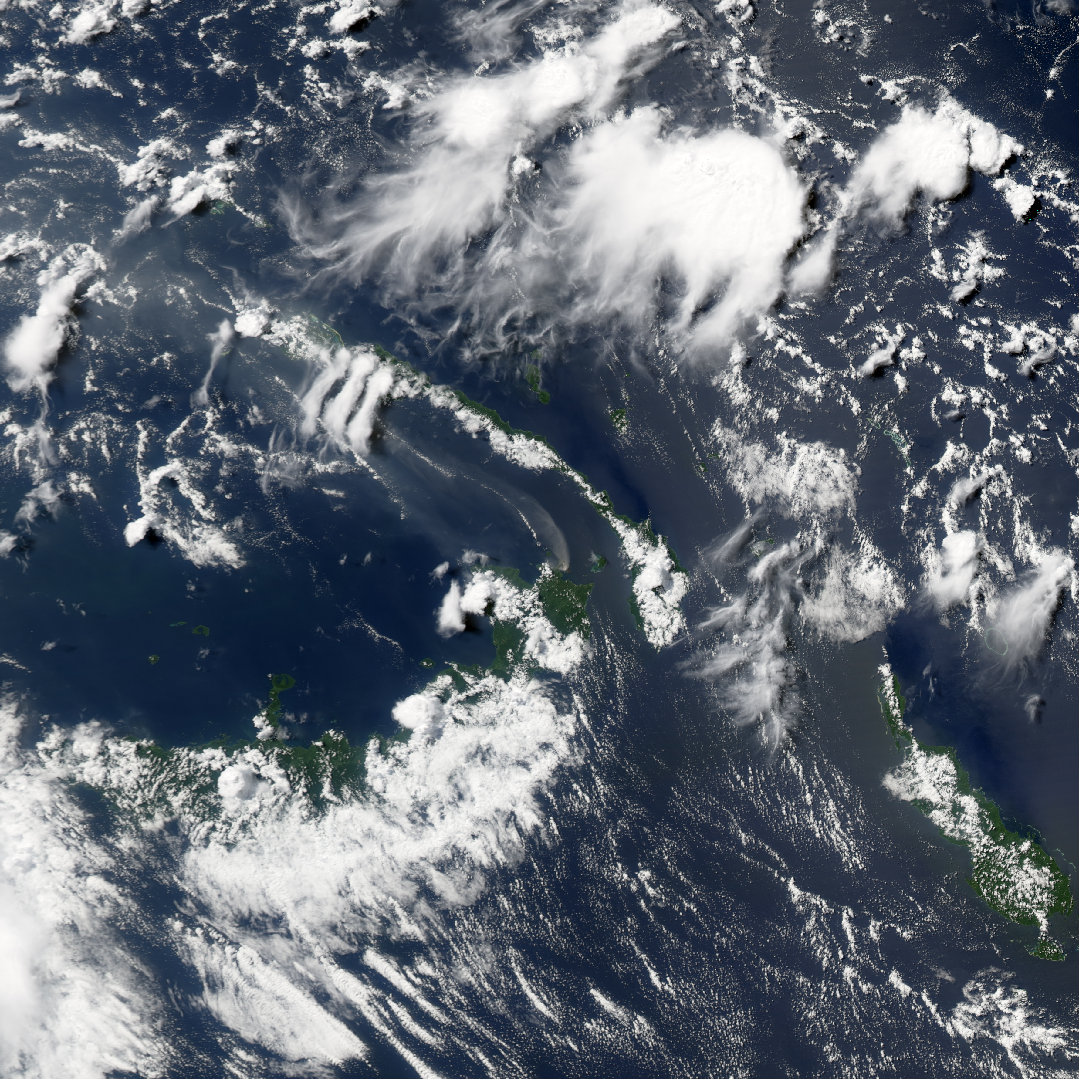
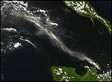
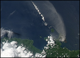
Rabaul Volcano, on the northeastern tip of the island of New Britain, released a plume on May 20, 2008. The Moderate Resolution Imaging Spectroradiometer (MODIS) on NASA’s Aqua satellite captured this image the same day. In this image, the plume is slightly darker and thinner than the opaque white clouds that hover nearby. The relatively dark color suggests a component of volcanic ash along with water vapor. The plume blows in a counter-clockwise arc, away from the island and over the ocean.
Rabaul is a pyroclastic shield volcano. Shield volcanoes resemble ancient warrior shields, thanks to their low, broad shape. Assembled from pyroclastic flows (avalanches of broken rocks, volcanic ash, and other materials), these volcanoes bear the scars of earlier eruptions. Rabaul’s explosive 1994 eruption, occurring at the same time as eruptions of two neighboring volcanoes, forced the temporary evacuation of Rabaul City. Before that, Rabaul City had used the sheltered harbor formed by the volcano.
You can download a 250-meter-resolution KMZ file of the volcano suitable for use with Google Earth.
NASA image created by Jesse Allen, using data obtained from the Goddard Land Processes data archives (LAADS). Caption by Michon Scott.
Rabaul Volcano, on the northeastern tip of the island of New Britain, released a plume on May 20, 2008.
alert message