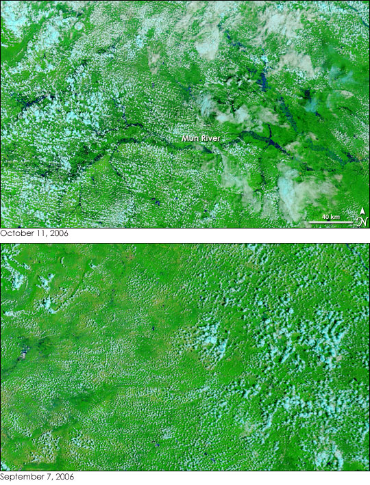
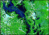
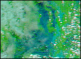
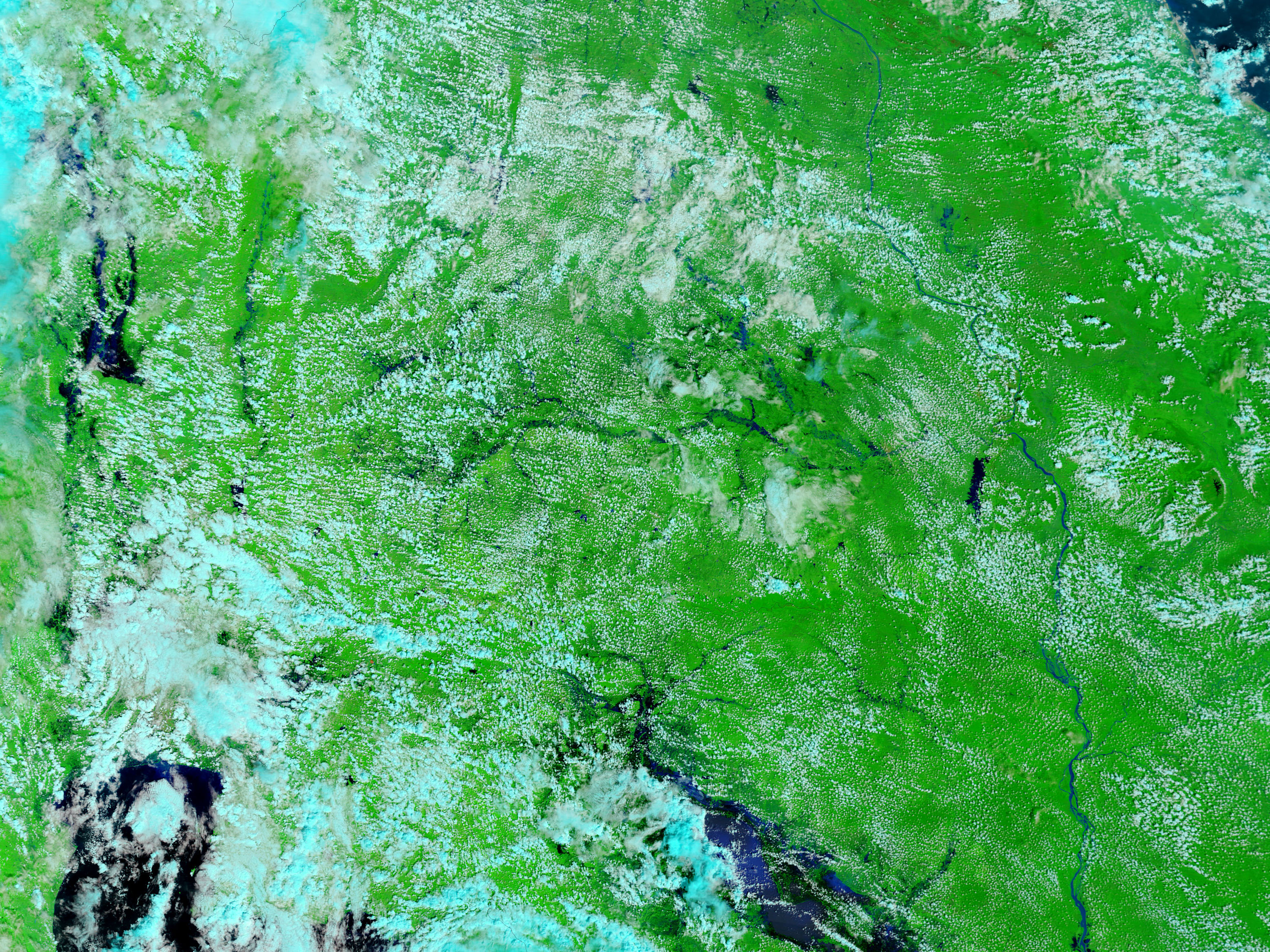
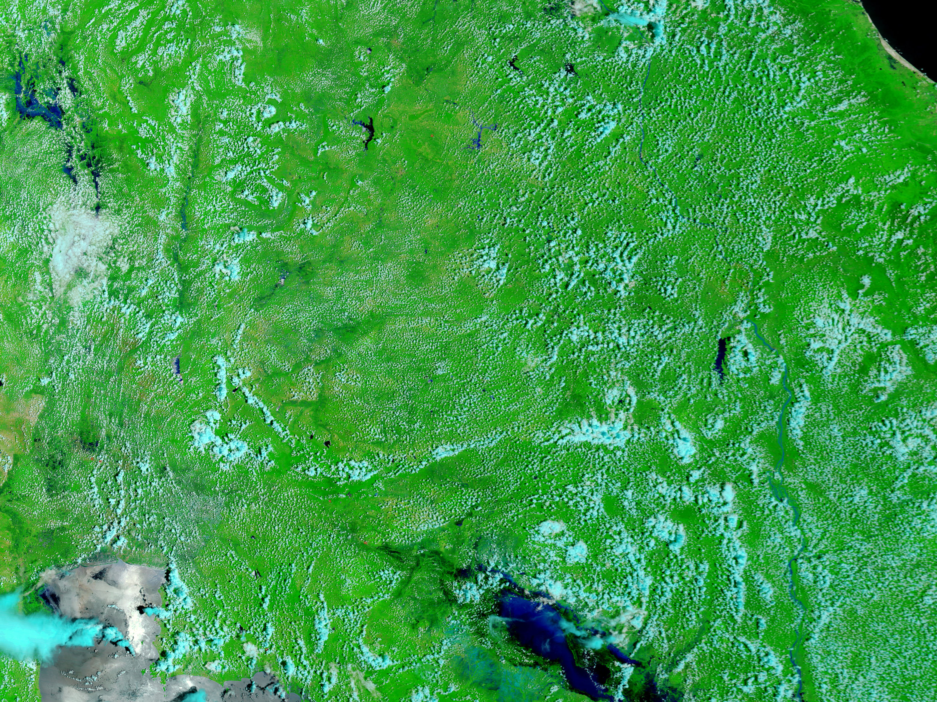
Though South East Asia faces monsoon flooding every year, 2006 brought unusually heavy and widespread flooding. Among the countries hardest hit was Thailand. On October 11, 2006, the Moderate Resolution Imaging Spectroradiometer (MODIS) on NASA’s Terra satellite detected fresh flooding in northeast Thailand. In the top image, the east-flowing Mun River and its tributaries are swollen far beyond their normal extents. The lower image shows the region a little over a month earlier, at which time the rivers were not even visible. Both images were made with both visible light, the light that the human eye sees, and infrared light. This combination makes water, black or dark blue, stand out from land, which is bright green where plant-covered and tan where no or few plants grow. The scattered clouds that cover both scenes are white (warm, water clouds) and light blue (cold, ice clouds).
According to the Associated Press, 39 people have died in Thailand since August because of monsoon flooding, and at least 138,000 others have suffered from waterborne illnesses. Daily images of Southeast Asia are available from the MODIS Rapid Response Team.
NASA images courtesy the MODIS Rapid Response Team at NASA GSFC.


