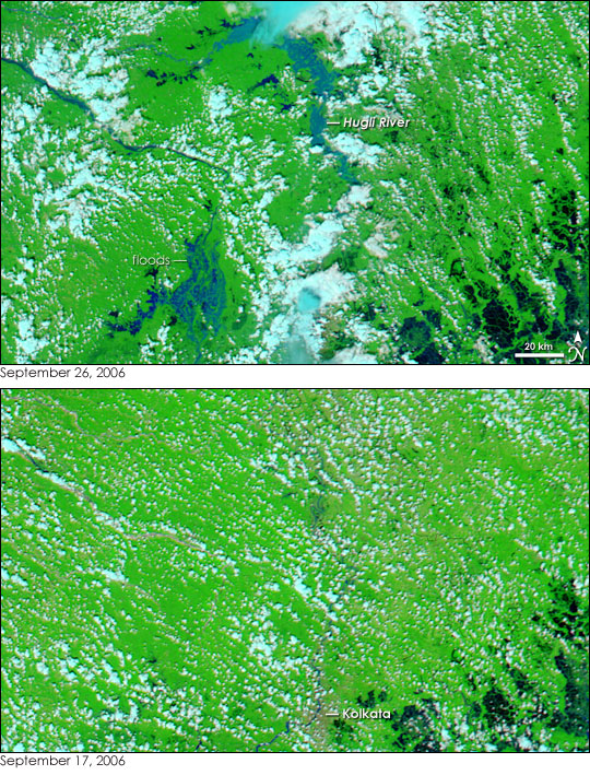
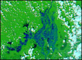
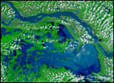
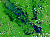
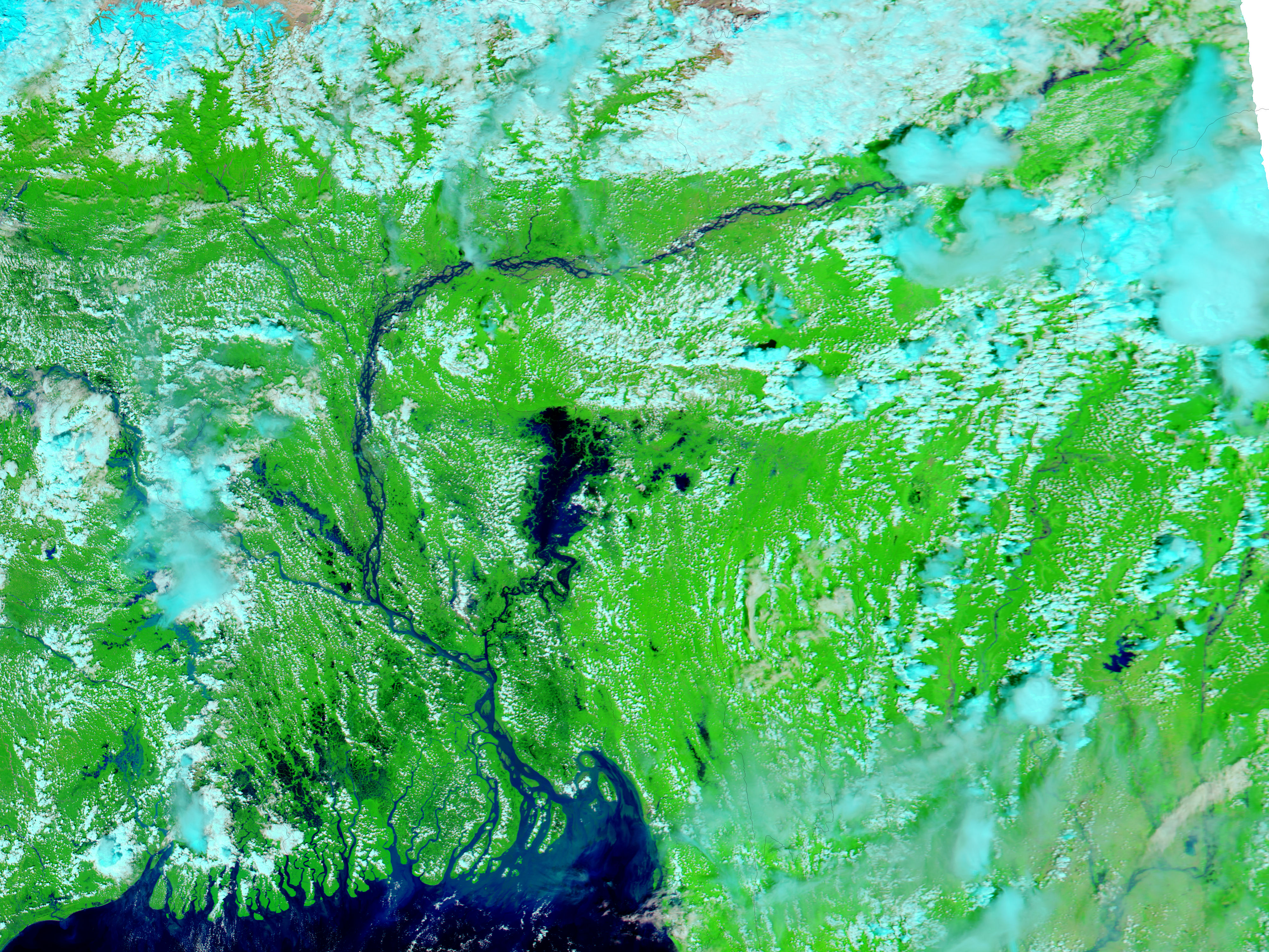
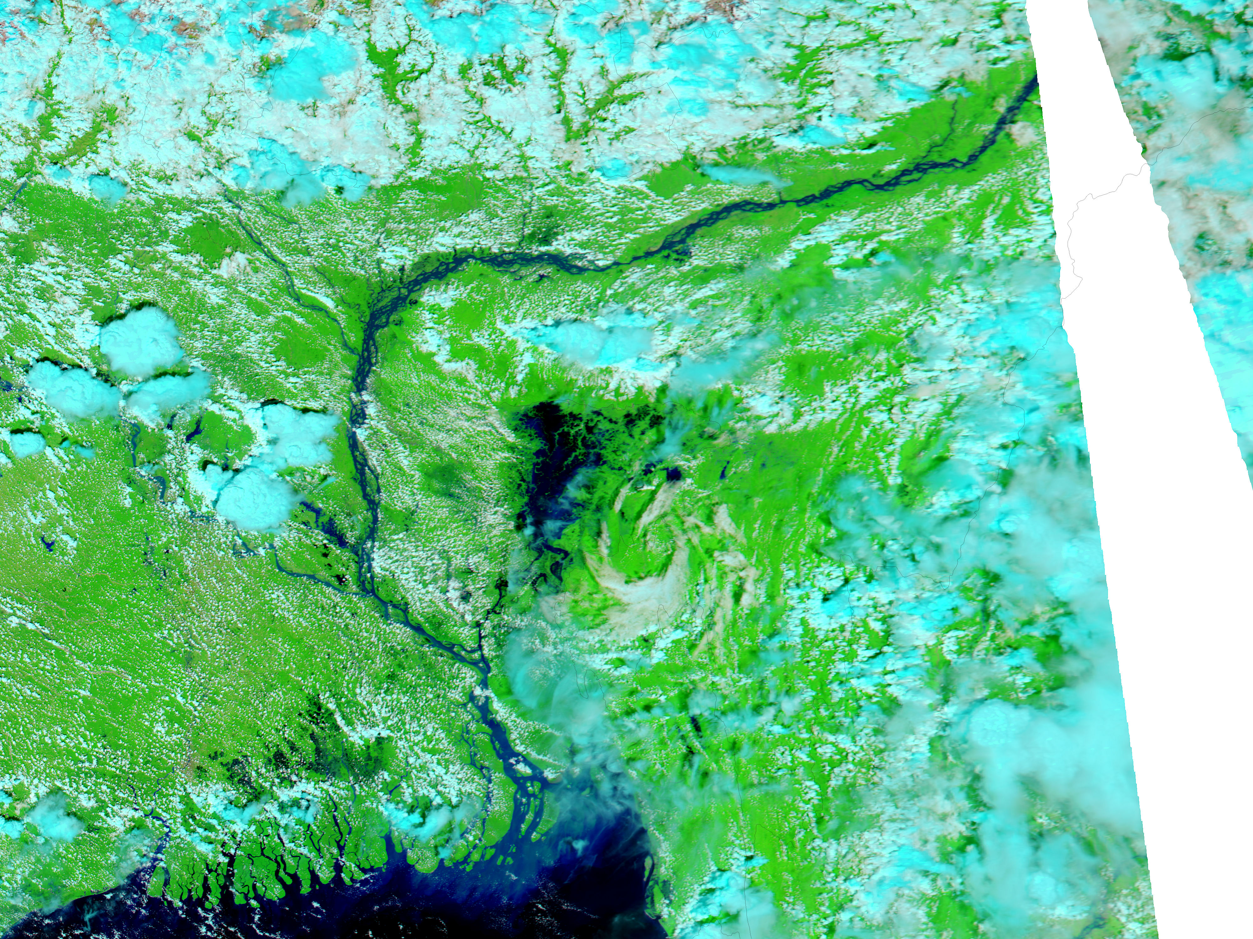
The combined impact of a tropical cyclone and monsoon rains drove the many branches of the Ganges River in the Sundarbans delta of eastern India over their banks in late September 2006. The most notably flooded river in the top Moderate Resolution Imaging Spectroradiometer (MODIS) image, collected by NASA’s Aqua satellite on September 26, is the Hugli River, which has spread several kilometers over its flood plain compared to conditions nine days earlier (lower image).
The Hugli River (also Hooghly) branches off the Ganges about 200 kilometers north of Kolkata (Calcutta) and flows south past the city through the state of West Bengal to drain into the Bay of Bengal. Though the city of Kolkata is obscured by clouds in the flood scene (it’s the tan region near the bottom of the lower image), the Australian Broadcasting Corporation reported that floods in the city forced more than 2,000 people from their homes. The cloud-free region around the city reveals extensive flooding, with water forming black or dark blue streaks and pools on the bright green, vegetated land. Additional flooding is visible along the Hugli and other branches of the Ganges in the large image.
These images were created using both visible and infrared light to allow water to stand out from the land. In these images, clouds are pale blue and white, water is dark blue or black, plant-covered land is green, and bare or sparsely vegetated land (like the city) is tan. Additional infrared images and photo-like images of India are available from the MODIS Rapid Response Team at NASA GSFC.
NASA images courtesy the MODIS Rapid Response Team at NASA GSFC.


