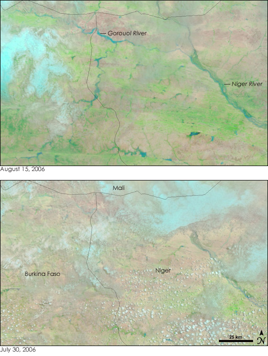
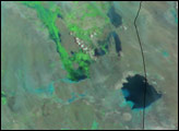
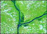
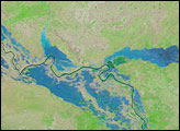
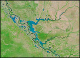
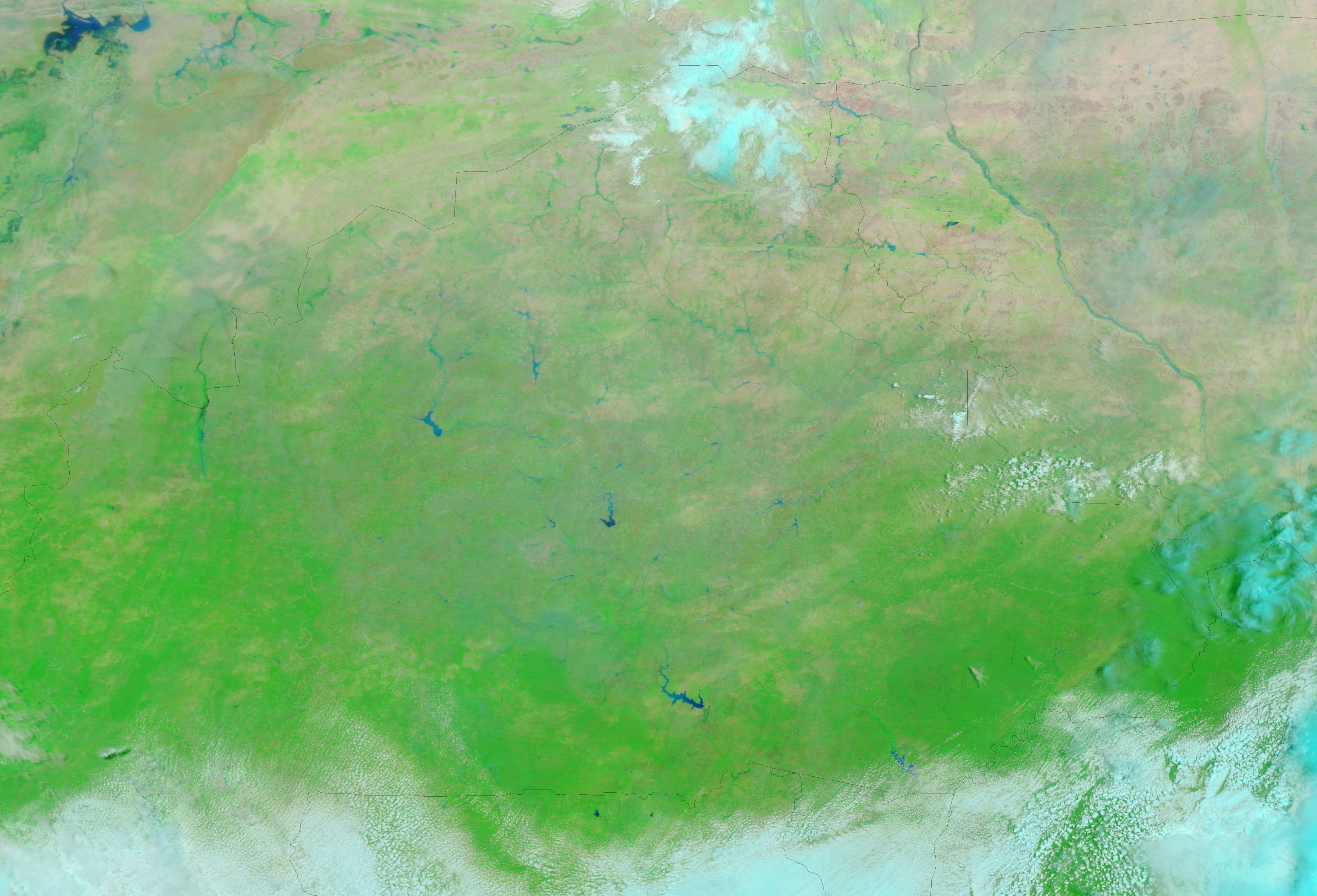
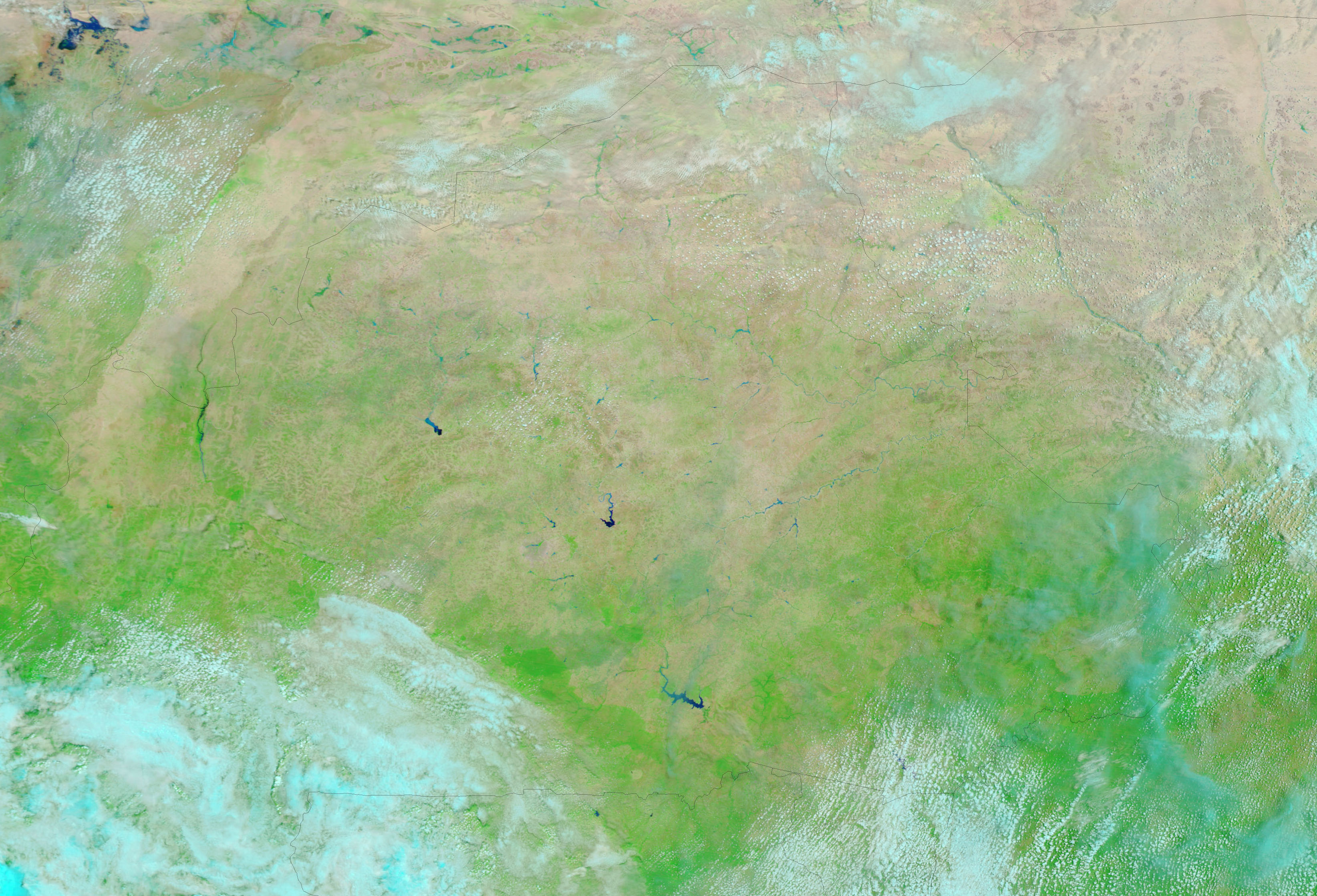
Though August is typically rainy in Africa’s Sahel region, heavy rains during the second and third weeks of August 2006 triggered floods in several countries across the continent, including northern Burkina Faso and southern Niger. The Moderate Resolution Imaging Spectroradiometer (MODIS) on NASA’s Terra satellite captured the top image of the floods on August 15, 2006. The lower image was taken on July 30, before the heavy rains started. Rivers that weren't visible in July are wide bands of blue in August. These rivers are tributaries of the Niger River, which runs along the right edge of the image. According to the United Nations Office for the Coordination of Humanitarian Affairs, 6,000 people in the city of Gorom-Gorom in northeastern Burkina Faso were made homeless when their mud and thatch houses disintegrated in the rain. Though the city is not visible in this image, it is located near the Niger border south of the Gorouol River.
One reason so much of the rain has caused flooding, says the UN, is recurrent drought throughout the region. The Sahel is a band of semi-arid land immediately south of the Sahara Desert, and it runs across the fattest part of Africa from Senegal and Guinea on the Atlantic Ocean to Ethiopia and Eritrea on the Indian Ocean. Pockets of drought have plagued the Sahel for several years, making the soil hard and slow to absorb water, says the UN. As a result, the rains run off, triggering the floods seen here. However, the rain also has a positive impact on the land. Brushes of green color the August image where bare or sparsely vegetated tan and pink land dominated in July. The UN Food and Agriculture Organization said that growing conditions had improved with the rains. In both scenes, clouds (pale blue and white in this color combination) obscure part of the scene.
The large images provided above are at MODIS’ maximum resolution of 250 meters per pixel. The MODIS Rapid Response Team provides daily images in a variety of resolutions.
NASA images courtesy the MODIS Rapid Response Team at NASA GSFC.


