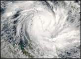
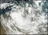
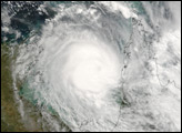
Tropical Cyclone Monica formed off the northeastern coast of Australia on April 17, 2006. This is the same general area where Cyclone Larry formed a month earlier. Larry caused devastation to Queenland’s coastal communities and destroyed a large fraction of the banana trees in the region. Cyclone Monica was nowhere near as destructive as Larry, and Monica’s path across Cape York Peninsula in northern Queensland took it well away from most settled areas.
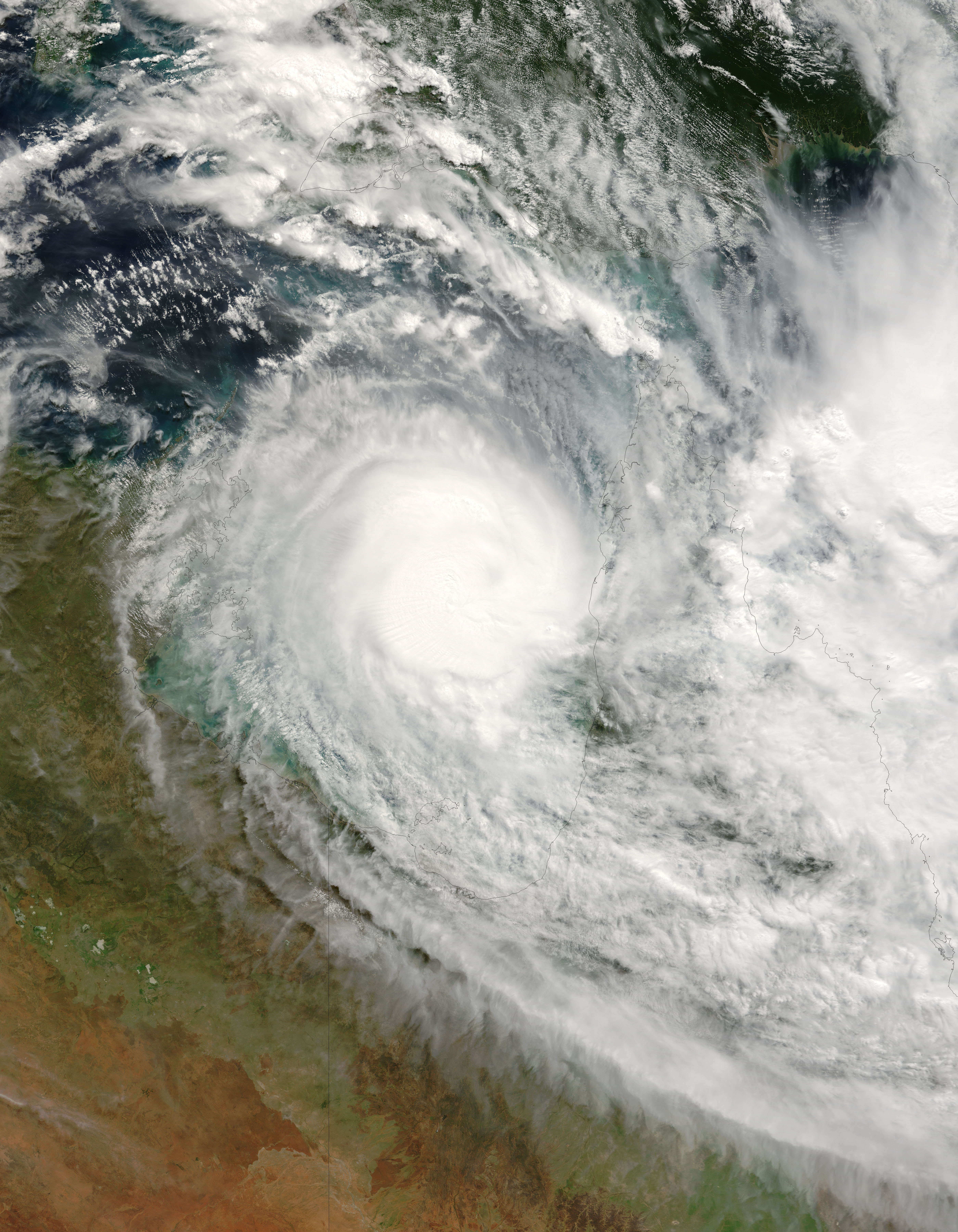
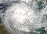
This photo-like image was acquired by the Moderate Resolution Imaging Spectroradiometer (MODIS) on the Terra satellite on April 21, 2006, at 11:10 a.m. local time (01:10 UTC). Cyclone Monica at this time was still a powerful storm, even after having lost some strength crossing Cape York on April 19 and 20. The storm was beginning to rebuild over the Gulf of Carpentaria. Sustained peak winds in the storm system were roughly 165 kilometers per hour (105 miles per hour) around the time the image was captured. At that time, Monica was expected to rebuild to a Category-4-strength storm before coming ashore again along the coast of the Northern Territory. Communities in Arnhem Land were bracing for very strong winds and heavy rains.
The high-resolution image provided above is provided at the full MODIS spatial resolution (level of detail) of 250 meters per pixel. The MODIS Rapid Response System provides this image at additional resolutions.
NASA image by Jeff Schmaltz, MODIS Rapid Response Team, Goddard Space Flight Center.
Tropical Cyclone Monica formed off the northeastern coast of Australia on April 17, 2006. This is the same general area where Cyclone Larry formed a month earlier.
alert message