high-resolution images
True Color, July 13 2001 (1.8 MB)
False Color, July 13 2001 (1.8 MB)
True Color, July 29 2001 (1.5 MB)
False Color, July 29 2001 (1.8 MB)
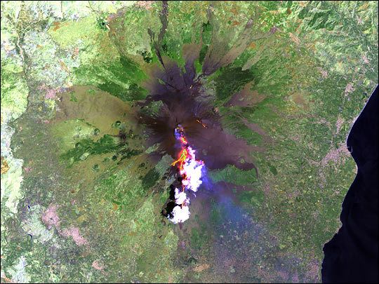
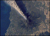
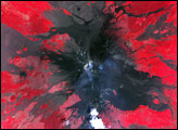
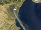
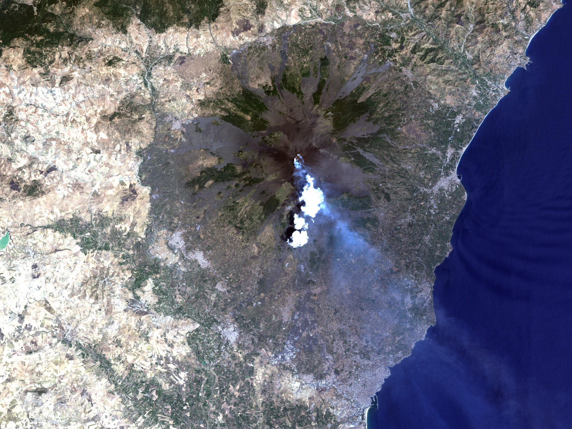
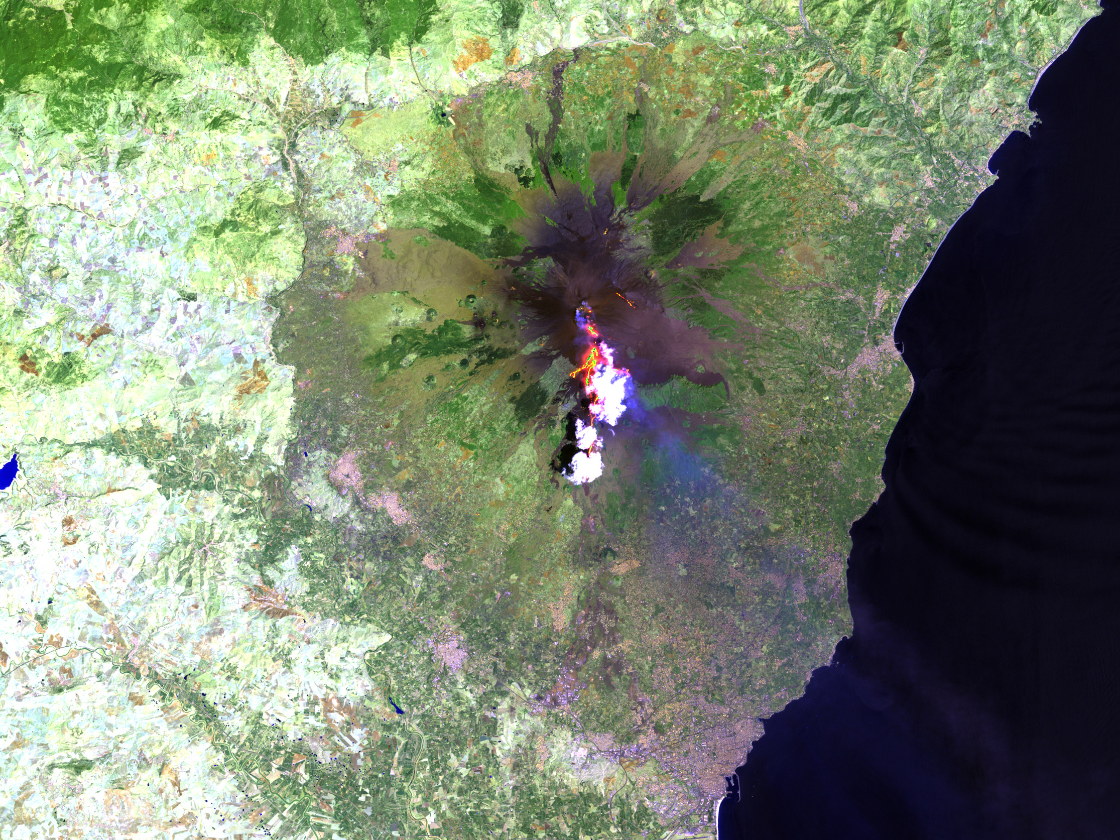
On July 29, 2001, emergency workers in Sicily, Italy, were working round the clock to reinforce dams to contain the lava flows threatening the tourist base, called Rifugio Sapienza, at the foot of Mt. Etna. Another river of lava stopped just short (about 4 km) of the town of Nicolosi. Meanwhile, the air over southeastern Sicily is thick with ash and nearby residents of Catania, a town located downwind of the volcanic plume, have been forced to use umbrellas while walking outside. As of August 2, after two days of relative calm, most emergency crews are cutting back their presence in the area according to news reports. In the meantime, the local airport has been closed and a state of emergency remains in effect.
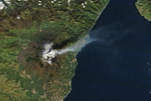
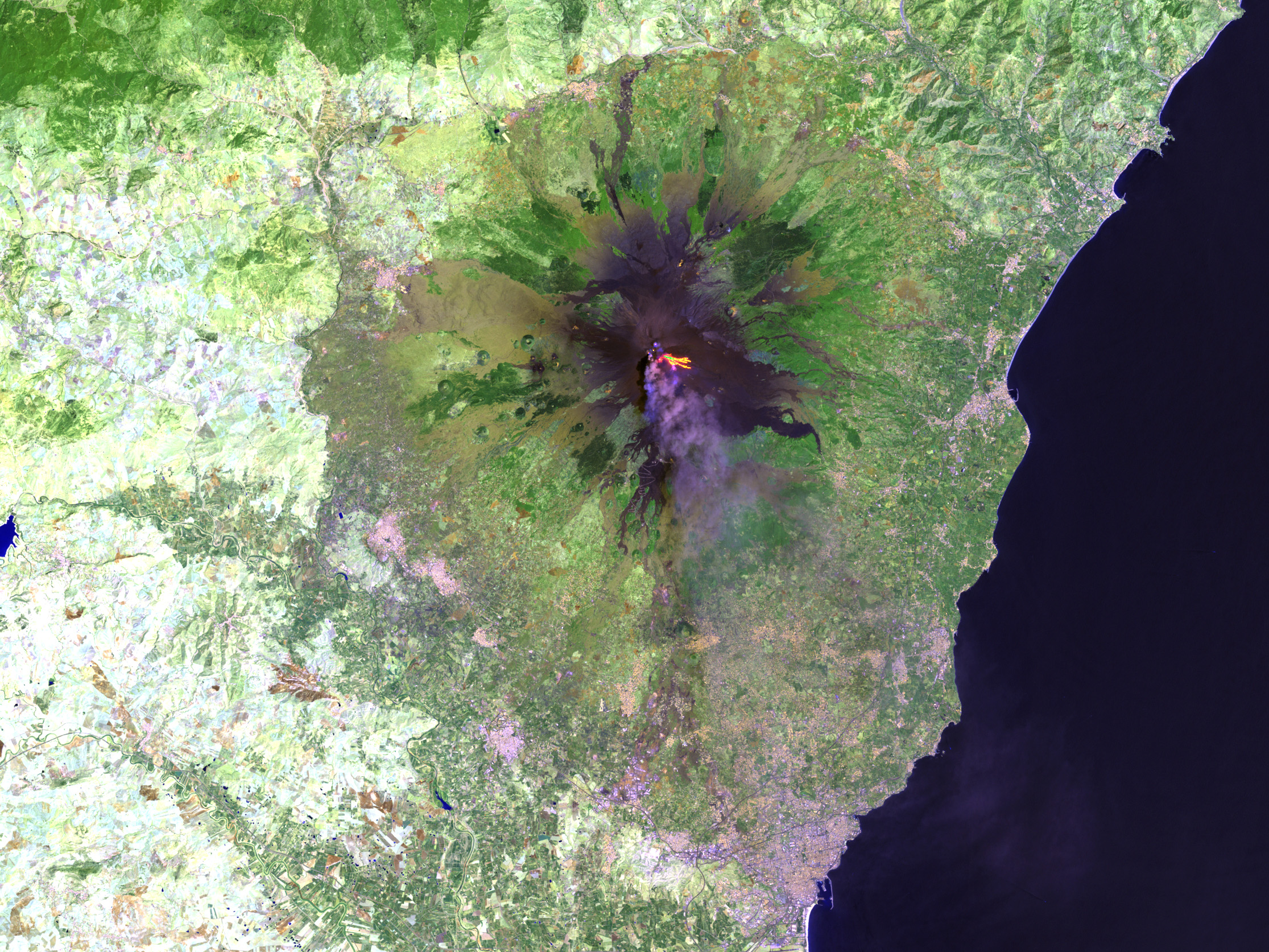
These Landsat 7 and Terra images show the area around the volcano on July 13, the first day of the current eruption event, and July 29, marking what experts hope is near the end of Etna's activities. The two Landsat 7 scenes were both produced in true and false color, each revealing different features of Etna's activities. The false-color images reveal the rivers of lava flowing down the flanks of the volcano (the bright orange ribbons radiating away from the volcano's caldera). The image also shows the vegetation (green pixels) in the landscape around the volcano and the bare rock surface left by old lava flows (brown pixels), all underlying the plume of smoke and ash (faint blue-grey pixels) streaming from Etna's caldera. A bright white cloud hovers above the volcano in the July 29 scene.
Images by Stuart Snodgrass, NASA Goddard SVS; Landsat 7 data courtesy USGS Eros Data Center
alert message


