The Earth Observatory has published its last Image of the Day on this website. Please join us on our new home at science.nasa.gov/earth/earth-observatory.
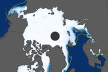
Each year, sea ice atop the Arctic Ocean and surrounding seas, bays, and gulfs collectively grows in extent throughout winter until reaching its annual maximum coverage in March. However, a regional look at the Gulf of St. Lawrence off eastern Canada reveals some nuances in this seasonal pattern. Sea ice in this gulf can be fickle, growing sporadically and sometimes not at all.
Typically, sea ice formation in the Gulf of St. Lawrence begins in December and accelerates in mid-January. The ice usually reaches its maximum extent by late February and holds steady through mid-March before starting to melt. But this timeline is based on the 1981-2010 average, and there can be significant variation from year to year, according to Walt Meier, a sea ice scientist at the National Snow and Ice Data Center (NSIDC).
“Some years, it may be high early in the season and then decline,” Meier said. “Other years, it can be quite low and then shoot up as late as March.”
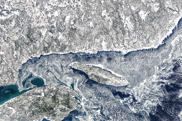
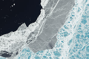
Winter 2024-2025 deviated from the typical pattern. In February 2025, the gulf’s sea ice coverage was well below average. Conditions stayed that way through mid-March, at which point sea ice was just one-third of average, according to Meier. That’s among the gulf’s lower extents observed during the satellite record, though other years have been even lower, including 2024.
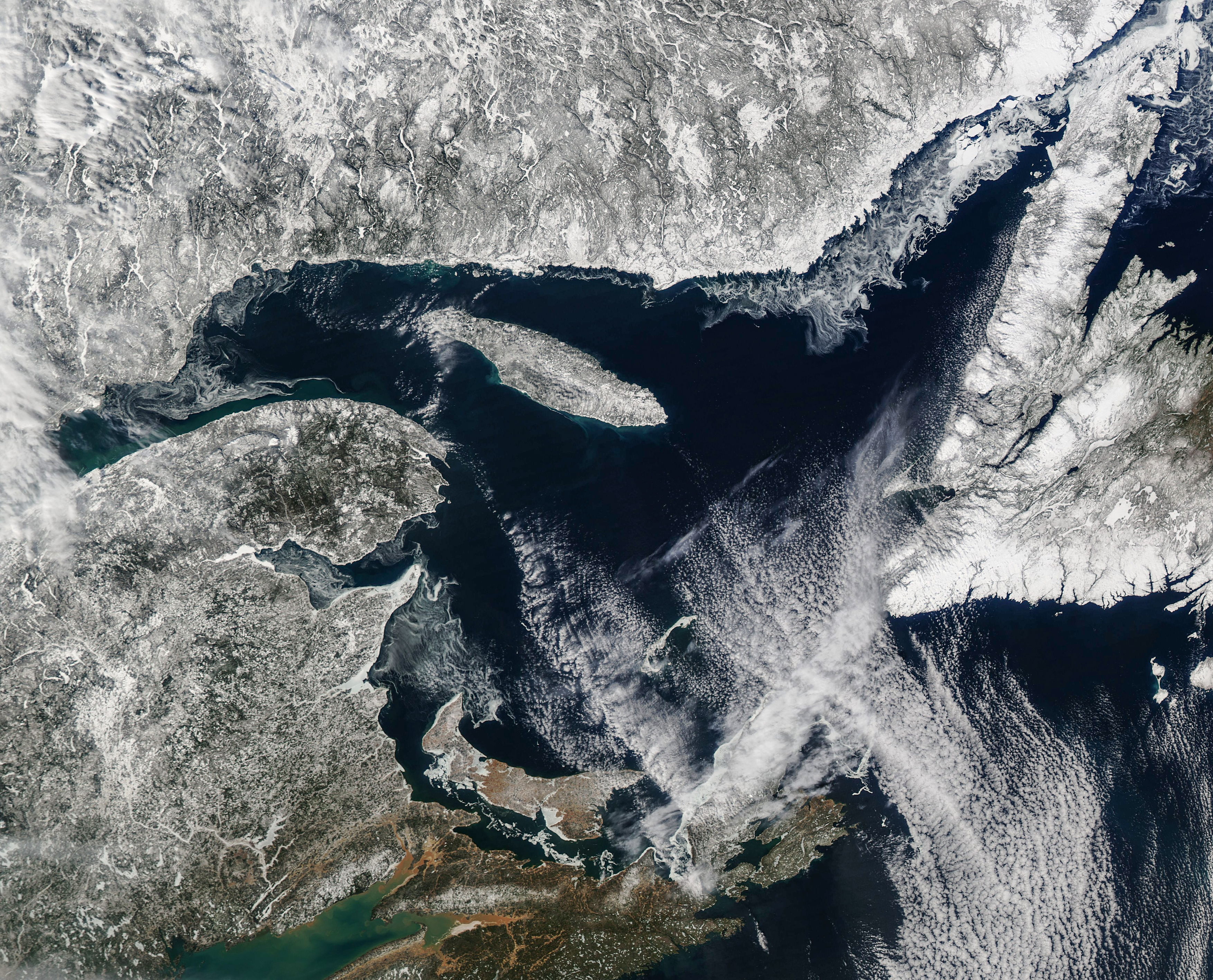
This image, acquired by the MODIS (Moderate Resolution Imaging Spectroradiometer) on NASA’s Aqua satellite, shows the Gulf of St. Lawrence on March 13, 2025. Patches of ice were only visible near the coastline toward the northeast and near the mouth of the St. Lawrence River to the west, and no ice warnings were in effect that day.
Air and ocean surface temperatures, which were a few degrees above normal in March, might have played a role in the low ice conditions shown in this image, according to Meier. Onshore winds can also be a factor, as they prevent the formation of new ice and push existing ice toward the shore.
The Gulf of St. Lawrence marks the eastern end of the St. Lawrence Seaway, a shipping route that connects the Great Lakes with the Atlantic Ocean. Though the Gulf has seen low ice this winter, ice-clearing activities along the St. Lawrence River were underway around the time of this image. (Parts of the seaway system close for several months each winter.)
The Gulf of St. Lawrence, along with the Sea of Okhotsk in the Western Pacific, is one of the planet’s southernmost areas where Arctic sea ice grows. Since 2010, however, the gulf has seen four winters that were nearly ice free.
According to Meier, years with low ice allow the water surface, dark compared to sea ice, to absorb more of the Sun’s energy and warm up earlier than normal, with possible implications for the region’s weather and fishing. Low-ice years can also pose challenges for seals that rely on the ice for birthing their pups.
NASA Earth Observatory image by Michala Garrison, using MODIS data from NASA EOSDIS LANCE and GIBS/Worldview. Story by Kathryn Hansen.