
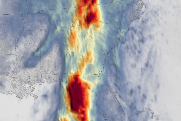
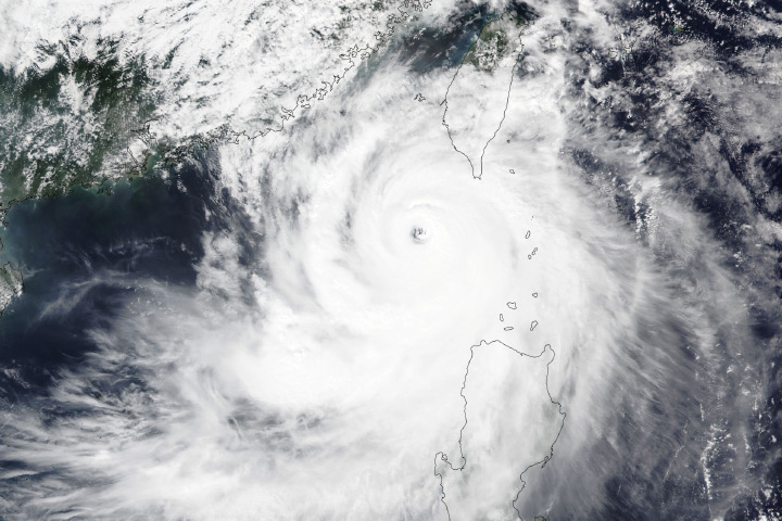
Hurricane Helene’s winds surged in strength as the storm churned over unusually warm waters in the Gulf of Mexico and closed in on the Florida Panhandle and southern Georgia on September 26, 2024. When the deadly Category 4 storm struck Florida’s Big Bend area and then pushed north, winds in some areas exceeded 140 miles per hour (225 kilometers per hour)—strong enough to snap trees, tear the roofs off buildings, and topple power lines.
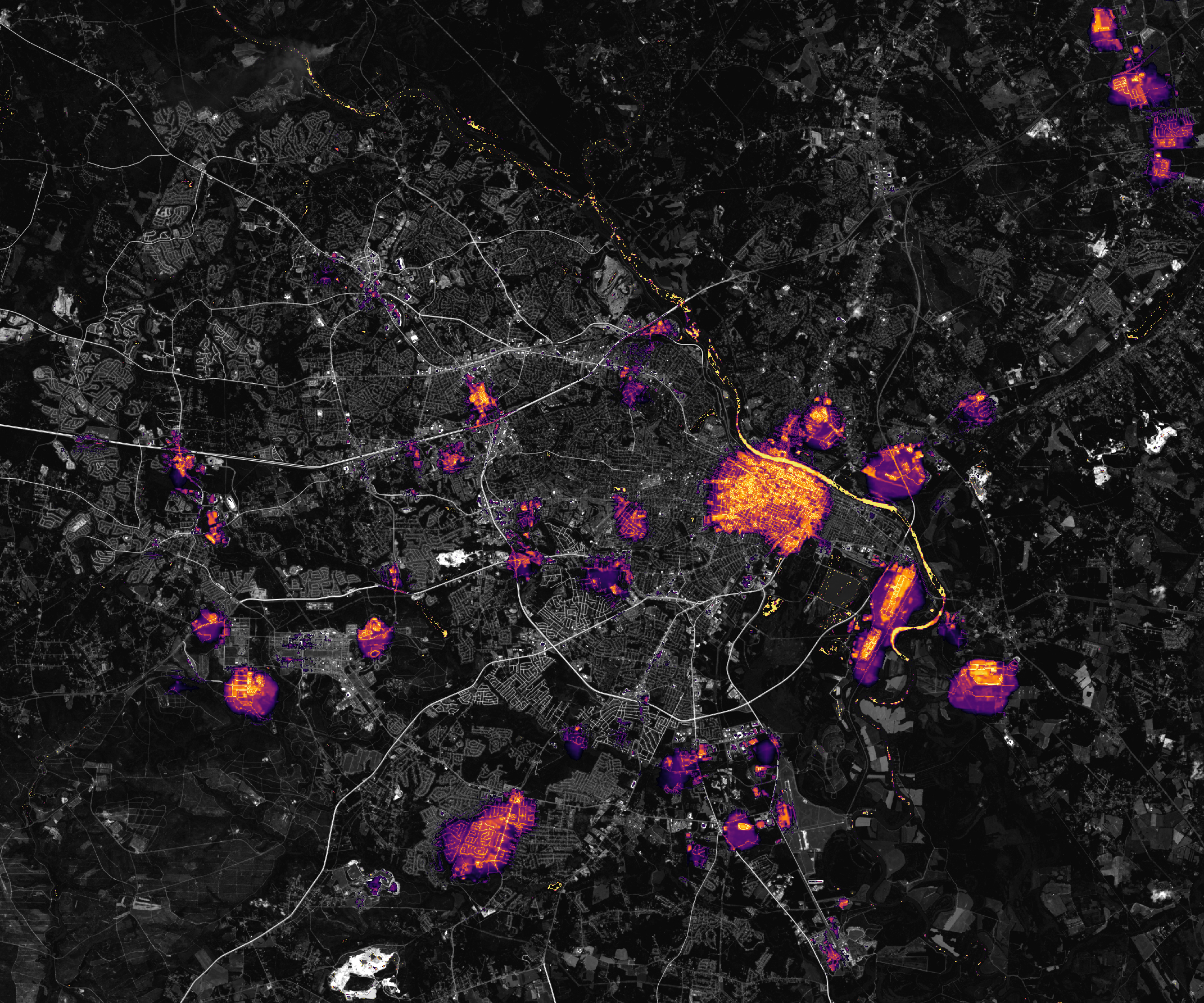
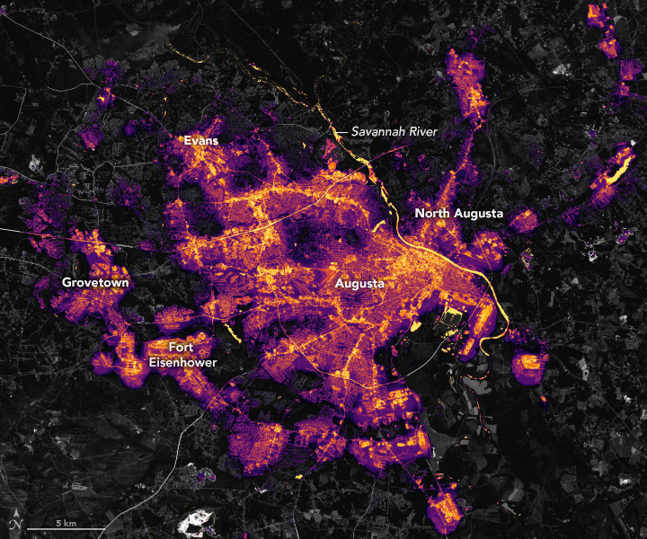
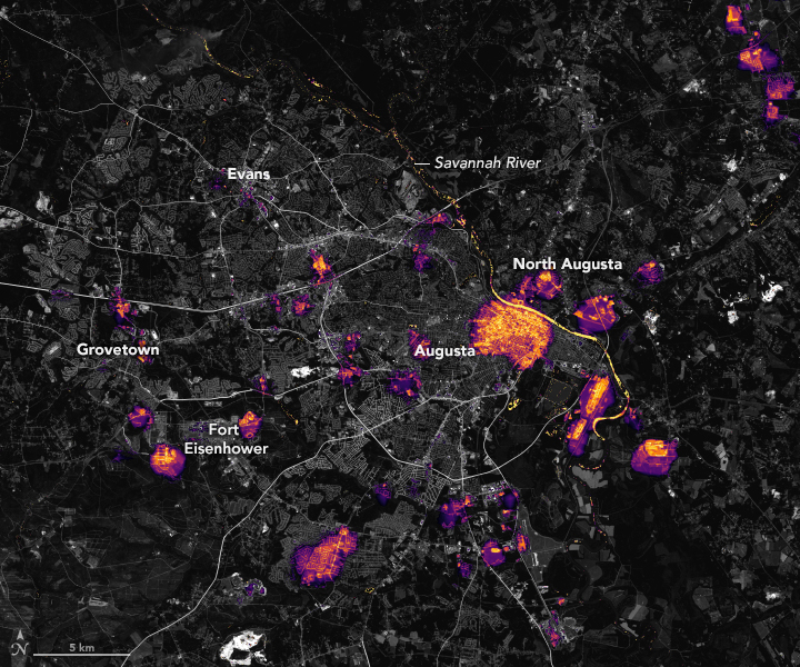
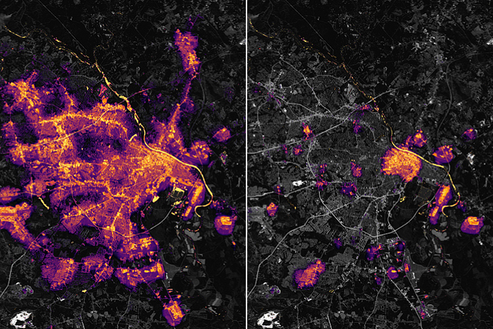
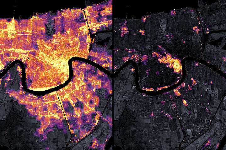
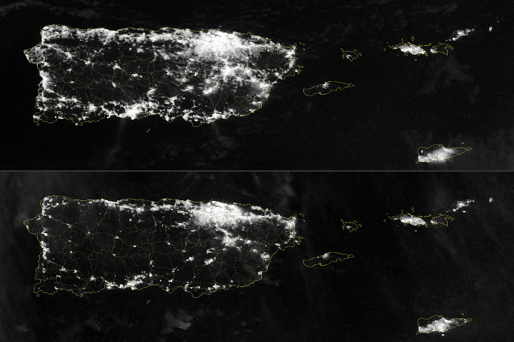
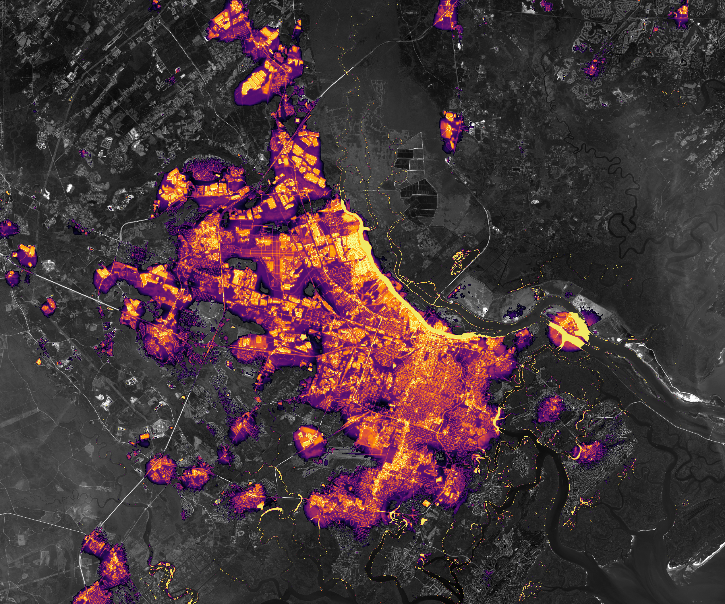
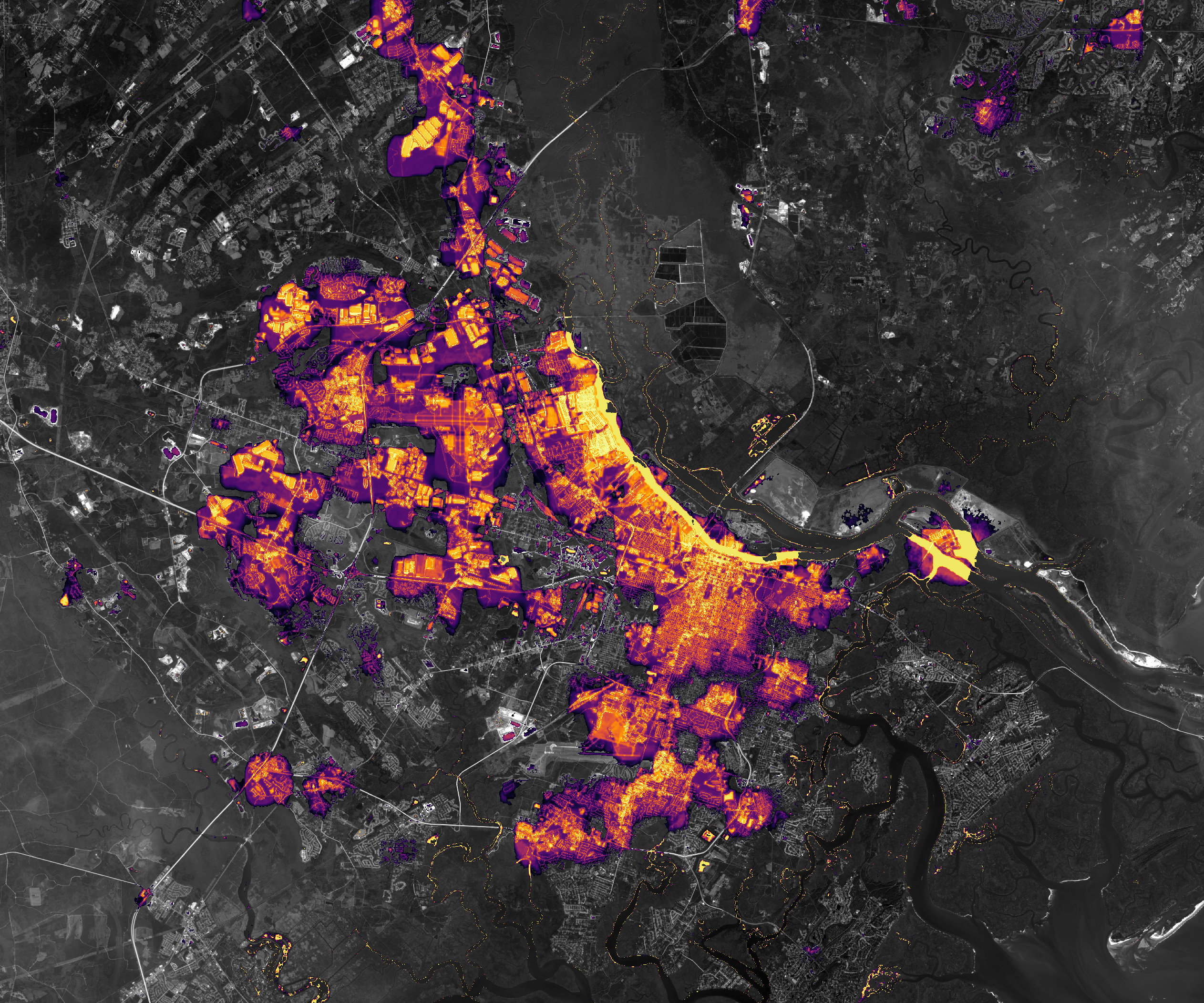
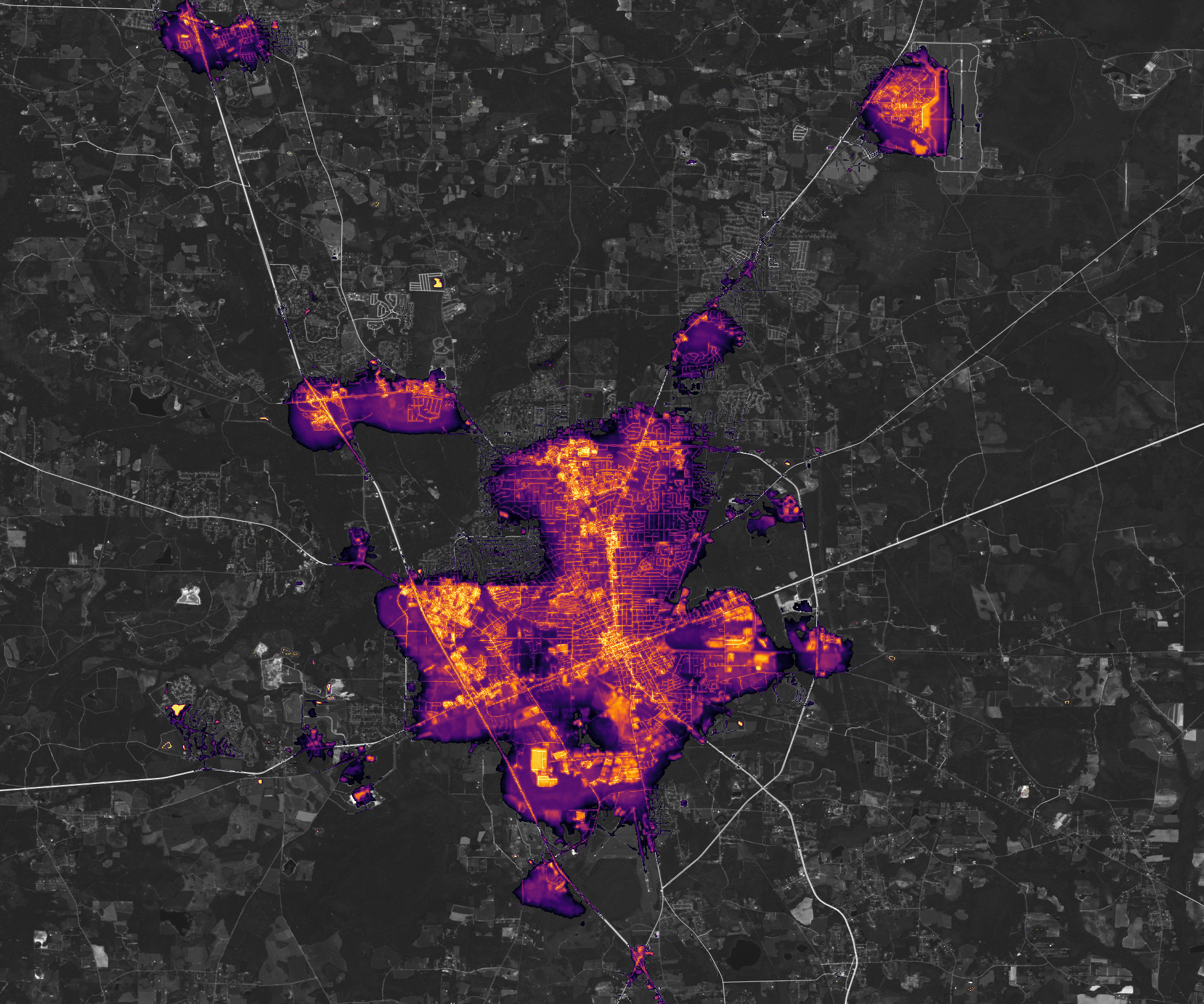
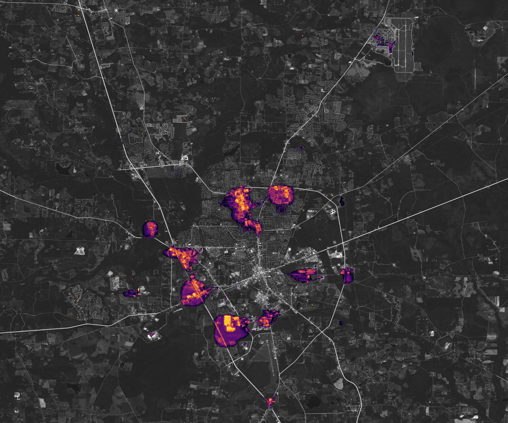
After the storm passed, millions of people across several states were left without electricity. The Visible Infrared Imaging Radiometer Suite (VIIRS) on the NOAA-NASA Suomi NPP satellite has a low-light sensor, the day-night band, that measures nighttime light emissions and reflections. It captured views of some of those losses in hard-hit communities in Georgia, including Augusta (above), Savannah (below), and Valdosta (second pair below).
Scientists with the Black Marble Project at NASA’s Goddard Space Flight Center, Science Systems and Applications, Inc., and the University of Maryland, College Park, processed VIIRS data to show nighttime lights before and after Helene passed through the Southeast. Data from September 28 were compared to a pre-storm composite (August) and overlaid on landcover data collected by the Landsat 8 and 9 satellites. These three cities were not the only communities in Georgia that lost power. Regional data showing the extent of outages is available here. Images of western North Carolina were not available because that area was covered by clouds on September 28.
Data published by Georgia Power showed that power had been restored to more than 840,000 customers by October 1. However, more than 400,000 Georgians still lacked power on that date, including 65,000 customers in Richmond County (Augusta), 38,000 in Chatham County (Savannah), and 40,000 in Lowndes County (Valdosta), according to data compiled by PowerOutage.us. More than 61,000 customers in Florida, 589,000 in South Carolina, and 383,000 in North Carolina were also without power on October 1.
Precision is critical for studies of night lights, said Ranjay Shrestha, a scientist based at NASA’s Goddard Space Flight Center and member of the Black Marble team. Raw, unprocessed images can be misleading because moonlight, clouds, pollution, seasonal vegetation—even the position of the satellite—can change how light is reflected and distort observations. The processing by the Black Marble team accounts for such changes and filters out stray light from sources that are not electric lights.
“Satellite-derived nighttime lights products like Black Marble are invaluable for capturing widespread outages in distributed energy systems,” said Shrestha. “These images not only reveal the immediate impact of disasters at the neighborhood scale but also provide insights into recovery trends over time, aiding in response, resource allocation, and damage assessment.”
The rate at which power is restored after hurricanes can vary significantly based on a variety of factors. Researchers from Florida Atlantic University and Georgia State University analyzed VIIRS data from Hurricane Ian, which roared across Florida in September 2022, and found notable differences in power restoration rates between urban and rural areas and between disadvantaged and more affluent communities.
NASA’s Disasters Response Coordination System has been activated to support agencies responding to the storm, including the Federal Emergency Management Agency (FEMA) and the Florida Division of Emergency Management. The team will be posting maps and data products on its open-access mapping portal as new information becomes available about flooding, power outages, precipitation totals, and other topics.
NASA Earth Observatory images by Lauren Dauphin, using Black Marble data courtesy of Ranjay Shrestha/NASA Goddard Space Flight Center. Story by Adam Voiland.


